17 Best Hikes in Jasper National Park

Here is our travel guide on the best hikes in Jasper National Park. These top hiking trails in Jasper will make your trip around the national park unforgettable. Includes tips on difficulty, length, or what to pack.
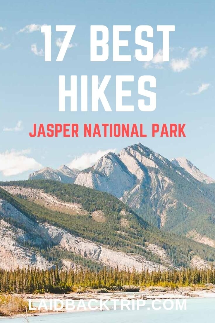
Jasper National Park offers top hiking trails for all abilities since it was established in 1907. With hundreds of kilometers of trails, Jasper National Park is a hiker's paradise.
While the variety of trails is wide, it can be hard to decide which hike is best for you.
The scenery is absolutely breathtaking, but one of Jasper's main draws is that every age and experience will find a suitable trail throughout the year.
Good day hikes are plentiful in Jasper, though most of them are moderately difficult, and you won't find that many challenging day hikes that are easily accessible as you would probably expect.
It's not like there are not any, but these treks usually require two or three days to complete. On the other hand, easy hikes in Jasper are easily found, and novice hikers will have a blast.
Finally, traveling in the Canadian Rockies can be challenging for budget travelers, but hiking is one of the best ways to see this part of the world for free.
To make the reading of our list of Jasper's top hikes easier, we sorted them by their difficulty, from easy walks, moderate routes to challenging day hikes.
Check out the list for our recommendations on the top hikes in Jasper.
Hiking Trails in Jasper
Before we dive into the list, it's useful to understand the Jasper area better. For easier navigation, Jasper National Park can be divided into five separate areas, with the town of Jasper being the heart of the national park.
There are two areas northeast of the town; Miette Hot Springs Area and Maligne Lake Area (or Maligne Valley Area).
Then, there is the area that surrounds the town itself, which features five smaller locations - Jasper's Connector Trail, West of Jasper, South of Jasper, Pyramid Bench, and Across the River.
Further south of Jasper lies Edith Cavell Area (Highway 93A). Lastly, Icefields Parkway connects Jasper with Lake Louise.
When planning your trip to Jasper National Park, knowing the exact location helps you to plan your travel itinerary better.
Athabasca Falls
Athabasca Falls is a beautiful waterfall in Jasper National Park just off the Icefields Parkway, about 30 kilometers south of Jasper.
The thundering falls are impressive any time of the year, and you shouldn't miss out on stopping there.
If you plan to visit only the main Athabasca Falls viewpoint platform, it's the easiest walk in Jasper and might not even be considered a proper hike by more experienced travelers.
However, you can cross the bridge and either follow the trail down along the canyon to the Athabasca River or turn left and walk upstream to another lovely lookout. It's still very easy, yet quite rewarding.
The trail ends abruptly as the mighty Athabasca River leaves the narrow gorge and spills out into the open valley once again.
Athabasca Falls trail is well-maintained and perfect for everyone. The lower part of the trail can be quite icy even in the spring or autumn, so you might want to bring microspikes just in case.
The trail is very busy, and if you arrive at the same time as one of those bus tours, the platform gets crammed.
If you arrive in Jasper on a rainy day and not keen on hiking in the mountains without the views, then Athabasca Falls is the place to go.
Toe of the Athabasca Glacier
Driving south from Jasper along the Icefields Parkway is once in a lifetime experience. The mountainous scenery is absolutely breathtaking, and the stops along the route plentiful.
The Athabasca Glacier is among the best stops along this scenic road. It's still the most-visited glacier in North America, even though the glacier is receding and losing its volume and size.
The aerial photos of Athabasca Glacier show the drastic change in the past 100 years the best, but you can also see the markers along the paved road and trail that indicate the line and location of the glacier in the past years.
The trail from the parking lot to the glacier lookout is 1.4 kilometers round trip with an elevation gain of 60 meters.
Toe of the Athabasca Glacier is an easy hike that shouldn't take you more than an hour, but the weather conditions are extreme (it's windy and chilly even on a sunny day there), and you should bring a down jacket or at least a windbreaker to stay warm.
There is a bit steeper section on the trail, but it's really short, and the majority of visitors should tackle it without any problems.
Always stay on the designated trail for your safety. Walking on the Athabasca Glacier is prohibited without a guide. Therefore, if you want to explore the glacier on foot, take a guided Athabasca Glacier Tour.
If you want to enjoy the views all day, stay in the Glacier View Lodge.

Horseshoe Lake
If you drive along the Icefields Parkway on a hot summer day and feel tired, a refreshing dip into the lake at the end of the Horseshoe Lake hike might give you some lost energy back.
A 1.5-kilometer leisure stroll will take you around magnificent cliffs towering above the dark blue glacial lake surrounded by the woods.
The lake has perfect swimming conditions, and crystal clear waters make this place one of the best Jasper's hidden gems.
Moreover, Horseshoe Lake is known among adventure seekers as one of the best places in Alberta for cliff jumping who want to plunge into freezing cold water from impressive heights.
The highest cliff jump at Horseshoe Lake has 25 meters, though you can find many low jump areas, so there are different heights for everyone.
A word of warning. Cliff jumping is a very dangerous activity, and you should know your limits and jump only at your own risk.
Each year, some people get seriously hurt here, and Parks Canada even considered shutting down the site, though it remains open.
Even if you don't want to cliff jump, this is a lovely spot without crowds that is worth visiting. You will find the Horseshoe Lake parking lot less than 30 kilometers south of Jasper.
Stanley Falls Trail
If you are looking for an off-the-beaten-path place in Jasper National Park, then drive along the Icefields Parkway for 88 kilometers towards the Banff National Park until you reach the trailhead to Stanley Falls.
Follow the clearly marked trail from the parking (it's almost parallel with the highway) until the place where you get to Beauty Creek. At this point, the trail turns left, and so should you.
The trail along the creek features several smaller falls and might vaguely reminiscent you Maligne Canyon (if you have been there), although this path has no railings or fences. Therefore, it's not exactly kid-friendly, as you will get close to drop-offs.
At the 1.6-kilometer mark, you will reach the Stanley Pass, where the official trail ends.
The waterfall is the place to turn around, but before you do that, enjoy your lunch there without the crowds that are so common in the Canadian Rockies. The trail beyond the falls shortly disappears, so there is no need to go much further.
Once you are all set, retrace your steps via the same trail, you've arrived there.
Here are the directions to find the parking lot.
A small unmarked pull-out parking is exactly 15.5 north of Columbia Icefields Discovery Center (on the right side) or 1.9 kilometers south of the Hi Beauty Creek Wilderness Hostel (obviously, when arriving from this direction, it is on the left side of the road).
Despite its small size, you should be able to find a spot unless a big RV is being parked there.
Mary Schaffer Loop
Mary Schaffer Loop is an easy stroll that belongs among our favorite things to do in Maligne Lake, about 50 kilometers southeast of Jasper.
In fact, this is one of the best easy hikes in Jasper for all ages and skill levels. So if you are looking for a family-friendly hike in Maligne Lake, then Mary Schaffer Loop is your best bet.
Depending on hiking direction, the first part of the loop leads along the lakeshore, while the second part goes through a forest of spruce, subalpine firs, and lichen-rich pines.
The path is 2.9 kilometers round trip, with almost no elevation gain, and you will come across a beautiful viewpoint mid-way.
The interpretative panels along the trail are quite interesting and will shed some light on Mary Schaffer and the area's history.
You will come across some benches where you can sit, enjoy the views, and have a snack. By the way, Maligne Lake is one of the most beautiful lakes in the Canadian Rockies.
You will find the Mary Schaffer trailhead at the Maligne Lake parking lot, and we believe it's slightly better to walk in a counterclockwise direction.
While you are in the area, you can rent a canoe or kayak from the boathouse at the beginning of the trail, though the rental prices are ridiculous.

Moose Lake Loop
Moose Lake Loop is another easy hike in the Maligne Lake area that leads mostly through the forest on a well-maintained trail.
While the Mary Schaffer Loop offers better views of the lake and interpretative panels, the Moose Lake Loop features some wildlife watching opportunities. And as the name of the lake suggests, you can encounter moose in the area, among other wildlife.
It rained hard on the day of our visit, and the forest was ghost-like, so we didn't encounter any animals this time (okay, we saw a squirrel, but as they are literally everywhere, it's not a huge success).
We guess they were smart enough to hide (unlike us), so who would have blamed them.
Probably as the result of the bad weather, we haven't seen any other hikers on the trail that day (though there were some footprints in the muddy sections), so we could enjoy some serenity of the Canadian Rockies.
Anyway, Moose Lake Loop is less than three kilometers long with only a slight elevation gain, making it also perfect for families with kids or novice hikers who are not yet ready for Bald Hills or Opal Hills.
Pyramid Lake Overlook Trail
Pyramid Lake Overlook is one of the underrated trails in Jasper National Park, probably because you will find hikes in the national park with far superior views.
However, those who want to enjoy a moderately challenging hike without crowds, might want to give it a try.
The best time to arrive there is early in the morning when the surface of the lake is calm and reflects the surrounding mountains.
Although the hike itself might not be the most popular one in the park, the lakeshore area often gets crowded, so it's better to get there early anyway.
The distance to the viewpoint is about 1.3 kilometers with an elevation gain of 150 meters.
The trail is easily modified, so you can either retrace your steps or complete the 9-kilometer loop via Patricia Lake, though you can shorten this route as well.
If you are looking not for a moderate hike but for an easy walk, then Pyramid Island Loop Trail is a short in-and-out trail (there is a tiny loop around the island, though) for all levels and ages.
The first footbridge was built in the 1930s, and Pyramid Island became a popular tourist spot since then.
And if you bring a picnic lunch, you won't find many better places than the serene shores of Pyramid Lake. By the way, Pyramid Lake is a popular spot for wedding ceremonies.
On the way to Pyramid Lake, make sure to stop at Patricia Lake, another beautiful lake in Jasper.
Not only can you explore the lake area on foot, but you might also want to consider staying in lovely Patricia Lake Bungalows overnight.
Lastly, the entire area is easily accessible on foot from Jasper if you don't have transportation.
Old Fort Point
Old Fort Point Trail is a pleasant and easy hike from Jasper, offering some nice views of the valley from the prominent bedrock hill.
There is a parking lot on Old Fort Point Road just behind the charming bridge over the Athabasca River, but you can walk to the trailhead from the town on foot using one of the designated trails (the bridge has a sidewalk, so it's safe to cross there).
Taking the left path makes the hike a bit easier (clockwise direction), while the trail on the right has stairs; therefore, the climb is steeper and more challenging.
This hike also includes a set of Parks Canada red chairs. We would recommend this hike to you if you have some spare time in Jasper and visited other places around the town already.
Old Fort Point Loop is 3.8 kilometers with an elevation gain of 130 meters.
Sunwapta Falls
Sunwapta Falls is another stop on the Icefields Parkway worth a visit. A pair of fast-flowing falls that are fed by the Athabasca River is located 55 kilometers southeast of Jasper.
The Upper Falls are absolutely stunning, and they have a small forested island on the river just before the drop-off. In Stoney language, Sunwapta means 'turbulent water,' and we feel the wording is very accurate in this case.
While the Sunwapta Upper Falls can be reached via a short trail from the parking lot, the Lower Sunwapta Falls requires some hiking.
With less than 100 meters elevation loss/gain over 1.5 kilometers each way, the reward in the form of lower falls comes with minimal effort.
An often muddy trail gradually descends through a forested area and offers almost no views until it finally emerges near the lower falls.
Together with Athabasca Falls, Upper Sunwapta Falls are often busy, so we recommend you consider hiking to the Lower Falls to escape the crowds.
Please, enjoy the beauty of the falls only from the designated trails.

Valley of the Five Lakes
Valley of the Five Lakes is a family-friendly hike featuring two loops, five beautiful lakes, and a nice, well-maintained trail.
There are some ups and downs along the way, but nothing strenuous. The short loop is 4.7 kilometers with an elevation gain of 100 meters, and it takes about 1.5 to 2 hours to finish it, including photo stops.
The shorter loop leads around all five lakes, but you can do an extension that encircles the entire First Lake that will add another five kilometers to the total distance (around three hours in total).
The trails are well-marked (9, 9a, 9b), and it's easy to navigate around the lakes, plus you can always use Maps.me if you are not good with the directions.
The advantage of this hike is that even the shorter loop is very scenic with beautiful views along the way and allows you to see the best of the valley.
The different colors of each lake and easy trail grade make this hike worth considering, especially if you are not looking for a serious scramble. And by the way, there are the iconic red chairs on this trail between the third and fourth lake.
Bring a bug repellent as the damp areas can be bug-infested in the summer.
You will find the Valley of the Five Lakes trailhead at the parking lot about 10 kilometers south of Jasper on the Icefields Parkway.
Maligne Canyon
Of all the hikes on the list, Maligne Canyon presents a very different experience. Forget the mountains for a while, and imagine walking around the waterfalls, potholes, limestone cliffs, caves, streams, and even more waterfalls.
Maligne Canyon's karst system is a unique feature of the national park visited by hundreds of travelers from around the world each day.
A series of connected trails with five bridges will allow you to see one of the top places in Jasper without too much effort.
The sixth bridge is quite far from the rest and arguably not worth the hike unless you manage to arrange transport to/from there, so you don't have to retrace your steps.
The trails are well-maintained, easy to navigate, and the views from the wooden bridges perched above narrow gorges will leave you in awe.
Maligne Canyon gets busy during peak times, but it's not that crowded as Johnston Canyon in Banff National Park.
Some areas are closed in winter, but Maligne Canyon remains open throughout the year.
In fact, the Maligne Canyon Ice Walk across the bottom of the canyon is one of the best winter activities in Jasper National Park.
Admire the frozen waterfalls, beautiful ice formations and explore the caves that you wouldn't have a chance to access otherwise.
Moreover, Maligne Canyon is beautiful even on a rainy day, so you can always leave it for the day the weather forecast shows the worst weather on your trip.
There are two Maligne Lake parking lots. We strongly recommend you make the whole loop, so it makes almost no difference whether you park at the parking lot near Bridge No. 5 or the upper one at Bridge No. 1.
We usually park at Bridge No. 1., but that's us.
Edith Cavell Meadows
Exploring Jasper's high alpine ecosystem as you traverse blooming meadows with expansive views of the rock wall of Mount Edith Cavell is one of the best experiences in the national park.
Named after a brave nurse who saved many lives during World War 2, Mount Edith Cavell offers perfect hiking trails and incredible scenery.
In our opinion, Mount Edith Cavell area is one of the best places you can visit in Jasper National Park regardless of whether you want to climb up to the meadows or just walk to the viewpoint.
Either way, the best time to visit the Edith Cavell area is early in the summer, when the alpine flowers are in full bloom.
Thousands of years ago, mighty glaciers carved the valley, so the iconic Angel Glacier we can see today spreading its wings on the mountain is only a remnant of that glacial period.
Mount Edith Cavell is a 3363 meters high mountain that can be seen from many places in Jasper National Park, and the massive rock wall towering above the pond with floating icebergs is insanely beautiful.
For some reason, Mount Edith Cavell always reminds me of some of the mountains we saw on the Plain of Six Glaciers in Lake Louise area.
This 6 kilometers trail with an elevation gain of 500 meters starts off with a gentle walk to the first viewpoint (Path of the Glacier Trail). Admire the views and start climbing on the dirt trail; a set of four switchbacks takes you to a junction, where the loop begins.
Take the left path (clockwise direction) and steadily climb to the highest point (2200 meters above sea level).
Here, you can take a detour from the main loop to climb even higher (2300 meters above sea level) and then retrace your steps back to the main circuit.
Once you are back on the main trail, continue descending down via the second part of the loop.
The trail offers some incredible views of Mount Edith Cavell, Angel Glacier, and Cavell Pond on the way down, so keep your camera ready for those fantastic photo opportunities.
There will be another detour from the trail, but this time it's a very short one, less than 100 meters.
From here, continue walking north until you reach the original set of switchbacks that will take you back to the Path of the Glacier Trail and, ultimately, the parking lot.
Path of the Glacier Trail
This low-commitment introduction to Jasper National Park is a perfect alternative for those short on time. The 1-kilometer hike is very gentle and accessible to all ages and abilities. Therefore, the trail is often busy.
If the Edith Cavell Meadows trail is closed due to bear activity, the Path of the Glacier Trail is still worth a trip.
The upside is that the views, even from this short trail, are absolutely breathtaking, and you won't miss that by much by not hiking the Edith Cavell Meadows Trail.
The road to the Mt Edith Cavell parking lot is narrow and winding, so drive slowly and check the vehicle size restrictions before you go - the maximum length is 25 feet (7.6 meters).
Also, Cavell Road is usually open from mid-June to mid-October, though the dates vary each year, so it's better to ask about opening and closing dates at the visitors center.

Wilcox Pass
Hiking to the base of Athabasca Glacier is an incredible experience, but what if we told you that you could see the glacier from above?
Wilcox Pass is a moderately difficult hike that starts on the opposite side of the valley near the Wilcox Creek campground (read our guide on Camping in the Canadian Rockies).
From the parking lot, keep on the trail heading northwest. The path is well-maintained and leads through a forested area at first.
The first part is not that exciting, but it's quite steep and strenuous, so you can find some enjoyment in that.
Once you reach a pair of red chairs typical for Canadian national parks, you should have beautiful views of the Athabasca Glacier or Mount Andromeda (on a clear day).
For most, this is the turning point. We believe it's worth the effort to hike up until you reach the open valley. As the trail gains in elevation, you'll start to get sweeping vistas of the landscape on the other side of the valley that will make up for the effort.
In the valley, you have a few options on how to proceed.
You can hike all the way to Wilcox Mountain, stay in the valley and explore it a bit more, and then hike back.
It's even possible to walk across the entire valley and then descend on the other side, but you would end up at the Tangle Falls parking lot, which makes no sense unless you arrange transport to pick you up.
Wilcox Pass trailhead is located only 3 kilometers east of Columbia Icefield Discovery Center; the parking lot is very small, and finding a spot can be difficult at peak season.
If you are looking for more hikes in the area, try hiking the Parker Ridge Trail (it’s close but already in Banff National Park).
Opal Hills
When you arrive at Lake Maligne, you have two similar moderately difficult hikes to choose from. We'll start with the hike we enjoyed a bit more, but you won't make a mistake by hiking any of them.
Opal Hills is one of the steepest trails in Jasper National Park, and the elevation gain is about 500 meters on 4 kilometers (8 kilometers round trip). Needless to say, any moderately fit hiker can finish the loop without much difficulty.
Start on the upper parking lot, and follow the Mary Schaffer Loop for 250 meters.
At the first junction, turn left, and continue through a forest until you reach another one. Now it's time to decide whether to hike clockwise or counterclockwise.
We hiked the Opal Hills Loop counterclockwise, but it's often recommended to hike clockwise as the climb is less gruesome.
The next part is steep and strenuous without any views, but if you hike slow and steady, you will make it soon to the point where the forest starts to disappear slowly.
Finally, the views open up as you enter a beautiful valley with alpine meadows.
Obviously, the best time to hike Opal Hills is when the alpine flowers are in full bloom; nevertheless, the area is beautiful any time of the year.
You can extend the hike and climb from the valley to the lake viewpoint, but it's not essential to enjoy this area, and moreover, you can decide on the spot whether it's worth it or not.
Note that the area is known for grizzly and black bear activity, so carry a bear spray with you, and hike in a group of people (the group size depends on the Parks Canada recommendations, but it's usually three to four people per group).
Sometimes, the trail can even be closed in July or August, so it's better to ask about the trail status in the visitor center before you go.

Bald Hills
An eight-shaped Bald Hills loop starts from a different parking lot than Opal Hills, roughly one kilometer further down Maligne Lake Road.
Bald Hills offer some beautiful views of Maligne Lake (though it's a bit in the distance) and a great hiking opportunity.
The trail has a steady incline the entire way, and having the elevation gain dispersed along nearly four kilometers helps a little.
When you reach the first junction, you can choose from the more challenging trail on the left (shortcut) or the easier fire road on the right.
If you are used to hiking, turn left as the way is much more entertaining and even offers some views. If you want to make your life easier and don't mind walking on the wide gravel road, stay on this trail.
Once you get to the upper loop, it's easier to walk clockwise as the incline is more gradual. However, it might be safer to tackle the steep part first and then descend gradually; in this case, hike in the counterclockwise direction.
The views from the top are amazing, and you should savor the moment.
When you plan your Canadian Rockies itinerary, you might also be wondering whether it's better Bald Hills or Opal Hills.
Bald Hills is often considered as the hike with better views (unless you climb the Opal Peak that offers views that beat those from Bald Hills trail), but as the hills are not bald anymore, you have to go beyond the first lookout, to the open area of alpine meadows.
Both hikes have pros and cons, but at the end of the day, they offer a very similar experience.
The Whistlers Trail
The hardest day hike in Jasper, the Whistlers Trail, is not for faint-hearted or people out of shape. The hike from the trailhead to the summit is 7.5 kilometers each way, with a total elevation gain of 1200 meters.
Depending on your pace and level of fitness, allow yourself anything between three to five hours in order to reach the summit.
The trail starts in the forested area, and later on, you will come across a few rockslide areas with big boulders.
This is a point where you can easily lose the trail if you are not paying attention (follow the pink ribbons if they are still there); also, wearing sturdy hiking shoes helps a lot.
After that, expect a leg-burning incline and more switchbacks. As soon as you reach the uppers station, crowds will emerge from the aerial tramway, so be ready to mingle with them.
The last part of the hike between the station and summit is called the Whistlers Summit Trail, and we listed it as a separate hike down below.
Basically, the hardest part (not counting the descent back to the parking lot) is behind you, so follow the trail and enjoy the scenery along the way.
Jasper Skytram
If you find the idea of ascending more than 1000 meters horrid, then you can always take the Jasper Skytram to make your trip easier. The ride costs $54.60, and you can reserve Jasper Skytram here.
Keep in mind that the Whistlers Trail trailhead and Skytram don't start in the same place.
Two separate parking lots are located about 1.3 kilometers from each other. So if you hike up but take the gondola down, you will need to walk a bit more.
The Whistlers Summit Trail
For those who took the Jasper Skytram, the Whistlers Summit Trail offers a short but steep walk from the terminal station to the summit.
Parks Canada rate this hike as moderate, but we would say it's on the easy side of moderate due to its short length and well-maintained trail.
Either way, walk slow and steady, and you will get to the summit from the station in less than thirty minutes (it will probably take a bit longer as you might want to make some photo stops).
The Whistlers Summit lies at 2464 meters above sea level, and the 360 views are stunning and worth the effort.
As the Skytram makes this area really accessible, don't expect to have the trail for yourself.
Indian Ridge
If you are looking for the off-the-beaten-path hike in the south Jasper area, you can continue to Indian Ridge (2752 meters). This trail is roughly 3.4 kilometers from the Whistlers Summit to the Indian Ridge, and the elevation gain is approximately 300 meters.
From Whistlers Summit, the trail descends a bit into a valley, only to start climbing the Indian Ridge. The path is clearly visible (when there is no snow) but not maintained, and you should pay attention to where you are going at all times.
The views from the Indian Ridge are even better, and white-furred mountain goats can often be seen from the trail.
The trail is exposed and rocky; use trekking poles. They are true life-savers, especially if you decide on hiking from the parking lot.
If you are a moderately fit hiker, you can definitely hike all the way up from the parking lot, but be prepared that it will take you anything between seven to ten hours.
As this will be a challenging day hike, bring plenty of water, stay hydrated, and don't forget to pack a lunch and some energy bars to boost your strength.
If you are not sure whether it's safe to refill water from the streams along the trail, use either SteriPen or a water bottle with a filter. Note that there are no streams on the upper part of the trail.
If you are short on time or not looking for a serious challenge, it makes much more sense to take the Skytram up, down, or both ways.
Bit of warning before you go. Both Whistlers Summit Trail and Indian Ridge are above the tree line making the walk on the exposed trail challenging.
On a sunny day, make sure to use strong sunscreen to prevent sunburn.
As there is nowhere to hide along the way, make sure you bring a proper rain jacket, and some extra warm layers in case the bad weather arrives.
Sulphur Skyline Trail
In our opinion, Sulphur Skyline Trail is the best day hike in Jasper. The distance from the parking lot to the peak is about 4 kilometers with an elevation gain of 700 meters; therefore, Sulphur Skyline is rated as a difficult hike.
And as there is no gondola, you have to get to the summit all by yourself; that's the reason we put it behind the Whistlers Summit.
The first part leads mainly through the forest and gradually climbs all the way to series of switchbacks.
Once the trail turns into switchbacks, the hike becomes more strenuous, but you will get limited views from the path, so you can take some breaks while enjoying the views.
Eventually, you will climb above the tree line, but the exposed rocky ridge might present some challenge on a windy day. If you have trekking poles, don't leave them in the car, you will find them handily in this section.
The stunning views of The Fiddle Valley, Ashlar Ridge, and Utopia Mountain from the top are well worth the effort.
One of the lesser-known facts about Sulphur Skyline is that it's usually among the first snow-free hikes in Jasper National Park.
As you've probably guessed, the views of the Canadian Rockies are not the only reason why we loved this hike so much. Ending the day in natural hot springs is a dream that you can fulfill here at Miette Hot Springs.
Even though the hot springs are enjoyable anytime (even without the hiking part), one of our most memorable visits was on a snowy day at the beginning of July.
Water temperature is kept between 37 and 40 ºC, but the best selling point of these hot springs is the low entry fee.
Believe it or not, the Miette Hot Springs entrance fee is $7.21 for an adult making it one of the best things to do in Jasper National Park if you are traveling around the Canadian Rockies on a budget.

Staying Safe
Before setting out on your hike, don't forget to stop by a park visitor center to obtain the most up-to-date recommendations, trail conditions, and warnings.
The weather in Jasper can change rapidly, and you should always be prepared for the worst, even in the summer.
Always have a proper rain jacket with you, even on a clear day summer day. If the weather forecast looks bad, rain pants also come very handily.
A comfortable daypack where you can keep extra dry layers is a must-have, the same as sturdy hiking boots. For more information, read our Canadian Rockies packing list.
One of Jasper's biggest draws is wildlife viewing. Always keep a safe distance from the wildlife. We recommend you bring binoculars or a camera with a telephoto lens if you are an enthusiast photographer. Canon EOS R6 paired with Canon RF 100-500mm F4.5-7.1 will deliver incredible results.
Furthermore, hiking in the bear country has a very specific set of rules, and it's important to be prepared before you set out on a hike. When hiking, make noise, clap your hands to make your presence known.
Always carry a bear spray, and keep it handy.
Some trails require hiking in a group of three or four people. These requirements are often mandatory, and if you don't follow them, you will be facing a hefty fine.
Travel Insurance
We never leave home without travel insurance that was designed to cover our expenses if something goes wrong during the trip.
Travel insurance protects against theft, flight delays, injury, illness, cancellations, and much more.
World Nomads provides travel insurance for travelers to cover their trip essentials, including sports and adventure activities.
SafetyWing is affordable travel insurance for backpackers, long-term travelers, and digital nomads.
Travel smarter and safer!
Entrance Fee
There is an admission to Jasper National Park, but once you are in the national park, the hikes are free. While you can get a day pass for $10, we believe you should consider purchasing the Parks Canada Discovery Pass that is valid for one year.
In this case, the entrance fee for an adult is $69.19 per adult or $139.40 for a family or a group of seven people.
You can use the Discovery Pass for over 80 national parks and sites, and we believe it's worth the investment.
Where to Stay
The best place to stay in the national park is the small town of Jasper. Jasper is a lovely town with a nice variety of accommodation for all types of travelers.
Surprisingly, you won't find many hotels in the national park outside this town. On the other hand, campgrounds are plentiful in Jasper National Park.
However, accommodation in Jasper is expensive, and hotels fill up fast during peak times. Reserving a hotel room in advance in the high season is essential to have a stress-free vacation.
When you arrive in the middle of the summer in Jasper without a reservation, you might end up paying a lot more for far less, as the best affordable hotels will be booked out.
Here is our choice of the top hotels in Jasper and its surroundings.
Budget | Mount Robson Inn - It is almost impossible to find budget accommodation in the Canadian Rockies when not camping. This hotel is reasonably priced and offers clean facilities and excellent breakfast.
Mid-range | Jasper Inn and Suites - Convenient location, indoor pool, onsite restaurant, and clean and tidy rooms should convince you to stay here.
Luxury | Fairmont Jasper Park Lodge - You will hardly find better accommodation in Jasper. Beautiful surroundings, comfortable rooms, and excellent service are the main reasons to stay here.
Alternatively, you have a few more options to choose from.
Edmonton is always a solid option where you can find plenty of hotels before or after your road trip.
Hinton is near the entrance to Jasper but lies just outside the national park, so you might expect slightly lower rates for rooms.
Valemount in the west might have some cheaper rooms as well.
Lastly, you can stay in Lake Louise before or after road tripping the Icefields Parkway.
How to Get There
The best way to get to Jasper National Park is by car. Jasper town lies in the heart of the national park and serves as a perfect base for your explorations.
Renting a car in Canada is very easy, and all major cities and towns have multiple rental companies to choose from.
There are three main routes to Jasper you can choose from.
To get to Jasper National Park from Edmonton, about 360 kilometers away, follow the Yellowhead Highway (Trans-Canada Highway 16) west to Jasper's entrance gate, and then continue west until you reach the town (the ride takes about 4 hours).
Calgary lies 420 kilometers southeast of Jasper, and you should allow yourself at least 5 hours. Drive west along the Trans-Canada Highway 1 until you reach Lake Louise, and then turn onto scenic Icefields Parkway (Highway 93) and drive north towards Jasper.
As the road is very scenic and features many stops, you might want to make your travel itinerary a bit more flexible.
Lastly, west of Jasper lies Mount Robson Provincial Park, and the nearest settlement is Tete Jaune Cache, while Valemount is the closest town to Jasper in this direction.
This is also the direction you will arrive from if you travel directly to Jasper from Vancouver or Kamloops.
If you don't want to drive, then you should look into private tour operator's offers. Some tour operators have a shuttle bus between Edmonton, Jasper, Lake Louise, Banff, and Calgary, though the bus fares are really expensive for what they offer.
For example, if you go from Edmonton to Jasper, you pay around $100 for just a basic bus ride.
If you travel in a group, rent a car to save money. If driving is out of the question, try finding someone with whom you can share the drive.

Get Around
Getting around the Jasper National Park is easy if you have your own car. In fact, it's the best way to get around the Jasper National Park.
If you travel from abroad, you can always rent a car in Jasper upon your arrival, but as we stated above, it’s more convenient to rent the car in either Edmonton, Calgary, or Vancouver.
The road conditions in Canada are excellent, and all major roads are paved.
You can always opt for guided tours or take a taxi. Guided tours are an excellent alternative that will show you the best of Jasper in a relatively short time, though they tend to be a bit more expensive.
And while hiking in Jasper is fun, you can always explore the area in various ways.
Jasper tours range from Maligne Lake Cruise, evening Wildlife Tour, private Canoe Adventure on Pyramid Lake to Bike Tour; simply put, Jasper has it all.
Getting around Jasper by taxi is fast, efficient but it will cost you a fortune (if you don't travel in a group of three or four people).
The main disadvantage of this way of travel is that you also must arrange the return trip. On shorter hikes (1-2 hours), you can ask the driver to wait for you, but you will pay for the waiting time.
Lastly, you can hire a driver for a day (if available) and pay a flat rate.
Travel Resources
Here you can find links to all the travel resources we use and which you might find helpful when planning your next holiday.
Accommodation: When looking for accommodation, we usually search hotels via Booking.com or Hostelworld.
Tours: Although we love to travel independently, some places are better to visit with a guided tour.
We prefer GetYourGuide for its easy-to-use interface and solid reputation. Another great alternative is Viator.
Rental Cars: When going on a road trip, we always use Rentalcars.com, a reliable site for booking a rental car in advance.
Flight Tickets: When looking for flight tickets, you can search Skyscanner to find the best price.
Travel Insurance: World Nomads and SafetyWing cover against risks of travel.