How to Visit Møns Klint
Out of all the cliffs we saw in Denmark, Møns Klint was definitely the most breathtaking of them all.
Lucie and I recently visited Møns Klint in Denmark, and here is all the essential information we gathered during our trip.
When we first sat down to plan our Denmark trip (just a few days before we actually left, to be honest), we did not have a lot of must-see spots on our list right away. One of the rare exceptions was Møns Klint, the white chalk cliffs along the eastern coast of Mon Island.
I have to admit I only had a vague idea about Denmark's natural attractions, and after doing a bit of quick research, the only place I truly wanted to see was those cliffs. From the few photos we had briefly seen, they looked absolutely stunning. And since Lucie felt the same, it was pretty much decided that at some point on our trip, we would definitely make a stop there.
Since we started our trip from Germany, it actually took us more than a week to reach Mon Island. The whole journey was pretty amazing, and we especially loved exploring the Jutland region. Along the way, we also got to see a few beautiful cliffs, like the ones at Bovbjerg and Rubjerg Knude. But compared to the chalky cliffs of Møns Klint, all of them, despite their undeniable beauty, felt almost ordinary.
But a bunch of pretty photos and high expectations do not always reflect how much we actually enjoy places we have never been before, so we were really curious about how our time at Møns Klint would actually go. So, let's get into it.
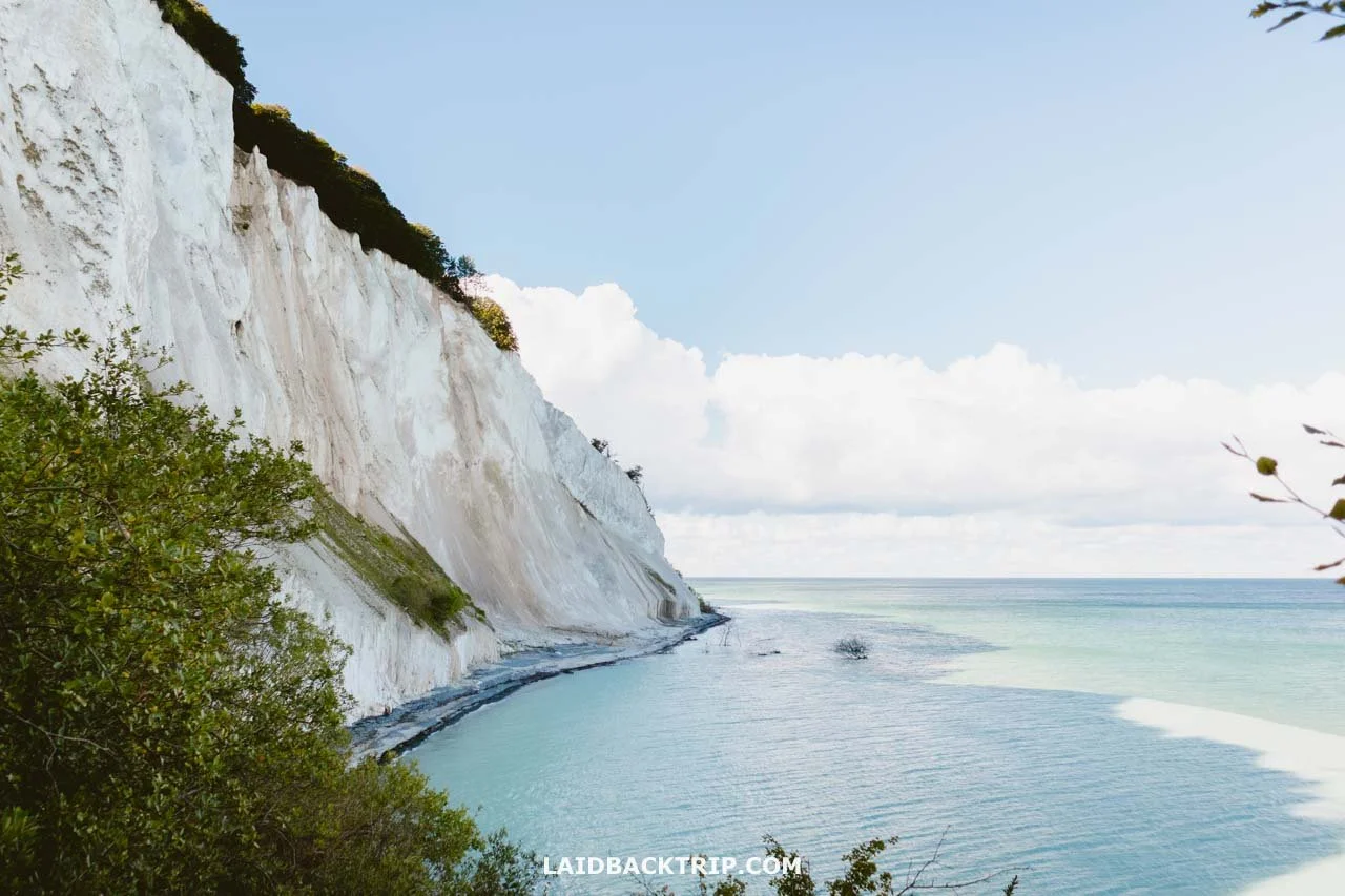
The white chalk cliffs were truly amazing.
Driving to Møns Klint
Because this was part of our larger Denmark road trip, driving to Møns Klint was the obvious plan. We kicked off the day early in Svendborg, on Funen Island, roughly 180 kilometers away from the cliffs.
Our first quick stop was in Nyborg to see the old castle, and then we drove across the Great Belt Bridge to Trelleborg Fortress, where we spent the rest of the morning. After that, we still had about a two-hour drive to the cliffs, but we made it more fun by squeezing in a few extra stops around Mon Island, including some churches and neolithic sites.

At last, we spotted Møn Island, the place where the cliffs are.
For anyone starting from Copenhagen, it is about a 140-kilometer drive that takes roughly two hours. And if you are not traveling by car, don't worry; we have included a few alternative options at the end of this guide, so stick around.
Anyway, driving around Mon Island was pretty straightforward. The main road from Stege was a well-paved two-lane road, but every time we took a short detour, the rural roads turned into narrow, almost single-lane routes.

Møn Island is connected to Zealand by a regular road bridge.
Around 2.5 kilometers from the Møns Klint Geocenter, the main road linking the cliffs to the rest of the island changed into a gravel road. It was well maintained during our visit (we drove a car with all-wheel drive, though it wasn't required), just somewhat narrower than the main road.
Parking at Møns Klint
Before the trip, I saved two possible parking spots on my map. The first was the main parking area right by the Møns Klint GeoCenter. I liked that we'd be right next to the main upper cliff trail and was pretty sure there would be plenty of empty spaces.
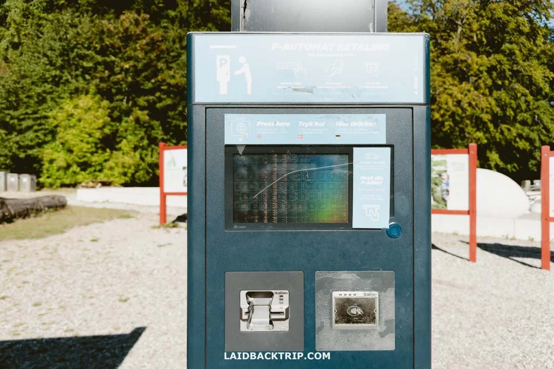
Our license plate got scanned automatically as we reached the parking, and we just paid at this ticket machine.
The other option I considered was Havrelukke P-plads, a free parking lot about 1.7 kilometers before the GeoCenter. Since we were already behind schedule and still hadn't decided whether to visit the museum, we decided to keep it simple and just left our car at the main parking lot.
The only minor downside was that parking at Møns Klint GeoCenter cost 45 DKK per car for the day, but that was fine with us. If you want to visit Møns Klint for free, though, you'll need to park at Havrelukke P-plads or another lot that does not charge a fee.
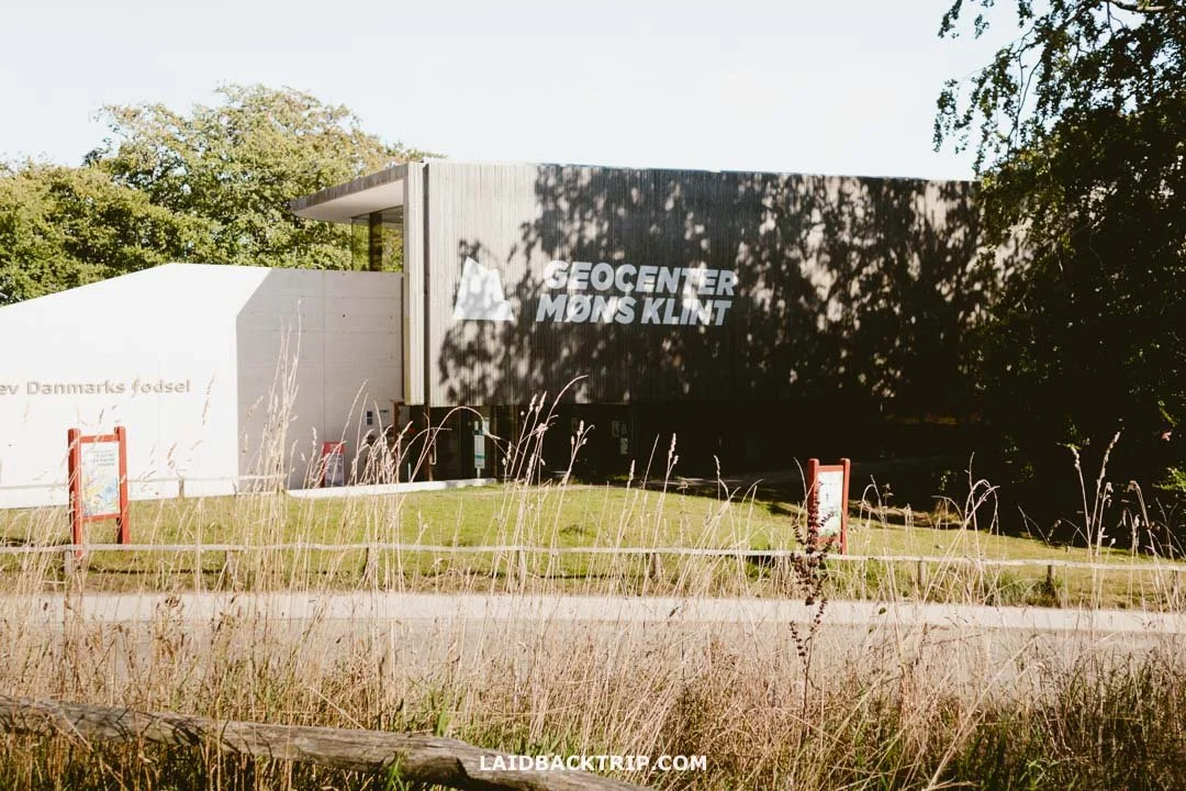
Møns Klint GeoCenter
We got to Møns Klint just before 4 PM, and with the museum closing at 5 PM (open from 10 AM to 6 PM in high season), we spent a little time debating if we should go to the GeoCenter or not.
The modern museum, packed with geological and natural history about the cliffs, looked like a great way to begin our visit. The issue was how little time we had before it closed. Lucie was more in favor of going inside, but I preferred to just explore outdoors since the museum would be shutting in about an hour.
We skipped Møns Klint GeoCenter because we did not have time.
I wasn't against going inside, but with so little time, I thought the visit would feel rushed. Also, the GeoCenter tickets priced at 155 DKK per person seemed like a lot for such a brief visit. I later learned they give a 10% discount if you buy tickets online ahead of time, which lowers the price a bit, but it's still quite expensive.
Just so you know, the GeoCenter runs fossil hunts at the beach, where you can look for preserved remains of prehistoric animals and plants from the Cretaceous period with a local guide. It's an additional 25 DKK per person.
Hiking the Møns Klint Trails
So, with that settled, the next thing we had to figure out was which trail to choose. Yeah, with nature all around, it is no surprise that hiking is the best thing to do at Mons Klint. Møns Klint has seven marked trails, and since we came for the cliffs, we thought about doing a loop that would combine a walk along the edge with a beach, practically offering the very best views and scenery this area has.
Since the GeoCenter is kind of in the middle of the most scenic part of Møns Klint, my first thought was to combine the 2.7-kilometer Røde Udfald trail, which is a loop north of the museum, with the 2.3-kilometer Gråryg trail to the south into one big loop.
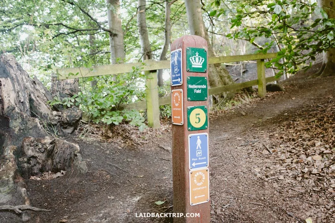
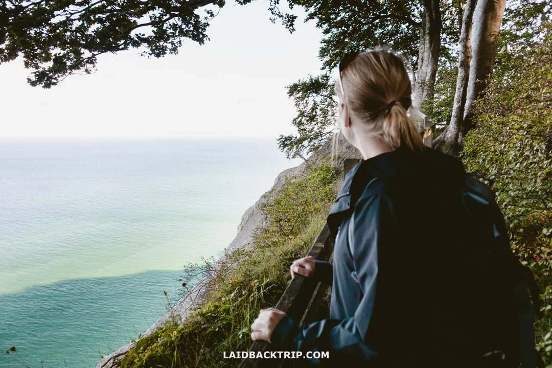
These trail markers were really easy to follow.
The problem with my plan became clear when we got to the starting point and found out that the stairs on the Røde Udfald trail were damaged during the 2023 storm and still had not been repaired (they're expected to reopen sometime in 2025).
After a quick debate, we decided to do the Gråryg trail first, which would bring us back to the GeoCenter, then take just the upper part of the Røde Udfald trail before returning the same way. It wasn't ideal, but given the circumstances, I think it was a pretty good plan.
Maglevand - Gråryg Trail (No. 5)
From the parking lot, we walked past the Møns Klint GeoCenter, where we found the trailhead for all the cliff walks. There was a simple blue sign with "Stranden" written on it (which means beach in Danish) and two yellow-green markers labeled 4 and 5. That was the path we followed for now. From there, we took the Maglevand stairs (Maglevandstrappen) down to the beach.
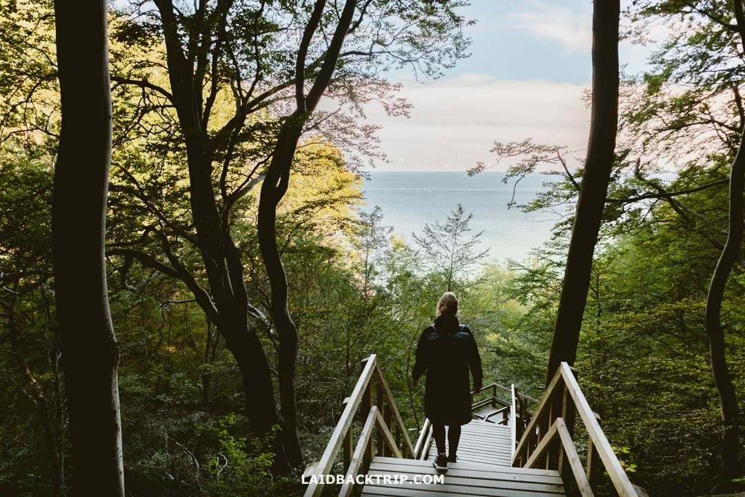
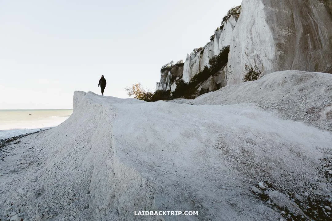
It's almost 500 steps to reach the beach from the top.
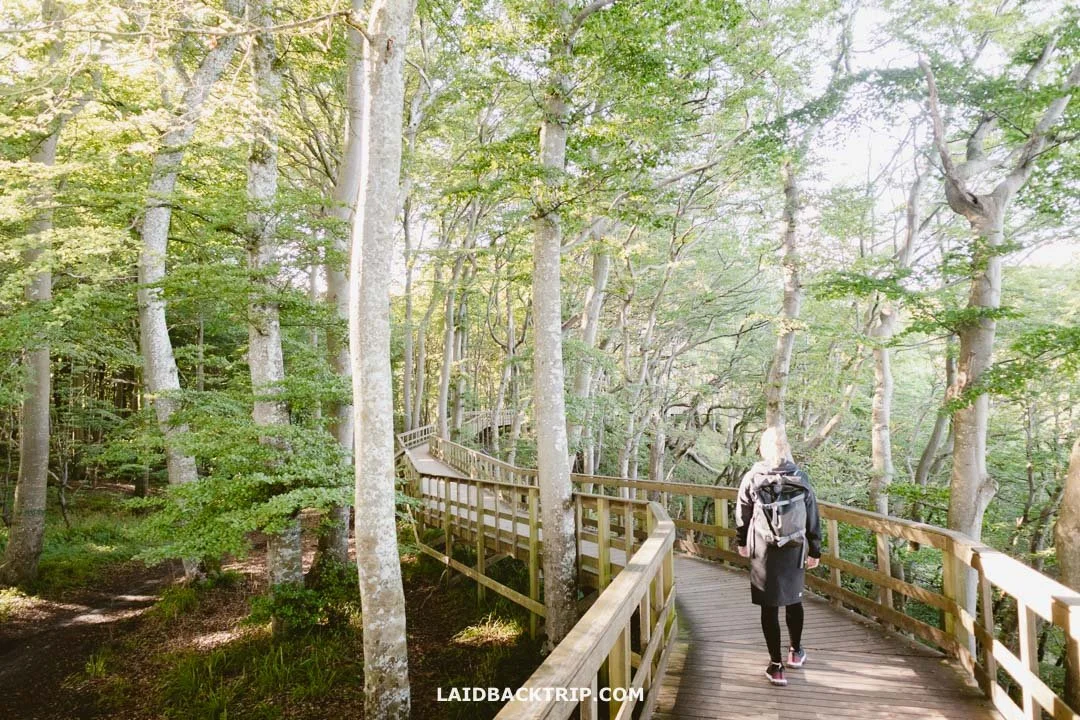
Right from the start, this was one of the coolest parts of the hike. The wooden staircase took us through a still lush green forest, and since we were walking down, tackling the 497 steps of Maglevandstrappen (Denmark's longest staircase) was pretty easy. Through the trees, we could see the Baltic Sea, and the further we went, the more appeared. When we were almost at the beach, the forest ended, and we stopped for a few photos at a small viewing platform.
As we made our way down to the beach, we quickly realized it might be high tide. Our brilliant deduction came from noticing that the last steps of the wooden stairs were partially submerged. Fortunately, there was still some space beneath the stairs where we could squeeze in to keep our feet dry, though we couldn't help but worry about what the rest of the beach might look like.

When the tide is in, the stairs end in the water.
Other than this area, the beach walk was completely fine. After checking some photos, I saw that during low tide, things looked good, but in a few pictures, the water had risen even more. It all comes down to timing when you go.
Since we arrived at Møns Klint in the afternoon, there were fewer people around.
After a little while, we realized this was one of the easiest beach walks we had ever done. In Jutland, we hiked across all kinds of sandy beaches like Sorte Naese and Grenen, but here, we walked on firm chalk and limestone. Only the last stretch before reaching the Gråryg staircase had pebbles, which, on the other hand, made the walk a bit tougher.
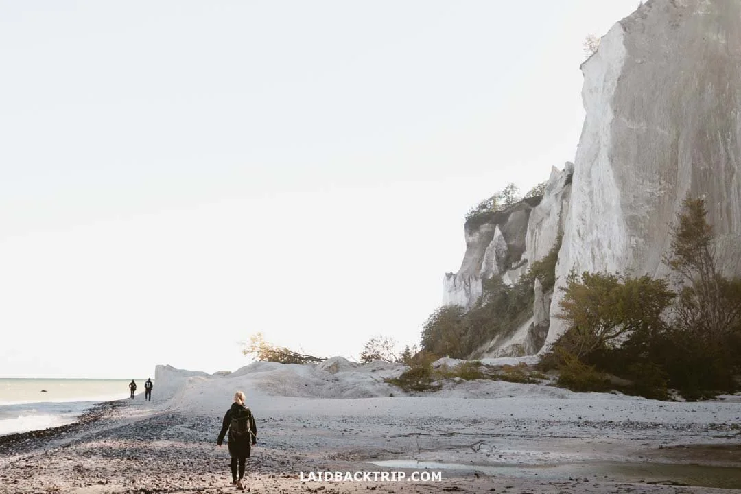
At times, the white chalk cliffs looked like they came from another world.
Mons Klint
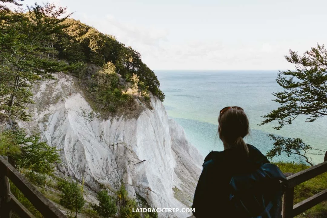
Once we reached sea level, we finally got a good look at the cliffs. To me, Mons Klint felt surprisingly intimate, more than I expected. They first took shape 70 million years ago during the Late Cretaceous period and eventually solidified into thick layers of chalk. It was the glaciers from the last Ice Age that formed their final form.
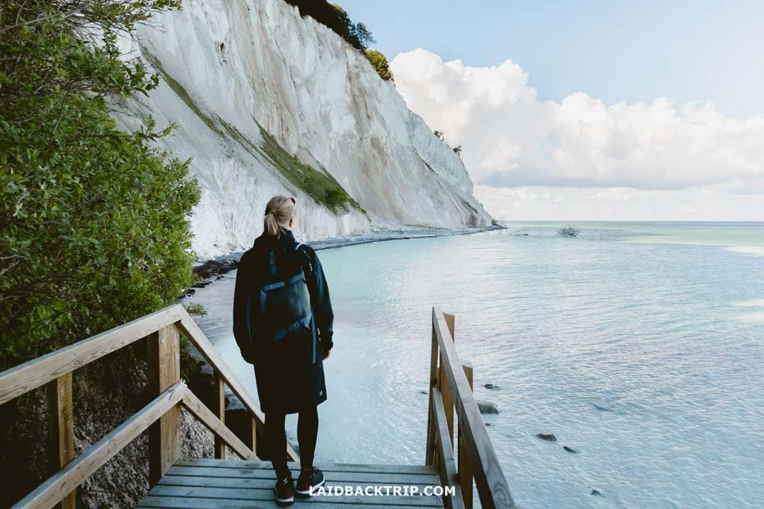
This was definitely one of our favorite views at Møns Klint.
The cliffs extend for about six kilometers and reach 128 meters above the Baltic Sea. Though those numbers sound impressive, the cliffs felt somewhat smaller whether we were at the water's edge or standing above them. I think it was mainly because their upper sections were covered in forest, and the viewpoints often had limited visibility, showing only part of the true scale of the landscape.
Even so, the cliffs were truly incredible and absolutely worth seeing. The experience they offer is just very different from, say, the Cliffs of Moher or Giant's Causeway, which we visited a few years ago in Ireland. Mons Klint is also Denmark's first UNESCO biosphere reserve, meaning it's not officially a World Heritage UNESCO site yet, though I noticed it's on the tentative list.

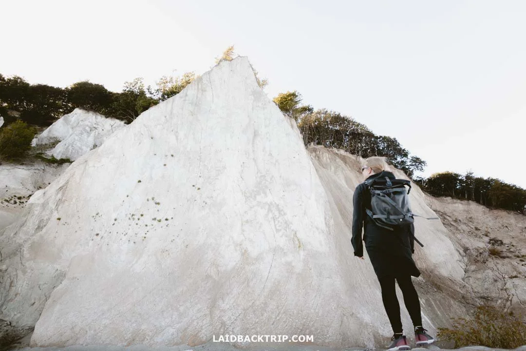
Seeing the eroding cliffs from the beach was pretty surreal.
Climbing Grårygtrappen
I wasn't sure whether the Gråryg staircase would be open since it had been also damaged, but thankfully, it was. I figured it should be since I hadn't seen anything saying otherwise. Still, there were very few people around now, and we hadn't run into anyone coming from the other direction for quite some time.

Grårygtrappen had already been fixed after being damaged a few months earlier.
So when we got there, I was quite relieved that it was fixed. Honestly, it would not have been a huge deal if the staircase had been closed since we would have just walked back the same way we came. But a loop is always better than an out-and-back trail, right?
Grårygtrappen has 468 steps, so only slightly fewer than the Maglevandstrappen we took earlier. Anyway, getting back to the top was not too difficult, though it was definitely more challenging than our hike to Isbjerg Hill or Ejer Bavnehøj, the second-highest point in Denmark.
After getting back up to the cliff's edge, we made our way around to the GeoCenter area. We had hoped to catch some great views of Møns Klint from the top, too, but because of recent landslides, there were only a handful of good viewpoints. It was a bit of a letdown but also a reminder of how Møns Klint keeps shifting due to erosion and how vulnerable these incredible cliffs are to extreme weather.

Some viewpoints were unfortunately closed off because of landslides.
When to Visit Møns Klint
We visited Møns Klint right as summer turned to autumn (in September), and one thing that stood out was how green everything still was. The forest was mostly deciduous, and the trees still had their foliage, making the walk back to the GeoCenter feel even more charming.
I've come across some winter photos of Møns Klint, and without the leaves, the scenery looked much more barren, but the contrast with the white chalk cliffs still gave it a unique charm.
Møns Klint itself is open year-round, but the GeoCenter shuts down from November 1st to March 27th, so just be aware of that. You can visit anytime, but if you want to see the cliffs at their best, spring to fall is the way to go.
The Møns Klint area was still amazing at the end of summer.
Røde Udfald (No. 4)
Once we got back to our starting point behind the GeoCenter, we figured that since the Møns Klint area had been pretty amazing so far, we wanted to explore a bit more. So we decided to do at least the upper part of the Røde Udfald trail, which was still open as usual.
Starting from the same place as before, we turned left (though really, we just continued on the same path) and made our way toward the Røde Udfald staircase. We followed the blue trail signs for Dronningestolen (Møns Klint's highest point at 128 meters) and Forchhammers Pynt, along with the familiar yellow-green marker labeled with the number 4.

The trail to Røde Udfald stairs also offered some beautiful views along the way.
We decided that once we had seen enough, we would just head back the same way. After passing a nice picnic area with tables and benches, we climbed another wooden staircase a few meters ahead, though this one was much shorter than the others. Soon, we reached the Dronningestolen viewpoint and kept walking. After about a kilometer, we arrived near the Vitmundts Nakke viewpoint, where we enjoyed some final views of the Møns Cliffs before heading back to our car.
There were even more landslides in this area, and at one point, the trail was practically right on the edge of one. That made me a little uneasy, but aside from that, the trail seemed pretty safe.
Landslides are very common in the Møns Klint area.
Travel Insurance
We never leave home without travel insurance that was designed to cover our expenses if something goes wrong during the trip.
Travel insurance protects against theft, flight delays, injury, illness, cancellations, and much more.
World Nomads provides travel insurance for travelers to cover their trip essentials, including sports and adventure activities.
SafetyWing is affordable travel insurance for backpackers, long-term travelers, and digital nomads.
Travel smarter and safer!
Trails at Møns Klint We Missed
All in all, we walked just under two kilometers on the Røde Udfald trail and a bit over two kilometers on the Gråryg trail, so in total, we covered about four kilometers at Møns Klint. Both trails were clearly marked, and the steeper parts along the cliff's edge had wooden stairs, which made the hike pretty easy.
Since this was our first visit to Møns Klint, we weren't really interested in the 'inland' trails. We didn't have much extra time, and honestly, those trails away from the cliffs looked more like easy walks through regular forest and countryside, which wasn't really why we came.
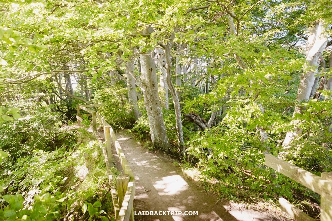
This is generally what the trails at the top of the cliffs looked like.
If you do have some extra time (perhaps staying a few nights at Camp Møns Klint nearby) and want to see more of the region, the 9-kilometer Klintholm Gods trail is a popular choice. Also, if you stay at the lovely Liselund Ny Slot Hotel, there's a 2.5-kilometer Liselund trail that circles the park around the hotel.
Accommodation Near Møns Klint
Before deciding to drive a bit further north, we thought about staying at Møns Klint. Nearby places like Klintholm Marina Park Cabins and Villa Huno looked great, but we also liked the idea of staying near the cliffs in cool spots like Maglebjerggaard Gæstgiveri or The Light House.
How Much Time We Spent at Mons Klint
Overall, Møns Klint was truly one of the most beautiful places we have visited in Denmark, though it took less time to see what we wanted than we thought. We spent a little under two hours there, covering the four-kilometer loop trail at a relaxed pace and stopping often.
Even if the Røde Udfald trail had been open and we did the full loop, the time spent would have been pretty much the same. The main difference would have been taking a different staircase down to the beach. The part of the beach we missed because of the closure, we pretty much walked anyway, just along the cliff's edge instead of on the beach.
We likely would have spent two to three hours inside the museum if we'd gone in, but without it, those two hours seemed plenty. Sure, we could have spent extra time walking the less crowded trails, but we'd rather use that time to explore more of Møns Island itself, which we mostly did on the way there.

We passed through the town of Stege on our way to Møns Klint.
Our favorite spots were the group of churches, Elmelunde Church, Magleby Kirke, Keldby Church, and Stege Church (the whole Stege town was lovely), along with Sømarkedyssen dolmen and the Kong Asgers Høj burial mound.

Sømarkedyssen was just a few kilometers from the cliffs, so we decided to make a quick detour there.
There were definitely more interesting places we missed, but we were on a pretty tight schedule and had to keep moving. Since it was a beautiful sunny day, catching the sunset from the cliffs sounded perfect. But that wouldn't happen for a few more hours, so we decided to drive about 90 minutes to Stevns Cliffs and spend the rest of the day there.
Getting to Møns Klint Without a Car
As I promised at the start of this post, I'll quickly cover how to visit Møns Klint without a car. You have a few options; one is a Møns Klint Tour from Copenhagen, which is definitely the most convenient way since it takes you directly to the cliffs.
If you prefer public transportation, you first need to get to Stege (by bus), the largest town on Møns Island. From there, catch the 667 bus to Magleby. The main downside is that Magleby is about 5.5 kilometers from the cliffs, so you'll have to walk or bike there (bikes are allowed on the bus). Obviously, this option isn't very convenient for most tourists, so the tour really is the better choice.
No matter how you get to the cliffs, they are definitely worth a visit.
Another option is a free shuttle bus operated by Andel that circles Møns Island and stops at the Møns Klint GeoCenter, but it only runs on holidays and weekends. Like before, you'll have to get to the island first, with Stege being the easiest place to start.
Again, renting a car in Copenhagen or taking a tour is definitely the best way to reach Møns Klint. And if you bring a car, there's even more to explore on Møns Island or nearby, like Køge or the Stevns Cliffs I already mentioned.
Travel Resources
Here you can find links to all the travel resources we use and which you might find helpful when planning your next holiday.
Accommodation: When looking for accommodation, we usually search hotels via Booking.com or Hostelworld.
Tours: Although we love to travel independently, some places are better to visit with a guided tour.
We prefer GetYourGuide for its easy-to-use interface and solid reputation. Another great alternative is Viator.
Rental Cars: When going on a road trip, we always use Rentalcars.com, a reliable site for booking a rental car in advance.
Flight Tickets: When looking for flight tickets, you can search Skyscanner to find the best price.
Travel Insurance: World Nomads and SafetyWing cover against risks of travel.


