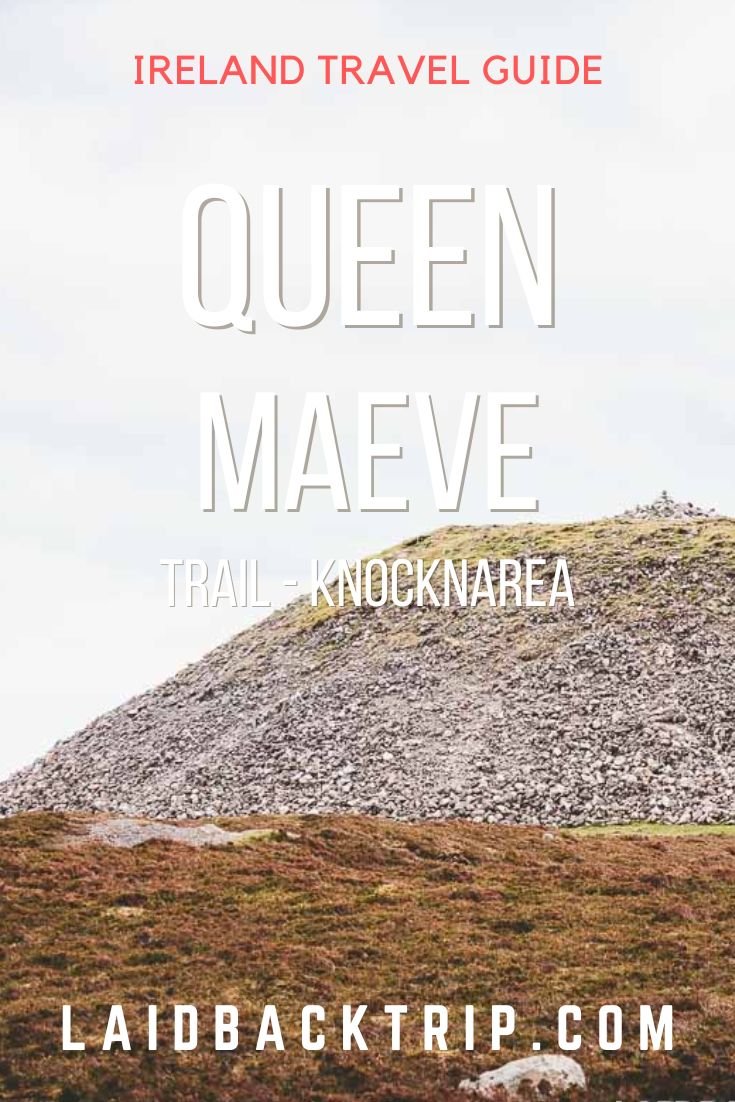
Hiking the Queen Maeve Trail - Knocknarea
Read our travel guide on Queen Maeve Trail - Knocknarea hike in Ireland. Includes trail description, tips on how to get, parking, trailhead, and when to go.
There are endless ways for nature lovers to spend an active day outdoors in County Sligo. In our opinion, Queen Maeve Trail is among the best ones.
As we love hiking, we wanted to include as many hikes and walks as possible in our Ireland road trip itinerary.
Unfortunately, this was not a long-term trip, so we had only limited time, and it was not an easy thing to do for obvious reasons.
When we eventually got to the western coast of County Sligo, we didn't pass on the opportunity to explore the Queen Maeve Trail on Knocknarea Hill.
Knocknarea is 327 meters high hill that dominates the Coolera Peninsula, and it's only a stone's throw from Sligo town.
This prominent hill offers an iconic image of County Sligo, lovely trails, and stunning views from the top.
There is one more reason to include Queen Maeve Trail in your itinerary, though.
As the name of the trail hints, Knocknarea has a huge 5.000 years old cairn at its summit, considered to be the final resting place of Queen Maeve.
So without any further ado, here is everything you should know about Queen Maeve Trail before you go.
Queen Maeve Trail - Knocknarea
If you're an outdoor person looking for a relatively short yet rewarding hike in County Sligo while road-tripping Ireland, we believe Queen Maeve Trail should check all your boxes.
As mentioned above, the views from Knocknarea are stunning, and you will get a chance to see Queen Maeve's Cairn.

Entry Points
There are currently three entry points to Queen Maeve Trail at Knocknarea Hill - Strandhill Trailhead, Rathcarrick - Coillte, and Glen Road Car Park.
Each trailhead has a parking lot where you can leave a car.
When deciding which one to choose, we believe all trails offer a very similar experience.
Furthermore, the trails interconnect at the summit, so you can easily explore Knocknarea on a loop hike.
Strandhill Trail
Due to its location, good parking, and easy access, Strandhill is probably the most popular trailhead at Knocknarea.
The 2.5-kilometer Queen Maeve Trail (one way) from Strandhill has an elevation gain of 300 meters and starts at the parking lot right next to Sligo Rugby Football Club.
From here, cross R292, pass through a wooden gate, and follow the well-maintained gravel path all the way to the first junction at the edge of the woodland area.
Here you should turn right and pass through another wooden gate. You will get nice views of the entire area on your right-hand side.
You could also turn left and reach the summit via Rathcarrick and Glen Road at this junction. Anyway.
After 500 meters, the trail abruptly turns left, and you will join a narrow wooden, raised boardwalk with many steps that will guide you through the forest.
Once you leave the forested area, continue along the wooden bog bridge until you reach a gravel path once again.
This is the steepest part of the hike and has plenty of steps.
The trail then gently makes its way to the top of the hill through heathland, where you will finally have a chance to marvel at the huge Queen Maeve's Cairn.
Rathcarrick - Coillte Trail
Admittedly, we didn't even consider starting at Rathcarrick.
However, it could be a solid choice for hikers who want to do the full loop or in case the other two parking lots are packed.
The 6.5-kilometer hike with an elevation gain of 250 meters starts with a decision of whether you want to hike around Knocknarea in a clockwise direction or vice versa.
Regardless of whether you take a left or right, this path eventually connects with one of the other two trails.
From the parking area, take a left, and the trail joins the Strandhill in two and a half kilometers.
If you decide to go left, it connects with Glen Road within the first kilometer and a half. A small parking lot can be found at the junction of L3506 and L3503.
Glen Road Trail
Sometimes referred to simply as Knocknarea Car Park or Queen Maeve's Grave Car Park, as shown on Google Maps, Glen Road is arguably the best starting point for this hike.
This is a 1.5-kilometer out-and-back trail with an elevation gain of 200 meters.
Even though some sections of the climb are strenuous, we would still consider it a fairly easy hike as it's very short.
The first part of the hike gradually climbs through farmlands.
If you ask us why we picked this trail, it was simply because it was the first trailhead/parking that popped up in our navigation app.
Deserted Village
Then the incline gets tougher, and so does the terrain. Sturdy hiking boots will work best here.
After a few minutes, we saw the remains of a tiny village on our left.
At least ten families lived up there, but the settlement was deserted during the famine years around 1948.
Knocknarea
There is not much to say about the climb itself, as the ascent is relatively steep but short and not difficult, especially if you keep a steady pace.
We moved fairly quickly over uneven terrain and reached the summit in less than twenty minutes.
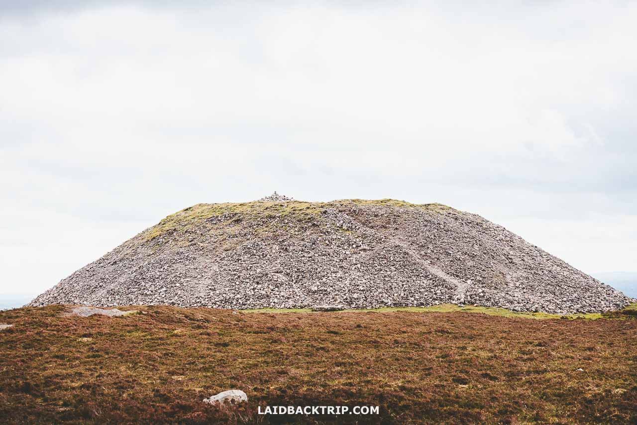
The giant mound of stone is pretty impressive, and the 360-degree views from the top are astounding.
If you've enjoyed the views from Diamond Hill Walk or Geokaun Mountain Trail, you won't leave disappointed.
Queen Maeve's Cairn
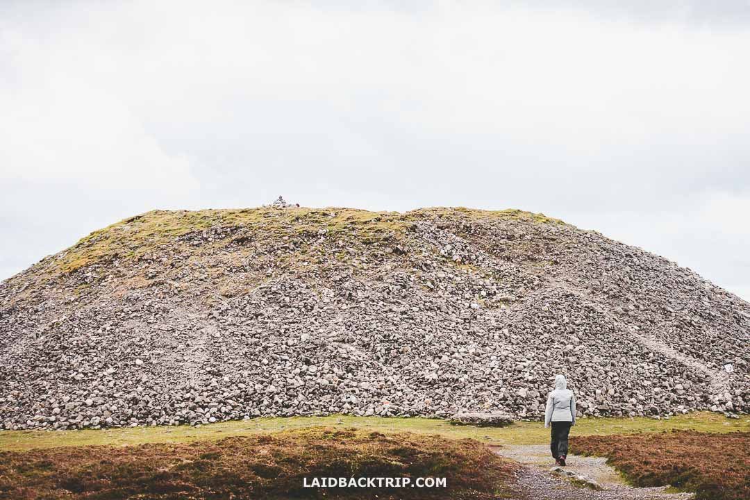
Being 10 meters high and 60 meters wide, with stones weighing approximately 30.000 metric tons, Queen Maeve's Cairn is the most impressive monument of this kind in the west of Ireland.
This Neolithic site was built between 3.500 and 3.200 BCE, and it's believed that it covers a passage tomb and the grave of Maeve, the Iron Age queen of Connacht.
Interestingly enough, it has not been excavated yet, giving this place almost a mystical aura.
Irish mythology depicts her as a strong archetypal female warrior, and you can find several places in Ireland named carrying this name.
Speaking of which, the name is also spelled Medb, Meadhbh, Maev, Maeve, Mave, or Maiv.
It's not allowed to remove any stones from the area, and it goes without saying that climbing Queen Maeve's Cairn is prohibited as well.
Even though it was written everywhere and there were Do Not Climb the Cairn signs at its base, there were still clearly visible paths leading to the top.
By the way, there are a few smaller passage tombs scattered around Knocknarea.
If you want to see more Neolithic sites in Ireland, you can find similar structures at Carrowkeel and Boyne Valley.
Views
Even though you get 360-degree views, the summit is fairly flat, so you need to walk around a bit to be able to enjoy the views of all parts of County Sligo.
The panoramic views from Knocknarea feature Sligo Bay, Ben Bulben, the Atlantic Ocean, and even Slieve League in the distance.
The views in all directions are breathtaking and well worth the effort.
When it was time to go, we headed back down the trail the same way we hiked up. The walk back was all downhill but not that easier for our leg muscles.
Opening Hours
Queen Maeve Trail can be explored at any time of the day, with sunset and sunrise being the prime time to see the stunning Knocknarea.
Entrance Fee
There is no entry fee to Queen Maeve Trail - Knocknarea.
If you're visiting Ireland on a budget, make sure to include as many hikes in your itinerary as possible.
You don't have to spend money on expensive tickets while being able to explore some of the island's most beautiful corners.
How Much Time Do I Need
In general, the Queen Maeve Trail is a relatively easy hike that takes about 1-3 hours to complete, depending on the trail you pick and your walking pace.
When to Go
The Queen Maeve Trail and the area surrounding Knocknarea are gorgeous from late spring to early autumn.
The hike can be done any season. We did the hike in early May, which is still a slower season in Ireland.
The trail from Glen Road was completely deserted, so we saw only two pairs of hikers at the top.
Summer is usually the busiest time to explore Knocknarea, so be prepared that your experience will most likely differ.
Also, don't forget that this is generally the most expensive time when to visit Ireland.
As County Sligo sees mostly mild winters, Queen Maeve Trail can also be enjoyed during this period.

What to Pack
Regardless of which trail you choose, wear proper clothing and be ready to adapt to changing weather conditions.
A waterproof and windproof outer layer is essential to ensure you stay nice and dry for the entire hike duration. This item should be on every Ireland packing list.
A large part of the trails (especially the one starting from Glen Road) and the summit are exposed to wind, rain, and sun.
Make sure to have a quality rain jacket or, alternatively, a windbreaker.
As we had rain in the forecast, we wore our rain pants right from the start.
Even though we lucked out and got only a few raindrops, it was really cold and windy up there. We also brought a comfortable daypack to store essentials and a water bottle.
In summer, make sure you bring strong sunscreen, a hat, and plenty of water with you.
How to Get There
Whether you want to start at Strandhill, Rathcarrick, or Glen Road, the easiest way to get to Queen Maeve Trail is by car.
Alternatively, it's possible to get from Sligo to Strandhill by bus.
Car
Knocknarea hiking trails are located on the Coolera Peninsula, less than a 15-minute drive from the town of Sligo.
It takes about an hour to get to Knocknarea from Donegal, which sits in the north.
The nearest large city is Galway, about a two-hour drive from Knocknarea. The journey from Dublin takes around two and a half hours when traveling via the M4 and N4.
With a car, you will enjoy a dynamic itinerary, choose your own routes, and reach places that would be hard to get to otherwise.
We do really believe Ireland is an ideal place for a road trip. Furthermore, driving in Ireland is not as daunting as it's often painted.
In case you want to find out more on this topic, make also sure to read our guide on renting a car in Ireland.
Travel Resources
When renting a car, we use Rentalcars.com.
Parking
Each trailhead - Strandhill, Rathcarrick, and Glen Road - has its own free parking area, and finding an empty space should not be a challenge.
Bus
Route S2, operated by Bus Eireann, connects Strandhill with Sligo (and Rosses Point), so you can also reach one of the entrances by public transport.
The bus departs every hour and stops at Mannionstown - Dorrin's Strand, about 100 meters from the Strandhill Trailhead.

Where to Stay
There's no shortage of choice when it comes to finding a hotel near Knocknarea.
Sligo, the largest town in Sligo County, boasts a diverse range of hotels catering to different budgets and preferences.
So, whether you travel on a budget or money is not a problem, the town of Sligo has your back.
Our next recommended option is the tiny town of Strandhill, which is more peaceful and might suit your preferences better if that's what you're looking for.
You will also find plenty of small family-owned bed and breakfasts along the way, offering great value for your money.
They usually have limited capacity, though, so it's essential to book early, especially when traveling in the peak season.
Here are our tips on the best hotels near Knocknarea.
Sligo | Riverside Hotel - Set in the heart of Sligo town, this hotel with affordable rates offers stylish en suite rooms with river views, a full Irish breakfast, and friendly staff. Everything you need is within walking distance.
Carraroe | Castledale - Nestled in a peaceful rural setting, this beautiful house boasts modern rooms, a well-maintained garden, friendly hosts, and ample parking.
Strandhill | Strandhill Lodge and Suites - Located in Strandhill, this modern hotel has spacious rooms with beautiful views, tasty breakfast, helpful staff, plenty of parking, and an ideal location for exploring Knocknarea and Strandhill Beach. Most importantly, it's only a 10-minute walk from the trailhead.
Staying Safe
If you stick to the designated trails, Knocknarea is generally a safe place to visit.
Ireland's weather, especially its coastal areas, can be unpredictable, so checking the forecast beforehand is essential.
Make sure to wear adequate clothing and footwear, and watch your footing as the terrain is rugged and uneven at times.
In case of rainy and foggy conditions, we would postpone the trip and wait for better conditions.
While you can still see Queen Maeve Cairn on the summit, the trail will be slippery, and the fog will obscure the views.
Here you will find more tips on staying safe in Ireland.
Travel Insurance
We never leave home without travel insurance that was designed to cover our expenses if something goes wrong during the trip.
Travel insurance protects against theft, flight delays, injury, illness, cancellations, and much more.
World Nomads provides travel insurance for travelers to cover their trip essentials, including sports and adventure activities.
SafetyWing is affordable travel insurance for backpackers, long-term travelers, and digital nomads.
Travel smarter and safer!

Is Queen Maeve Trail Worth It?
In our opinion, Knocknarea's Queen Maeve Trail is one of the best hikes in County Sligo.
Even though the trail is not as easy walk as it might seem at first, it's one of the most remarkable Ireland's Neolithic sites, and the views from the top are unparalleled.
Driving along the Wild Atlantic Way is an amazing experience, but it requires spending a lot of time in your car.
Therefore, we were really grateful for every opportunity to stretch our legs and explore some of the most beautiful places in Ireland on foot.
If you are an avid hiker and this is your first time in County Sligo, Queen Maeve Trail should be on your list.
If Neolithic history is your thing, make sure also to visit Bru na Boinne and Carrowmore Megalithic Cemetery while in Ireland.
Travel Resources
Here you can find links to all the travel resources we use and which you might find helpful when planning your next holiday.
Accommodation: When looking for accommodation, we usually search hotels via Booking.com or Hostelworld.
Tours: Although we love to travel independently, some places are better to visit with a guided tour.
We prefer GetYourGuide for its easy-to-use interface and solid reputation. Another great alternative is Viator.
Rental Cars: When going on a road trip, we always use Rentalcars.com, a reliable site for booking a rental car in advance.
Flight Tickets: When looking for flight tickets, you can search Skyscanner to find the best price.
Travel Insurance: World Nomads and SafetyWing cover against risks of travel.