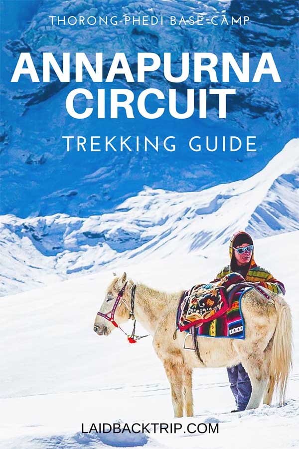
Annapurna Circuit: Crossing the Thorong La Pass
After two weeks of trekking in Nepal, we were prepared to cross the Thorong La, the highest point on the Annapurna Circuit, and get to Ranipauwa from Thorong Phedi. At 5416 meters, Thorong La Pass is a challenging day hike at high altitude. This travel guide includes acclimatization tips, trail description.
Crossing the Thorong La Pass (5416 meters above sea level) is the highlight of the whole two-week Annapurna Circuit, and the highest point you will reach on the entire trek.
For most of us, it's even one of the highest points in the world we can get without climbing experience and proper gear.
Thorong La is also the hardest day on the Annapurna Circuit, but it’s definitely worth the effort.
Getting to Thorong La Pass is challenging but doable in good weather. You will fight against the steep trail, fatigue, and high altitude.
Be always prepared for the possibility of snow, which can make the pass impassable for days. And although nobody wants to wait or in the worst scenario walk back, don't risk your life.
In October 2014, forty-three people lost their lives because of heavy snowfall when 1.8 meters of snow fell in 12 hours. Always have a backup plan in your Annapurna Circuit itinerary.
We had snow showers the last three nights before crossing the pass, but it didn't snow during the day, the snow was slowly melting, and the trail remained still passable.
Later that evening, before the actual hike, we talked to the lodge owner at Thorong Phedi about the weather, and he was optimistic and reassured us that everything should be ok the next day.
The journey from Thorong Pedi across Thorong La Pass to Ranipauwa (Muktinath) requires six to eight hours walk in good weather, and you'll ascend 1040 meters and descend 1620 meters that day.
As you can tell, Thorong La day hike is a pretty tiring, so make sure you do not underestimate this trip.
The climb to the Thorong La pass, the views of snowy Himalayas from the trail, and then the descend is still one of our favorite travel memories. And one of the best things we’ve ever done.
That's why we've put together this Thorong La Pass travel guide, where you can find out a bit more about what to expect and how to plan your day.

DAY BY DAY ANNAPURNA CIRCUIT ITINERARY
Part 1: Besisahar to Chame
Part 2: Chame to Manang
Part 3: Acclimatization in Manang
Part 4: Tilicho Lake Side Trip
Part 5: Tilicho Base Camp to Thorong Phedi
Part 6: Crossing the Thorong La Pass
Part 7: Ranipauwa to Jomsom
THORONG LA PASS HIKE
Finally, the most anticipated day has come. When we woke up at 5 AM, the place was still pretty quiet, but we could hear people leaving earlier.
Although many travel guides recommend starting Thorong La hike really early, we think you do not have to set off earlier than 6 AM or even 7 AM as you have the whole day ahead of you. We would have started earlier only if the weather forecast for the afternoon was bad.
We checked the weather the first thing in the morning and made sure it was clear, then we packed our stuff, had quick breakfast, and set off.
It was still dark and freezing outside. If you want to start really early, make sure to have a headtorch with fully charged batteries.
We were so cold that none of us wanted to hold trekking poles in our hands because our fingers were numb from the cold.
And by the way, trekking poles will make your day thousand times easier.
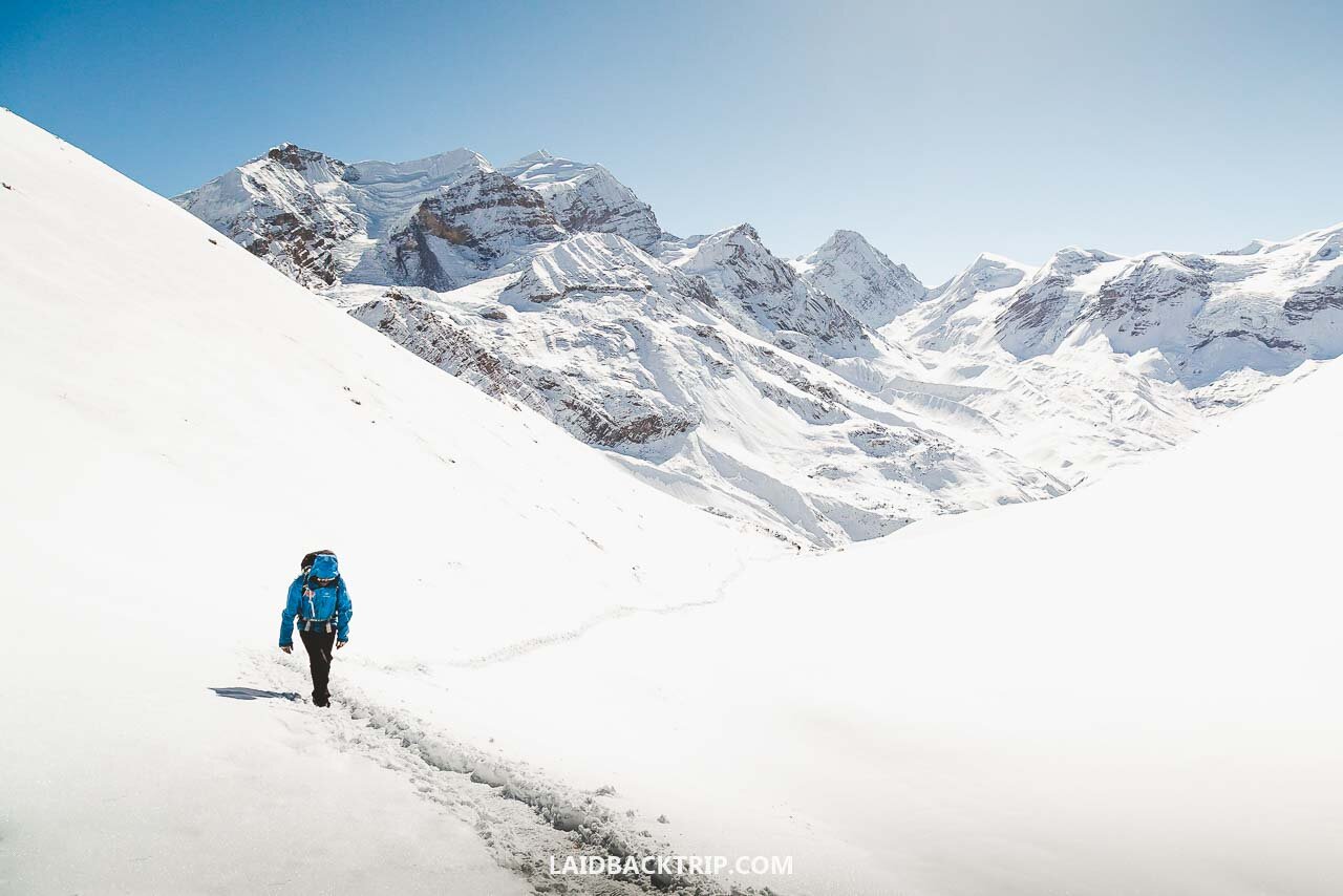
The path was extremely steep from the very beginning, and we steadily worked our way up through a series of several switchbacks.
Even though it was exhausting, it helped us to keep our bodies warm.
The only thing we had worried about was the snow covering the trail, which could make the crossing impossible. Fortunately, locals and early hikers had climbed their way up in the morning, making the trail visible and passable again.
After an hour of a strenuous climb, you'll reach the High Camp standing on a small opening. It is even possible to spend the night here, but we decided against it the day before, because the altitude is 4880 meters, and we felt it would be too high for us.
When we reached this plateau, we could finally see the sun rays, so we took off some layers.
If there's something you should seriously consider for hiking Thorong La Pass, it is the clothing. The first section is really challenging, so you'll sweat a lot, but it is also very cold in the morning.
That's why we wore gloves, a hat, a functional t-shirt with long sleeves, a short-sleeved t-shirt on top of that, a sports jacket, and a windproof jacket.
We also had outdoor pants on the lower body, woolen socks, and hiking boots. Thanks to it, we could change the outfit a bit and keep only dry layers. Make sure to read our Annapurna Circuit Trek Packing List before you go.
The trail goes up steadily from the High Camp, but it is not that steep as the first part.

The path traverses the canyon back and forth, and approximately 45 minutes later, you'll exceed the 5000 meters zone (there is a small seasonal tea house). We did not buy tea, but it was a perfect place for a snack.
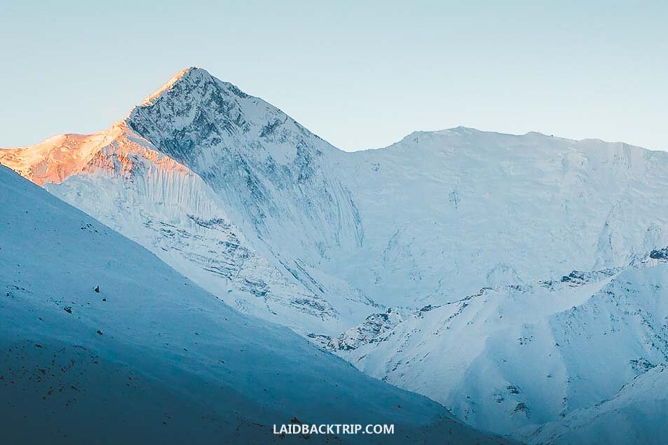
From this point, the trail is not that challenging, and we could have been amazed by the vistas of surrounding snow-capped mountains.
But the backpack, extortion, compacted snow on the trail, and the altitude started to slow us down. It was a true winter wonderland, but at this point, we really wanted to make it to the top.

We had to motivate ourselves, and as there were snow poles along the route, we stopped next to every single one and took a few seconds break just to catch a breath. We also saved up some energy bars, and they helped a lot as well.
Several false summits made the final push even harder, but after four hours, we finally reached Thorong La.
The pass itself lies between two 6000 meters high mountains, Yakwakang and Thorong Peak, and welcomes you with a traditional Chorten, prayer flags, and congratulation board.
Even though the views of both sides of the valley and the surrounding mountains are still incredible, this place is more about emotions that will surely overwhelm you.
After fourteen days of trekking the Annapurna Circuit, we finally made it to Thorong La pass at 5416 meters. It was a long journey since we‘ve first departed Besisahar, and made our way from the jungle to the snow-covered pass.
There were some people on the top already, but we could see that the sheer beauty of the Himalayas occupies the minds of everyone.
Take your time here, embrace the moment and admire the classic views of Great Barrier Ridge, Kali Gandaki Valley, or Chulu West peak.
There's a tea house at Thorong La pass, so feel free to refresh yourself, you are going to need it.
One would say that the climb up is difficult, but unfortunately, it is not the end of the day. Not at all.

Travel Insurance
If you plan your trip to the Himalayas in Nepal, there are several things to consider.
First of all, the trails are challenging, weather can change rapidly, and you'll be hiking at a high altitude - and unfortunately, mishaps happen. Plus, the highest point on Annapurna Circuit is 5416 meters above sea level.
When it comes to travel insurance, we never travel without it. It is not just us who think that travel insurance is important. The Nepalese government requires having insurance.
For your safety, it should cover sports activities and climb above 5000 meters.
Having a travel insurance number is even compulsory when filling out the form in order to get Annapurna Circuit Trekking Permits - TIMS and ACAP.
World Nomads provides travel insurance for travelers to cover their trip essentials, including sports and adventure activities.
SafetyWing is affordable travel insurance for backpackers, long-term travelers, and digital nomads.
Travel smarter and safer!

DESCENDING FROM THORONG LA
We found the descend (1600 meters) equally exhausting and hard as the climb up. Seriously.
The first section was extremely slippery because of the compacted snow turning the trail into ice, so we were more sliding than walking on the way down and fell down several times.
The lower part was tricky too, due to running water and muddy patches on the trail. You must be cautious all the time, otherwise your legs will suffer.

On the way back, we also made a crucial mistake.
We did not reapply lip balm and sunscreen again, so the next few days, our faces were swollen, lips sun-burnt, and we suffered while eating the food.
As the sun is super-strong in the altitude and the phenomenon is multiplied by the snow that reflects the sun rays, do not underestimate it. Always wear sunglasses, as the snow blindness is a real thing.
Also, even if you are not thirsty, keep your water bottle handy all the time to prevent headaches.
Trekking poles will help you tremendously at this point.
After 2 hours of descent, we finally reached a small settlement Chabarbu where we had lunch and restored some physical and mental strength to carry on.
From here, it's less than an hour of enjoyable walk to the quiet village of Ranipauwa, home to Hindu Muktinath Temple.

But for most hikers who have just finished their journey, it is mainly a place where you get a hearty meal, hot shower, and comfortable bed.
This side of the valley offers beautiful views of the seventh highest mountain in the world, Dhaulagiri (8167m), and a glimpse of the forbidden Mustang District and the Kingdom of Lo.
The Annapurna Circuit ends here for many travelers, and it is possible to take a bus to Jomsom, Pokhara, or Kathmandu.
You can still carry on from Ranipauwa on foot to neighboring villages, but at the time of our visit was the road under construction, so the walk was not very pleasant because of the traffic and dust.
So after a half-day walk to Kagbeni, we gave up and took a jeep from Kagbeni to Jomsom. And the next day arranged a transport from Jomsom to Pokhara.
But before you leave the area, don't miss the opportunity to experience a unique taste of the Tibetan atmosphere and visit the medieval village of Kagbeni, only two hours' walk from Ranipauwa (Muktinath).
Although we knew that Thorong La Pass would likely be the top experience on the Annapurna Circuit, we were very well aware that many things could go wrong, such as the weather, and we did not know how our bodies will react to the altitude.
In the end, we were grateful we did not rush it and acclimated well, so the day of climbing to Thorong La Pass was exactly how we dreamed it should be.
We hope that our Annapurna Circuit travel guides will take you safely to Thorong La Pass as well, and you will enjoy the otherworldly beauty of this part of Nepal's Himalayas mountains.

Travel Resources
Here you can find links to all the travel resources we use and which you might find helpful when planning your next holiday.
Accommodation: When looking for accommodation, we usually search hotels via Booking.com or Hostelworld.
Tours: Although we love to travel independently, some places are better to visit with a guided tour.
We prefer GetYourGuide for its easy-to-use interface and solid reputation. Another great alternative is Viator.
Rental Cars: When going on a road trip, we always use Rentalcars.com, a reliable site for booking a rental car in advance.
Flight Tickets: When looking for flight tickets, you can search Skyscanner to find the best price.
Travel Insurance: World Nomads and SafetyWing cover against risks of travel.