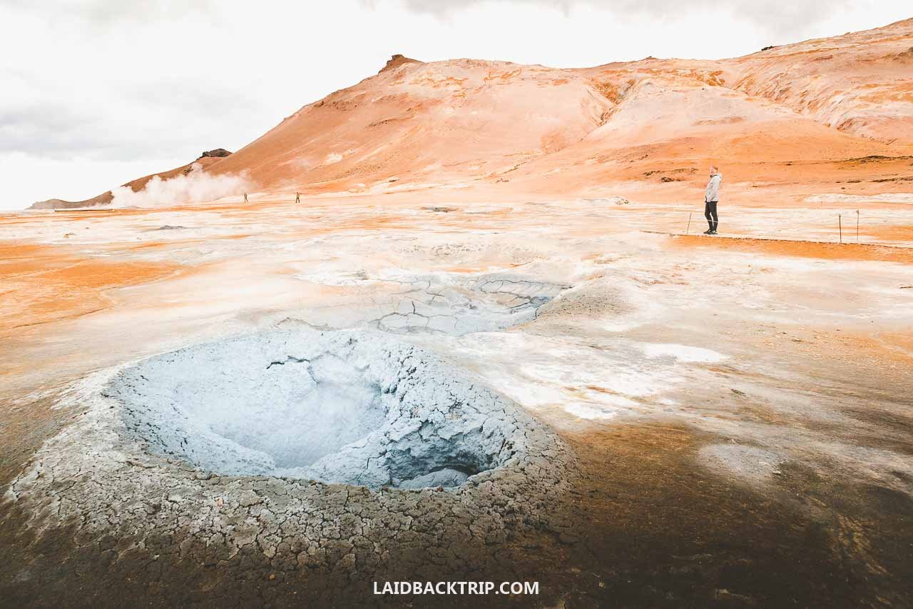
Hverir, together with the Námafjall trail, ended up being one of our favorite stops on our entire trip around North Iceland. Here's how our visit went.
Hverir was one of those stops on the Diamond Circle we were really excited to visit once we finally reached this part of North Iceland. We'd been on the road since morning, traveling from East Iceland's Borgarfjordur eystri, where we'd gone to see puffins, all the way to Husavik for an evening whale‑watching tour. Along the way, we had a few stops in mind, and Hverir was definitely one of them.
Its mud pools, steaming vents, and dramatic mineral‑colored landscape would've been enough on their own, but the area also had the Namafjall trail, which meant we could see even more of the geothermal field and finally stretch our legs after so much driving. A stunning landscape paired with an optional 3‑kilometer hike was exactly our kind of combination.
Exploring Hverir Geothermal Area
As we were approaching Hverir, driving along the unusually flat stretch of the Ring Road, we could already see steam rising from the geothermal area long before we arrived. Just like at Geysir Geothermal Area earlier in the trip, the site revealed itself even before we stepped out of the car.
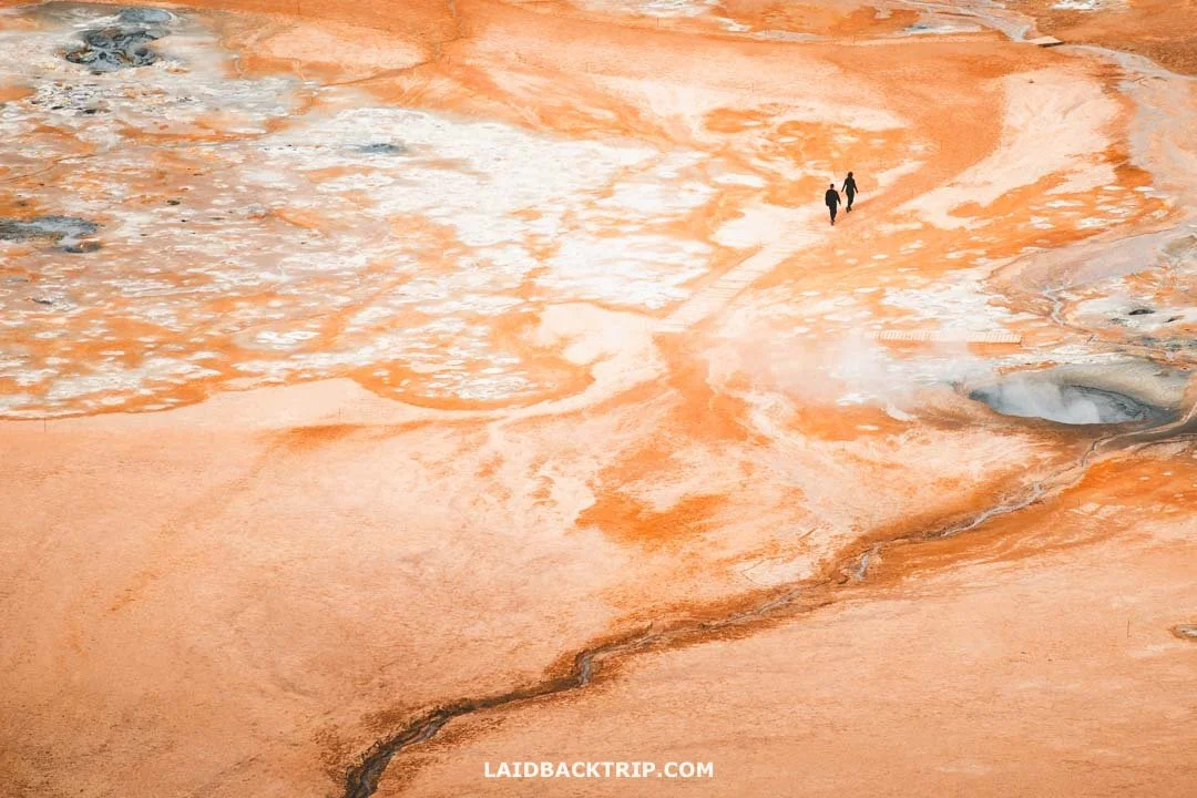
Walking through Hverir was a mix of strong sulfur smell and surreal beauty.
This wasn't unusual for Iceland. Many places like Seljalandsfoss Waterfall, Solheimasandur Volcanic Plain, and Dyrholaey Cliffs had appeared from the road long before we reached them. Once we parked, we were only a few steps from the trail and the first viewing platform. The parking lot was nearly empty, with no big buses in sight, a promising sign that we'd enjoy the whole spectacle without crowds.
What to Expect from Hverir
As soon as we left the car, the wind blew the typical rotten‑egg smell straight toward us. The strong scent of hydrogen sulfide hit hard at first, but after a few minutes we stopped noticing it. It simply meant we were getting closer to the colorful ground, steaming vents, bubbling mud pools, and hissing fumaroles. I'm not sure if I've always found these places fascinating, but despite the smell, they're always a joy to visit.
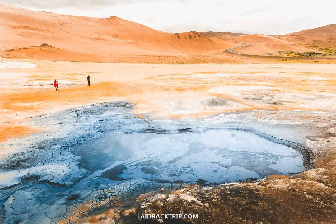
One of the boiling mud pools we saw at Hverir.
Like almost everything in Iceland, the Hverir area, sometimes called Namafjall, Namaskard, or Hverarond, has a volcanic origin, which didn't surprise us at this point in the trip. Before heading farther, we stopped to read the info panel by the trailhead. Hverir sits below the Namafjall mountain, part of the vast Krafla fissure zone.
At a depth of 1000 meters, temperatures exceed 200°C. Groundwater and rainwater seep into the volcanic earth, heat up quickly, and rise back to the surface as steam, powering the bubbling pools and fumaroles. The steam also carries hydrogen sulfide, the source of the strong smell. We also learned that because Hverir has rich sulfur deposits, it was once mined for gunpowder production.

Hverir's geothermal area was actually quite small and really easy to explore on foot.
Above ground, the scenery was just as dramatic as what was happening below. The main viewing platform was only a stone's throw from the car, reached by a paved walkway accessible to everyone. The view from here was breathtaking, accompanied by the ever‑present smell.
Standing on the platform, looking over the barren, alien landscape that resembled Mars, we understood why NASA used this area to train astronauts. Lucie mentioned it reminded her of the Idaho's Moon Craters we visited a few years back, even though the landscapes couldn't have been more different.
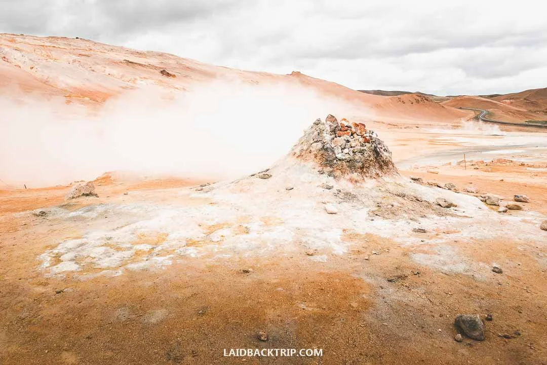
This was one of Hverir's most active fumaroles, constantly releasing hot steam and volcanic gases.
After taking in the views, we walked closer to the bubbling mud pools, hissing vents, steaming fumaroles, earth cracks, and mineral‑colored soil, figuratively speaking, of course, because we didn't want to get too close to boiling water and hot steam. The trail was easy to follow, even though most of the area had no boardwalks. The site was compact, so getting lost wasn't an issue.
Staying Safe at Hverir
As the name and smell suggested, Hverir was an active geothermal area. It had designated trails, which we gladly followed, especially since the warning signs showing that the hot springs reached 80 to 100 Celsius looked pretty ominous. Not all trails were roped off, but the most active and dangerous mud pools were, so staying on the path was easy.
Visiting Hverir in Summer
We arrived at Hverir at the end of June, on a relatively nice day. Despite the dark clouds above us, it didn't rain, it wasn't nearly as windy as it had been on the South Coast in previous days, and the sun often pierced through the clouds, even if only for short moments. Visiting Hverir at the start of summer gave us the highest chance for good weather, but as we'd already learned at Fjallsarlon Lagoon, even this season can bring its share of bad conditions.
In summer, there was obviously no snow, and because it didn't rain, all the paths were dry, making walking around Hverir as easy as it could get. The same was true for the Namafjall, as the trail was definitely easier than Glymur Waterfall or Waterfall Way.

Because we visited Hverir in summer, we could enjoy the contrast of the colored ground, the white steam rising from the vents, and the deep dark mud pools.
The Hverir area itself seemed like it would be easy to explore even in winter, making it a true all‑year‑round destination. However, hiking up Namafjall in winter, with snow and ice covering the trail, would definitely be more challenging without proper winter gear.
Hverir Is Open 24/7
We reached Hverir late in the afternoon, and the whole place felt unusually quiet. Only a handful of cars were parked there, which meant no crowds and definitely no big bus tours. Considering how popular Hverir is, we were relieved to have it almost to ourselves. Since the area is open all day, you can visit whenever it suits you. At other busy spots, like Reynisfjara Beach or Reykjadalur Hot Springs, we purposely arrived late to avoid the masses, but here it wasn’t necessary at all.
Is Hverir Worth Seeing?
The more we walked around Hverir, the more surreal the whole place felt. We'd already visited similar spots, from Geysir on the Golden Circle to Krysuvik on Reykjanes Peninsula, and even places like Wai‑O‑Tapu or Norris Geyser Basin in the past (and in different countries, of course). Each one was different and special in its own way.
Hverir was incredibly compact and easy to explore, and we were glad we stopped here. Even without a geyser, the bubbling and steaming mineral‑rich ground made it a remarkable place worth visiting.
No Entry Fee to Hverir
The silver lining is that the Hverir Geothermal Area itself remains free. Sure, with the new parking fee it doesn't feel quite as free as it used to when we visited, but at least they're not charging to see the bubbling mud pools and steaming vents. Hopefully, that stays unchanged, because all these little fees really add up when you're traveling around Iceland on a budget like we did.
Hiking the Namafjall Trail
While we really enjoyed Hverir, I was even more excited for the hike. After so much driving, I was ready for a proper break, and luckily the weather was on our side. We kept an eye on the dark clouds above us, because it looked like it could start raining any second, but every time the sun appeared, it gave us hope that it would stay that way for the next hour or so we planned to spend on Namafjall.
The sign at the trailhead mentioned a 2.5-kilometer loop, while my watch later showed 2.7 kilometers, but that tiny difference didn't matter. Hverir itself was fairly quiet, with only a few people around, but we had the Namafjall trail completely to ourselves. Since the boiling mud pools and steam vents were right next to the parking lot, it seemed like very few visitors continued farther.
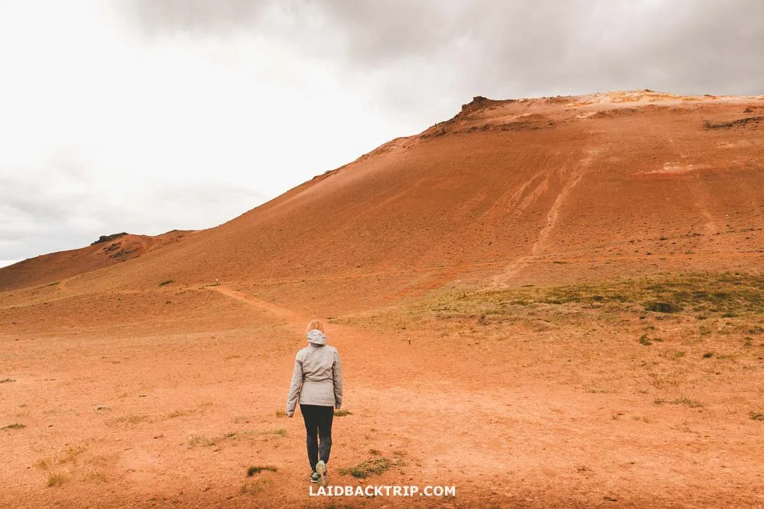
The hike up Námafjall started directly at the edge of the Hverir geothermal field.
The loop started right at Hverir, either from the northwest or southwest corner. Even from the main viewing platform, we could see paths climbing the mountain on both sides. We had no idea whether the trail was meant to be hiked clockwise or counterclockwise, so we simply chose the clockwise direction because we were already heading that way.
The first few hundred meters followed the hillside with barely any elevation gain. After about five or six hundred meters, the trail suddenly began to climb. Even though we'd already gained a bit of height, most of the ascent was still ahead. This next section was fairly steep, and the trail became less obvious, as it looked like everyone picked their own little path. It was a short stretch, and soon the wide trail narrowed into a normal one.
I was glad the trail was dry, because this part would've been super slippery in rain. Before the hike, we decided to ditch our heavy boots and wear trail runners instead, thinking we'd be walking faster and wouldn't spend the whole day on the trail. It turned out to be a good decision. Despite a bit of loose terrain here, the rest of the trail was perfectly fine.

The view from the Námafjall Mountain was incredible, though we still had a short hike ahead to reach its very top.
With every meter we climbed, the views kept getting better. In a few minutes, we reached the rocky outcrop we'd seen from the parking lot. The views of Hverir and the volcanic plain stretching beyond were incredible. To our left, we spotted another patch of steaming vents and sulfur‑rich soil, and when we looked ahead, we could see the true peak of Namafjall just a few hundred meters away.
This part of the mountain was mostly flat, with one last short climb before the summit. The area was dramatic, and the trail was roped off so no one could accidentally wander into active geothermal zones. In a few minutes, we reached Namafjall's summit at 490 meters.
From up here, we could enjoy views of Myvatn, Hverfjall Crater, Dimmuborgir Lave Field, Grjotagja Cave, and the Myvatn Baths. These were all places we planned to explore the next day, so it was pretty cool to see them from above.
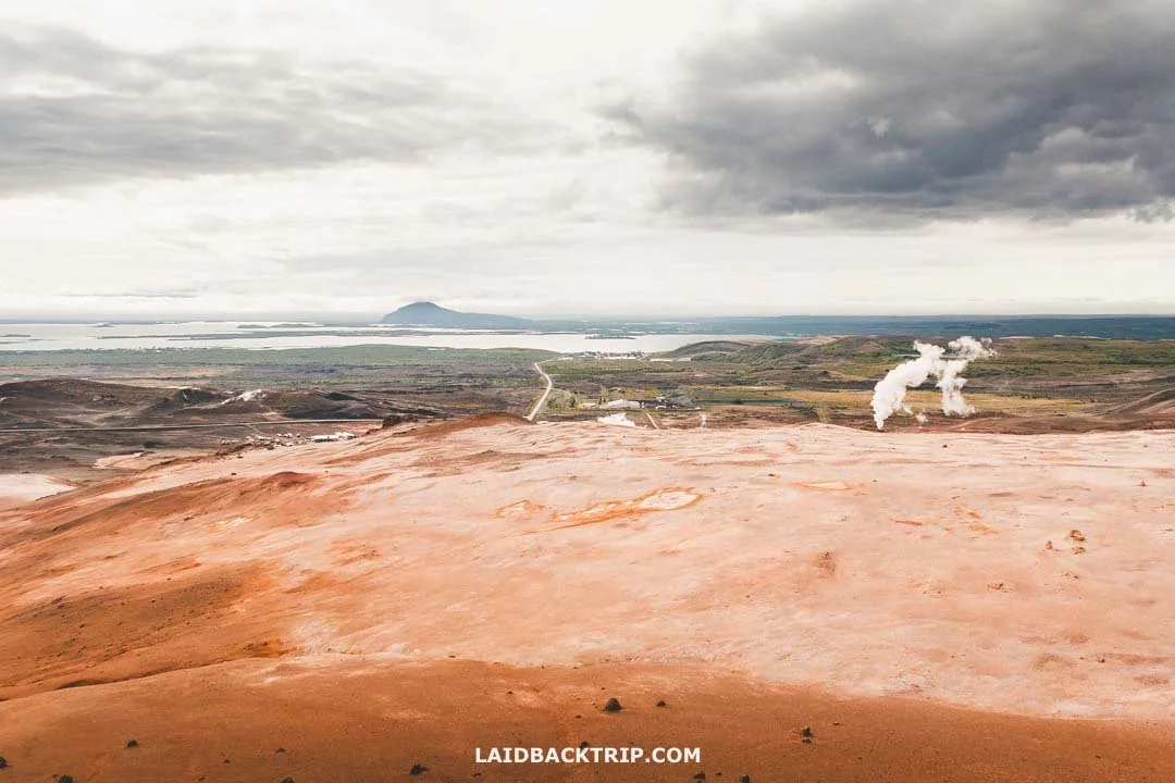
From the peak of Námafjall, we had an amazing view stretching all the way toward Lake Mývatn.
Despite the dark clouds, we took off our rain jackets on the way up, only to put them back on at the summit when the wind picked up. But once we started looping back down, we took them off again because this side of the mountain was sheltered and the sun made us sweat. After completing the loop, we ended up right where we started.
How Much Time to Spend at Hverir
Because we were limited by the departure time of our whale‑watching trip afterward, we spent about 90 minutes at Hverir. It took us around half an hour to explore the geothermal area and another hour to hike Namafjall. I'd say we didn't rush and enjoyed everything at a pretty normal pace. I definitely spent way too much time taking photos, so I was always behind Lucie on the trail, but still kept walking at a steady speed.
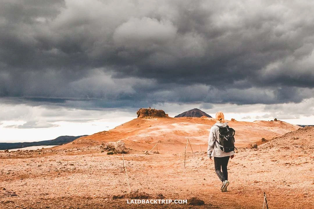
Hverir could have easily been a quick 15‑minute stop, but with the Námafjall trail we ended up spending over an hour and a half there.
I can imagine that if we'd arrived at Hverir on a rainy day like the one we had while hiking in Skaftafell, we would've spent less time watching the mud pools, and the big question would've been whether we'd hike Namafjall at all. The whole area is exposed, and I can only imagine how unpleasant the conditions would be up on the mountain in heavy rain.
Where to Stay Near Hverir
Now it was time to drive toward Myvatn. Normally, we would've explored the area more and maybe camped in Reykjahlíð or stayed at Sel Hotel Myvatn or Fosshotel Myvatn , but with our campervan, that didn't make much sense.
Our plan was different anyway, because we had that whale‑watching in Husavik coming up. All we had to do was drive for about 60 kilometers until we reached the town. As we left the Myvatn area, the weather changed and it looked like it would finally rain. It didn't, and the boat trip went smoothly. Afterward, we camped north of town and, after hiking in Asbyrgi, returned to Myvatn.
Getting to the Hverir Geothermal Area by Car
Located in North Iceland just five kilometers from Lake Mývatn, Hverir is one of the classic stops on the Ring Road. We visited it on our journey from the East Fjords, starting the day in Borgarfjordur eystri, more precisely Bakkagerdi, which meant we had about 230 kilometers of driving ahead. After returning to Egilsstadir, we still had roughly 160 kilometers left.
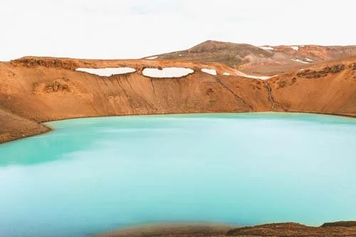
About 45 kilometers before Hverir, we made our first big stop at Dettifoss Waterfall. The turnoff to this incredible waterfall was actually just 20 kilometers before Hverir, but the detour added around 40 kilometers of driving. Then, only 300 meters before the Hverir turnoff, we turned right onto Road 863 to explore the Krafla area and the beautiful Viti Crater. That added another 20 kilometers.
After returning to Route 1, we finally turned onto Road 885, the short paved access road to Hverir (no dirt road so no problem for our small campervan rental). In just 300 meters, we reached the parking lot. All in all, it was roughly a 300‑kilometer journey from East Iceland to Hverir, including all the extra stops. The drive was incredibly scenic, but by this point in the trip, we were pretty used to that. You can check out rental car prices here.
After Hverir, we drove the remaining five kilometers to Reykjahlíd, and a few kilometers later turned onto Road 87 to complete the Diamond Circle. Once we were done, we explored the Myvatn area and eventually headed toward Akureyri, about 90 kilometers west of Hverir if you take the Vaðlaheiði tunnel. We didn't, so the journey was a bit longer again.
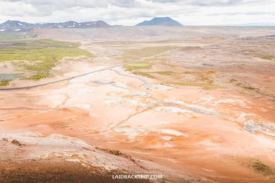
From the slopes of Námafjall, we could see the entire Hverir area, our parking spot, and even the Ring Road in the distance.
Parking at Hverir is Paid
The parking at Hverir was still free when we visited, but now it costs 1400 ISK per car. At that price, it's easily one of the most expensive parking fees for any of Iceland's attractions. We loved Hverir, but with this new fee, we'd probably only find it worth it if we also tackled the Namafjall trail. You can pay for parking at Hverir right at the on‑site terminal with a card, or simply scan the QR code and use the EasyPark app.
Hverir Without a Car
There are Myvatn tours from Akureyri, which explore the whole area, including Hverir, and they're especially popular with cruise passengers docking in town. Had we tried to reach Hverir without a car, we would've taken one of these tours, because no public bus stops at the site.

Discover Grjotagja, a tiny lava cave hiding a geothermal pool and the filming location of Jon and Ygritte's famous Game of Thrones scene.