3 Amazing Days on Iceland's South Coast
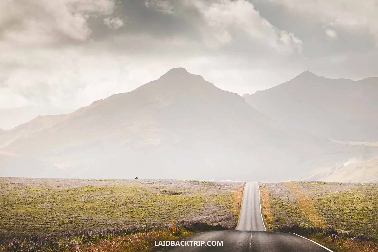
We spent three days traveling across Iceland's South Coast, and here's how our journey went!
Since the South Coast is often described as one of Iceland's most beautiful regions, we were honestly just excited to finally drive through it. We were in Iceland for basically only one day (plus a few hours after landing in Keflavík), and we were already getting close to Selfoss, where this scenic stretch begins. Between us and the small coastal town of Höfn, where our drive would end, were almost 400 kilometers of some of Iceland's most breathtaking scenery.
If even half of what we'd read about the South Coast was true, we were in for an unforgettable road trip. After years of traveling, we learned not to let expectations run too high, but lying in our sleeping bags the night before talking about the next days, we made an exception. This time, we were as excited as could be.
So, after leaving Reykjavík behind and touring the Golden Circle, we were ready to explore the South Coast. The thing about our Golden Circle loop, which we ended right at Selfoss, was that even though it was amazing, it still felt a bit too close to the capital. It's hard to explain, but that's how it felt. The nature was already stunning, but it was really the South Coast where our true journey around Iceland began. The whole drive was breathtaking, dramatic, and the farther east we went, the more remote it felt.
For three days, we could enjoy the untamed beauty of the rugged coastline, powerful waterfalls, black sand beaches, high cliffs, and massive glaciers. These were the top attractions of Iceland's South Coast, as were simply the views through the window of our car. In the following days, we visited some places that on their own were arguably even more dramatic or remote, but put together, the South Coast really offered the best of Iceland.

No matter which part of the South Coast we visited, the scenery was always just breathtaking.
Tips for Visiting Iceland's South Coast
Before I talk about what we saw on the South Coast, I'd like to mention a few essentials like what the roads were like or where we camped. It's really just some basics, but I think they should help you understand the way we planned the trip. Firstly, I have to say that the whole journey across the South Coast was incredibly easy, and while we were technically still getting to know Iceland, everything went as smoothly as possible.
I should also mention that we traveled the South Coast from west to east, though it honestly didn't matter much. For us, it was because of the way we were touring the Ring Road, so it was more about how we wanted to explore the whole route around Iceland rather than just the South Coast. If we'd gone the other direction, I don't think anything would bedifferent (except the order of the places we visited, of course).
How Many Days to Plan for the South Coast
It took us three full days to cover that 400-kilometer stretch between Selfoss and Höfn, and I need to add that we were usually on our feet from early morning and finished around midnight (or shortly after).
A big part of that was us traveling in summer, so we could take advantage of pretty much unlimited daylight, which allowed us to see a lot in one day (compared to if we traveled in winter, for instance). Simply, those three days for the South Coast sound about right, as had we had anything less, we would have had to make lots of compromises.
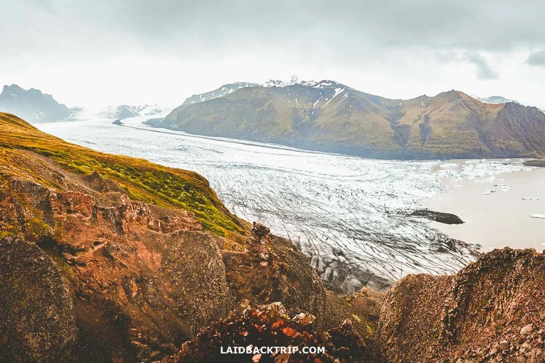
Even with the full three days, we still managed to see mainly just the highlights of the South Coast.
At the same time, I also need to say that we could have easily spent three more days on the South Coast without any issue. The scenery was incredible, and while I think I can say that we saw all the highlights, there were still tons of places we missed.
I could argue that they were smaller sites we'd like to visit on a second visit, but there were also activities like the ice cave tour, which we regrettably didn't have the opportunity to do. This one in particular was because it runs only in winter, but even if it wasn't for that, we'd have a difficult time squeezing it into our itinerary. There was simply too much to see.
Getting Around South Coast
I've already mentioned a few times that between Selfoss and Höfn we had to cover 400 kilometers of the Ring Road running through the South Coast, and that was without any detours, so in reality we drove more. Still, this stretch was incredibly easy to drive, at least in summer when road conditions were almost perfect.
The funny part was that since we traveled in summer, we practically never drove at night on the South Coast, even though we finished a couple of times after midnight, because with the midnight sun, it simply never got dark.
Route 1 was paved the whole way, as were most of the side roads we used to reach attractions off the main road. And the gravel roads we did take were usually well‑maintained and caused no issues, though we obviously had to slow down.
I should also say that we mostly stuck to the main attractions of the South Coast since it was our first time here. And while there were no toll roads on the South Coast when we visited, since 1 September 2026 the Hornafjörður Ring Road Toll has been introduced on a new section of Route 1 near Höfn.
We rented a small 2WD campervan that handled everything we planned, and for a summer trip it was more than enough. Of course, if we'd traveled in winter, we'd definitely choose 4WD, even though local roads are often cleared of snow and ice. Still, for safety we'd pick that option. But in summer, it wasn't needed. We couldn't drive on any F‑roads because our rental contract didn't allow it, but that wasn't a problem since we didn't have time for those kinds of trips anyway.
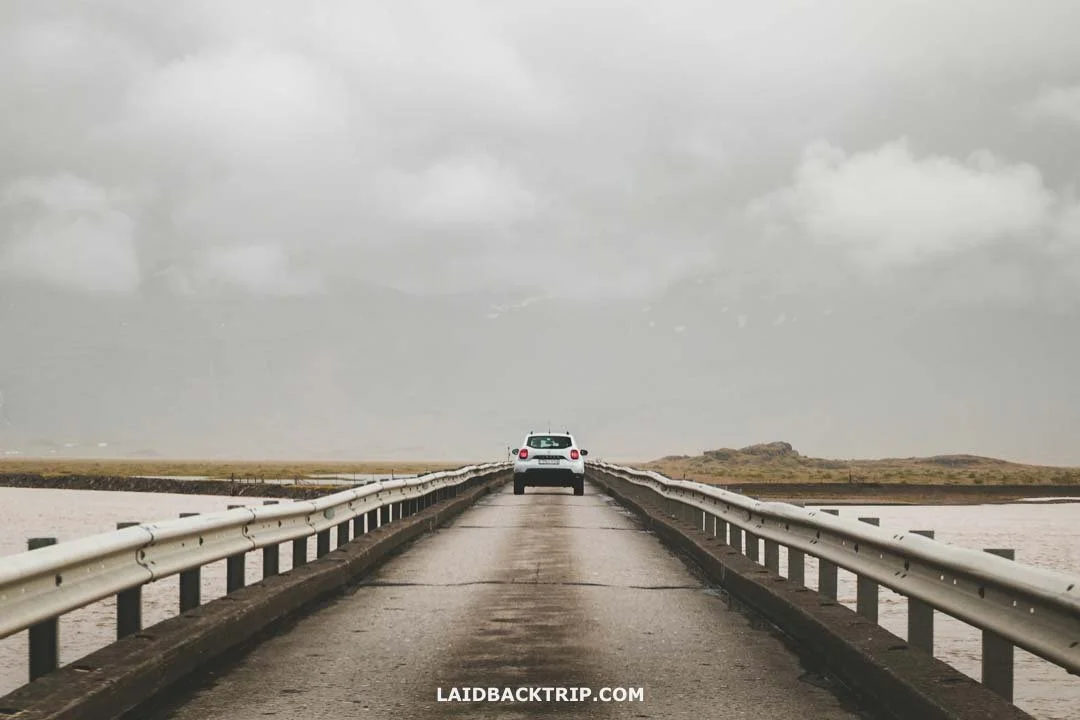
The stretch of the Ring Road that runs along the South Coast was actually really easy to drive on.
Each town had a gas station, so that one was fine too. Probably the longest stretch without a gas station was the 100‑kilometer drive between Skaftafell and Höfn, but that wasn't an issue since we could easily drive the whole South Coast without refueling. And from what we saw, there were even more EV charging stations for electric cars (there was even one at Jökulsárlón).
Likewise, Selfoss, Vík í Mýrdal, and Höfn had big grocery stores like Krónan, Nettó, and Bónus, and smaller shops in villages along the way. We kept things simple and stocked up in Reykjavík, then bought fresh veggies and fruit in Höfn.
While we think the best way to explore the South Coast is by car, it's not the only option. Many tour operators offer day trips to Iceland's South Coast, which let you see some of the most famous attractions, but as I said earlier, one day is really only enough to see a few highlights with lots of compromises.
Most tours focus on the stretch between Reykjavík and Vík í Mýrdal, though some go as far as Jökulsárlón, which makes for a very long day. If we wanted to see the South Coast without a car, we'd definitely consider one of these tours, since public transport would be way too slow.
The other option is traveling the South Coast by bus 51/52, which makes more sense for people doing the whole Ring Road, not just this part. The biggest downside, besides it taking much longer, is that the bus simply wouldn't stop at many places on our list. And often, like around Vík í Mýrdal, both Reynisfjara and Dyrhólaey were too far to walk, so we'd probably have to hitchhike. The same goes for Hveragerði, which we wanted to visit for the Reykjadalur Hot Springs. That one wouldn't require hitchhiking, but it would add 8 kilometers of walking.
Where We Stayed on Iceland's South Coast
We knew what places we wanted to see on the South Coast, but since we had no idea how things would work out, we kept our plans open, just like the places where we eventually stayed after long days on the road. The one thing we knew for sure was that we wanted to stay in campgrounds on the South Coast.
We were traveling on a budget in a campervan, so that was something that simply made sense. And because we weren't returning to Reykjavík but instead continuing farther east, we had to find one for each of the three days we planned to travel there.
Our rough plan was to camp in Selfoss since that's where we ended up after visiting Gullfoss, our last stop on the Golden Circle, and then see how things went. Eventually we also used campgrounds in Vík í Mýrdal, Tjaldsvæðið í Svínafelli just outside Skaftafell, and Djúpivogur. I also saved other campgrounds in places like Kirkjubæjarklaustur, Skógar, or Höfn in case something didn't go as expected, so we were prepared.
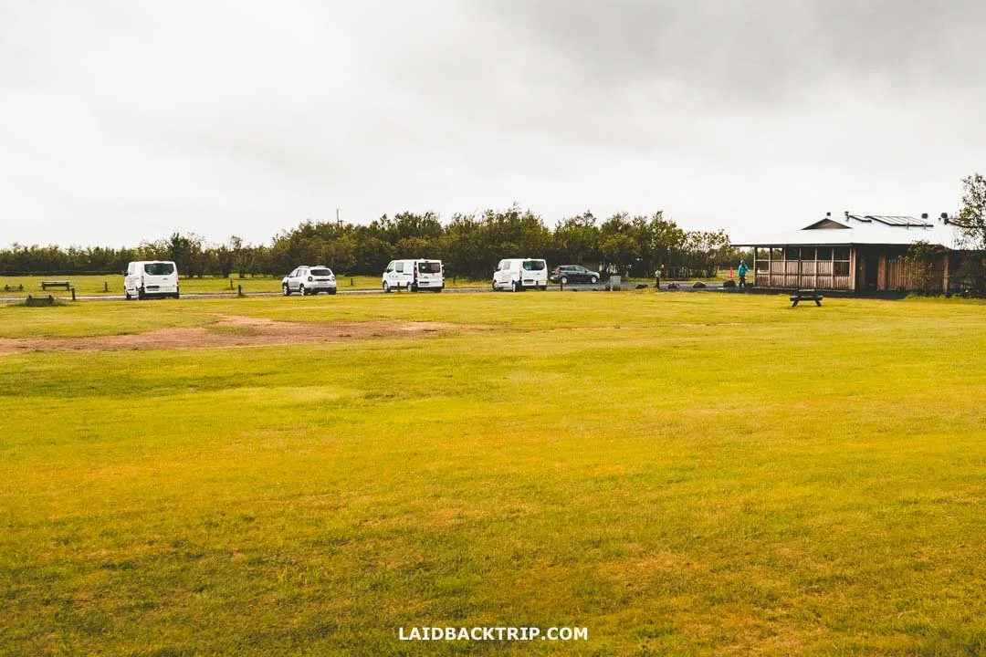
We camped every single night while on the South Coast.
The campgrounds in towns had all the facilities we needed, and we could pay by credit card, which was really convenient. Even though we usually arrived late in the evening, sometimes even after midnight, we never booked any campsite ahead and always found a spot without any trouble.
In each town, we also saved some traditional hotels along the South Coast in case the weather went really bad. On the third day, there was a lot of rain, and sleeping in a hotel instead of a campground sounded tempting, but since it was just that one day, we were fine.
Anyway, in Selfoss there was a cheapish hostel, while both Vík í Mýrdal and Skaftafell had nice places to stay simply called Hotel Vík í Mýrdal and Hotel Skaftafell. These places were definitely more expensive but also looked more comfortable. We also passed some really nice places outside towns like Fosshotel Glacier Lagoon or Hótel Skógafoss set in beautiful locations, but again, we luckily didn't find any reason to stay there since they were quite expensive.
Visiting Iceland's South Coast in Summer
We happened to visit Iceland's South Coast at the turn of June and July, which marked the early summer season. This period was considered the best time to visit because of a higher chance for good weather, and the super long days we really wanted to take advantage of. However, we also knew this region was known for unpredictable weather, so we had no idea how it would turn out.
Interestingly, for us, the forecast turned out to be pretty accurate. While the weather was really changeable during the days, and dark clouds were often replaced by sunny conditions in a matter of minutes, and vice versa, the only thing we were worried about was the rain (and, of course, earthquakes, but there were some warnings "just" for the North Iceland).
World Nomads provides travel insurance for travelers to cover their trip essentials, including sports and adventure activities.
SafetyWing is affordable travel insurance for backpackers, long-term travelers, and digital nomads.
The weather forecast showed high precipitation on our second day in the afternoon, and also during the whole third day, with a short dry window in the morning. And I'm not sure how normal that was, but it really did happen exactly the way the forecast predicted.
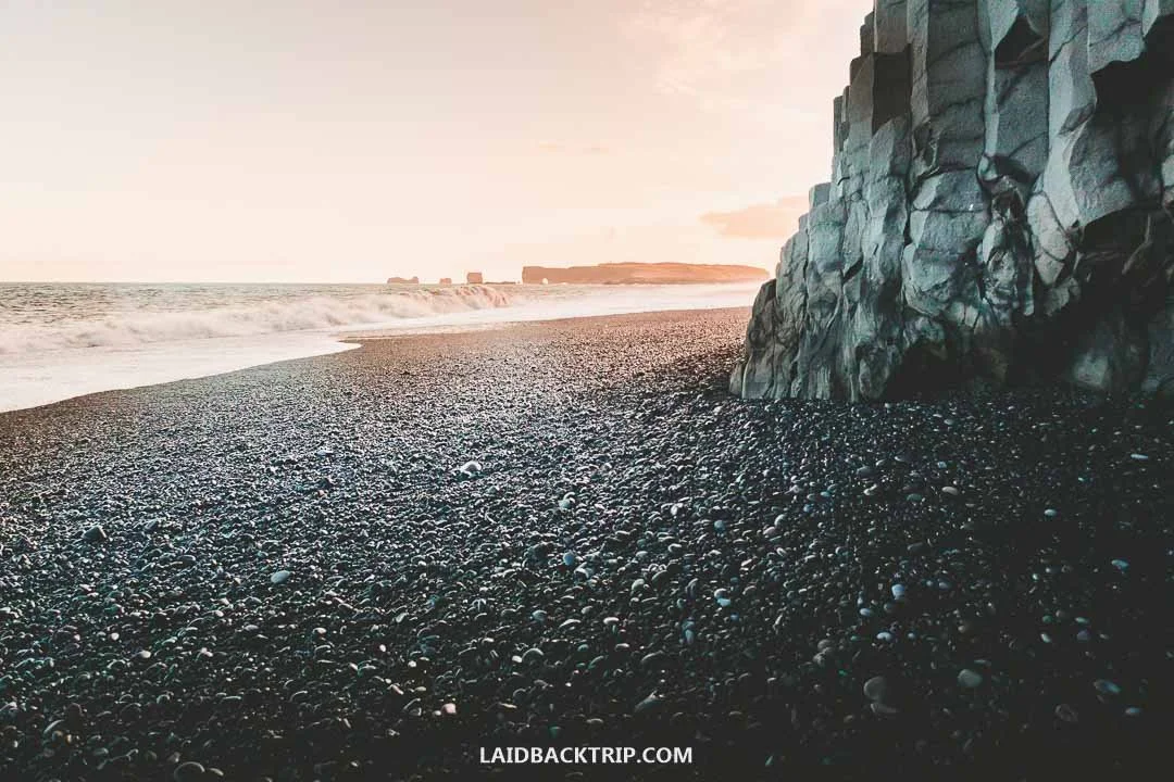
Thanks to the long days, we could show up late to popular places like Reynisfjara after most tourists had already left.
We were simply glad that we could enjoy the South Coast in summer. The best part was that while its famous sites were supposed to be busy during the day, we could use a little trick to avoid the crowds by visiting either early or late. Sure, there were times when that wasn't possible as we arrived in the middle of the day, but in many cases we pulled it off. Of course, this strategy was only possible during this time of year when the sun set only for a few moments and it never got dark.
While we really enjoyed the summer, we both wondered what the South Coast would be like in winter, as pretty much all the places we saw seemed very accessible even when cold, ice, and snow covered the region. The biggest reason we'd come back to the South Coast in winter would definitely be to see the Northern Lights, which was something summer simply couldn't offer.
South Coast Entry Fees and Parking Costs
Lastly, I'd like to mention that pretty much all the main attractions on the South Coast were free to explore. That was amazing as we tried to keep our expenses down. When we traveled there, most parking was also free apart from a few exceptions. However, that changed in the past few years, and pretty much all the must-sees now have parking fees. For now, only the smaller sites have free parking.
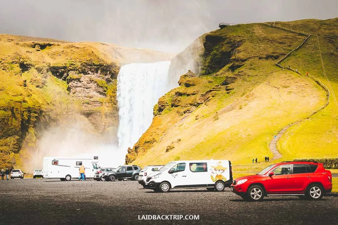
Parking lots at major South Coast attractions that used to be free are now charging a fee (like Skógafoss).
So while the big waterfalls and glacier lagoons remain technically free to visit, the parking fees kind of negated this big advantage. The fees for parking aren't big, but since this also happened in other parts of Iceland (like at Kirkjufellsfoss or Dynjandi Waterfal), not just the South Coast, it's now something every traveler must include in their travel budget.
What to See and Do on Iceland's South Coast
After writing down all the places we wanted to see on Iceland's South Coast, we knew for sure that this would be one of the most scenic drives we'd ever done. The list we put together had pretty much everything we wanted to see in Iceland, because the South Coast had famous waterfalls, dramatic cliffs, endless black sand beaches, majestic glaciers, iceberg lagoons, and jagged rock formations.
Since we were traveling at the start of summer, we also expected to see lupins in bloom, nesting puffins, lots of other seabirds, and we hoped to spot seals. We also included some places on the list that were less‑known or overlooked since we had a fairly flexible itinerary. So here are all the stops we made on the South Coast and everything we saw along the way!
Starting Day One in Selfoss
We started our day in the town of Selfoss, on the South Coast's western end. Our big plan was to travel the Ring Road counterclockwise, which meant we'd travel the South Coast from west to east. We planned to hit the road early, but since the day before we traveled the Golden Circle, and after seeing Gullfoss, didn't get to the campground until after midnight, it wasn't as early as we hoped. Still, we knew the days were super long, and as we already tested the day before, we could stay on the road well into the evening or even past midnight again.
Selfoss was one of those towns that, besides the campground and some nice hotels like Hotel Selfoss and Hotel South Coast, had a few grocery stores, gas stations (or EV charging stations), and that was pretty much it when it came to things to see or do.
It was one of the towns we used just as an overnight stop, unlike Akureyri or Seyðisfjörður where we also did some sightseeing. Still, the town served its purpose, and the next morning, after a good night of sleep (a sleep mask was essential), we were ready to finally explore the South Coast. We hadn't been this excited about a place in a long time.
Driving Off the Beaten Path to Keldur
It rained overnight, and while it stopped in the morning, we hoped it wouldn't start again. The weather forecast was on our side, but this was the South Coast, so we had no idea how accurate it would be. Still, we couldn't hide our excitement that the weather looked like it might cooperate today.
Before we started exploring the natural attractions on the coast, we decided to take a short detour to the Keldur Turf Houses. We'd never seen historic turf houses before, and that alone made it worth driving a few kilometers off the Ring Road.
So from Selfoss, we followed Route 1 for about 45 kilometers. Roughly halfway between Hella and Hvolsvöllur, just past Hotel Rangá on our right, we turned left onto Road 264. This 12‑kilometer road was mostly paved except for the last four kilometers. We had a 2WD campervan, and the road was fine, though some sections had washboard, which was better than potholes but still not much fun.
We drove through a rural, mostly flat landscape along a road with no traffic. Ahead of us was Hekla, one of Iceland's most active volcanoes, which we could see beautifully despite the clouds.
Once we reached the T‑junction, we turned left, parked at the small lot about 300 meters from the site, and walked the rest. We were the only ones there and had no idea what to expect. The site with the Keldur Turf Houses was quite small and took only minutes to explore. We learned there was a fee of 2500 ISK to enter the museum, but since we just wanted to enjoy the turf houses from outside, we could explore for free.

The architecture of turf houses is traditional to Iceland, and not that many have remained today.
For us, that was enough since we didn't have much time, so we appreciated the info panel that explained Keldur'shistory. This was the oldest existing farmhouse in Iceland, and Keldur's inhabitants appear in Old Icelandic Sagas, including the Saga of Njáll. Yesterday, we learned a lot about old Icelandic history in Þingvellir, so it was cool to find out more on this topic here, too.
These traditional farm buildings have stood at Keldur for centuries, and while most structures were built in the 19th century, the materials came from much older buildings, like the hall sill carved with the date 1641. The turf houses were really picturesque (we peeked inside through one of the open doors, but there wasn't much to see), and the old church was charming too. But the coolest feature was the underground tunnel, probably built around the 11th–13th century, used as an escape passage during conflicts.
Later we found out that more turf houses were scattered across Iceland (for instance, we saw them also on Snæfellsnes or Tröllaskagi), so they were not as rare as we thought, but this site had a whole cluster of them, which was pretty cool. And as I said, Keldur Turf Houses are one of those places most people skip, so we practically had the place to ourselves (a few folks arrived shortly after us, but that was it).
Following the Backroads to Gluggafoss (Merkjárfoss)
We knew that Seljalandsfoss, one of the South Coast's top attractions, was close, and we couldn't wait to explore. But we didn't head there just yet, because we wanted to see one more waterfall slightly off the beaten path.
It was Gluggafoss, about 35 kilometers away. So we drove back the same way we arrived, and once we returned to the Ring Road, we continued toward Hvolsvöllur, where, about 300 meters past Hotel Lóa, we turned left onto Road 261. The whole stretch was paved, so we tackled it pretty quickly.
Iceland was home to tons of amazing waterfalls, and by traveling around the country for two weeks, we could see a good amount of them. My favorite part was that even the overlooked ones were incredible. As we pulled into the empty parking lot, we realized this would be one of them.
From the parking lot, we walked about 150 meters before reaching the waterfall. Gluggafoss, fed by the Merkjá River (which is why it's also called Merkjárfoss), had two main drops and a total height of about 52 meters. First, we came across the smaller lower waterfall with water tumbling down in three channels, while the 44‑meter cascade was a bit farther away.
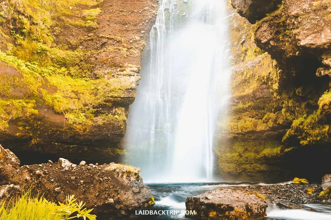
Since Gluggafoss is often overlooked, we could enjoy it in the morning with no one else around.
We had Gluggafoss to ourselves, which was a nice change after visiting busy places like Geysir the day before. It was also a calm moment before the storm, in this case the South Coast's crowded main sights. I'm not sure Gluggafoss would normally be worth a detour, but since the scenery was beautiful, the waterfall dramatic, and no one was around, I think this little side trip turned out pretty great.
Now it was finally time to see Seljalandsfoss, about 18 kilometers away. We took Road 250, which Martin idyllically described as a charming shortcut through the rural Icelandic landscape that would save us about 20 kilometers of driving and, as he said, a lot of time. He was right about the charming part, but I don't think his time‑saving calculations were correct. Anyway, we saw lupins, grazing sheep, and mountains, so it was all good.
Taking a Walk Behind Seljalandsfoss
After two less‑known sites, we were ready to finally visit famous Seljalandsfoss and maybe even learn why the South Coast has the reputation of Iceland's most beautiful region. After joining the Ring Road again, we had just a five‑kilometer drive ahead.
After a few moments, we could spot the waterfall in the distance, though it looked more like a tiny white dot. Shortly after crossing the mighty Markarfljót River, we turned left and followed the Seljalandsfoss road that took us to the main parking area (it was the next turnoff after Road 249).
We'd had a peaceful morning, and since we visited two places most people skip, it didn't feel like we were about to enter one of Iceland's busiest spots. But that obviously changed at Seljalandsfoss, which wasn't just popular with travelers like us but also with pretty much every tour heading along the South Coast. Luckily, we arrived on a fairly quiet day, so even this extremely popular stop was very enjoyable.
The parking was spacious, though paid. The waterfall itself was free and about 250 meters ahead, so we put on our rain gear and started walking toward it. At first sight, the 60‑meter Seljalandsfoss looked beautiful, but the reason it was so famous, and why we stopped here, was simply because this was one of Iceland's few accessible waterfalls we could walk behind.
And that was one of those little adventures we couldn't miss. So we followed the trail that in a few moments led into a deep depression in the rock, allowing us to practically walk around the entire Seljalandsfoss. Standing behind the waterfall was incredible.
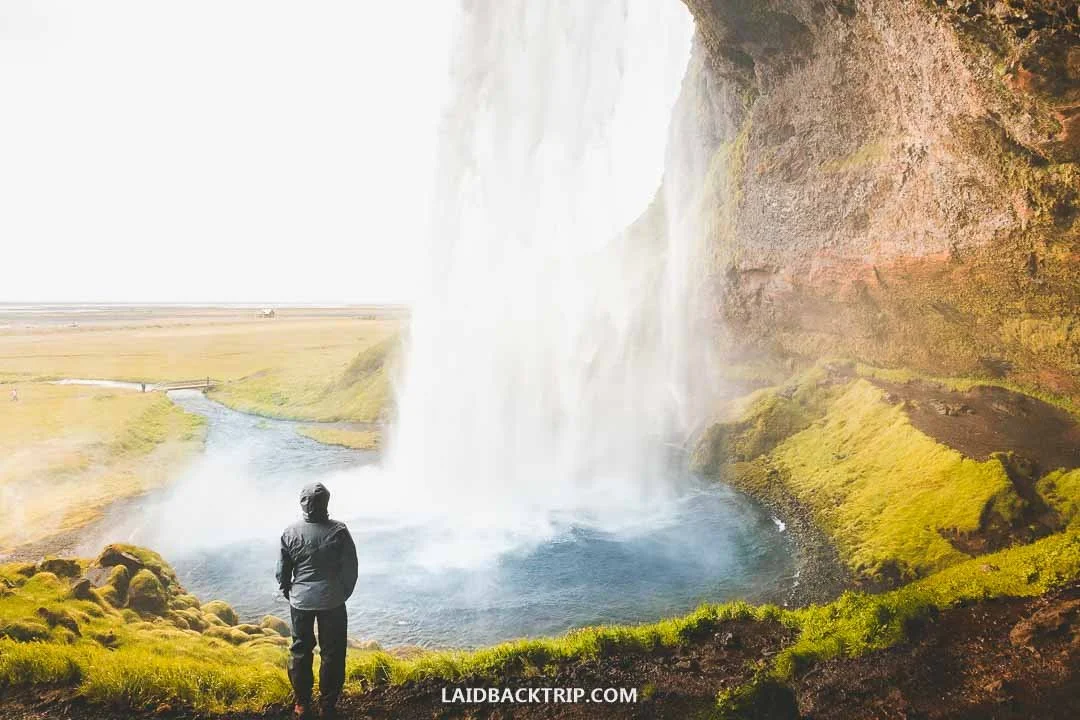
Walking behind Seljalandsfoss was an incredible experience.
The spray was everywhere (that's why we put those rain jackets and rain pantson ), and we just enjoyed watching the falling water from behind. It was one of those views we could enjoy for hours, but since we were technically in a heavily eroded cavern, we stayed only a couple of minutes. Once we appeared on the other side in one piece, we admired Seljalandsfoss from a different angle and then walked back to our car.
Only a short walk from Seljalandsfoss was Gljúfrabúi, one of Iceland's easily accessible "hidden" waterfalls. Hidden meant that it was tucked inside a narrow crevice, and while we considered visiting it too, we decided it would take more time than we wanted since we already had other plans. And we still had tons of waterfalls to see in the next few hours. Our very next stop was a good example of that.
Seeing the Power of Skógafoss Up Close
Only a thirty‑minute drive from Seljalandsfoss was another of Iceland's famous waterfalls, Skógafoss. It was a fairly quick journey without stops since we were just too excited to finally see this waterfall. It was fed by meltwater from the Skógá River, originating from two major glaciers, Eyjafjallajökull and Mýrdalsjökull.
That meant Skógafoss had plenty of water all year round, and since we were visiting in early summer, that was something we didn't worry about. As we neared our destination, Eyjafjallajökull was supposed to be somewhere on our left, but because of the clouds, we couldn't see anything.

Being so close to the power of Skógafoss was just mind‑blowing.
And while walking behind Seljalandsfoss was awesome, it was really Skógafoss that showed us the true power of Icelandic waterfalls. We'd already been to Gullfoss, which was incredibly powerful, as was Dettifoss later on, but compared to those two, Skógafoss offered a very different experience. Here, we could see its sheer force from up close.
The other two we explored by walking along the canyon edges they carved. At Skógafoss, we could practically walk along the river shore to its very base. Of course, not literally, because we stayed within a safe distance, but it was still a pretty intense experience. Standing in front of such a sheer mass of water plunging from a 60‑meter cliff above us was mind‑blowing. It was one of those places that left us speechless.
Hiking the Waterfall Way Trail
After enjoying this spectacle, we took the stairs on our right and climbed to Skógafoss's upper viewing platform, but after what we'd just seen, the view from up there wasn't nearly as overwhelming. We didn't mind, because we had another reason to make this climb. The thing about Skógafoss is that it's not the only waterfall in the area. Not even close. The whole valley above is full of them. And I'm not exaggerating, because even the trail along them is called Waterfall Way.
We didn't have time to do the entire 26‑kilometer trail that connects Skógafoss with Þórsmörk (the whole stretch is Fimmvörðuháls, while Waterfall Way is just the part with waterfalls), so we did our best with the time we had and walked about 3.5 kilometers before turning around.
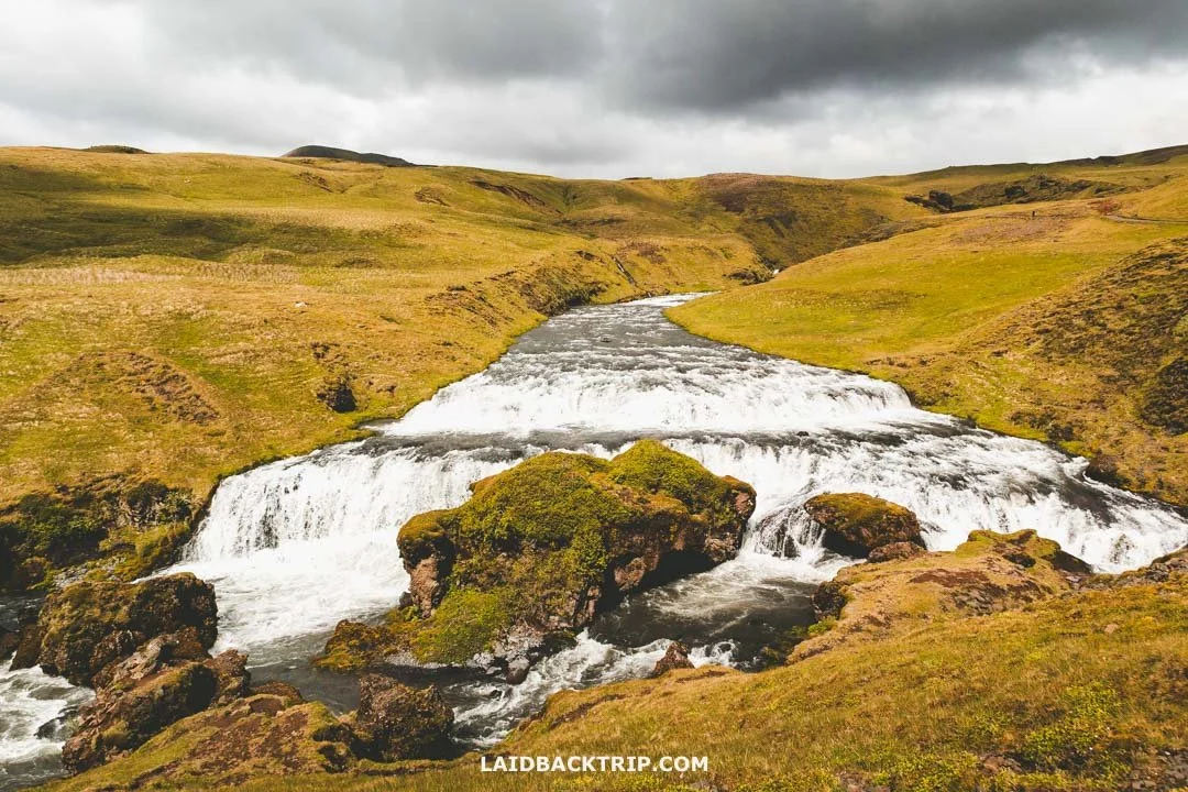
Even with the limited time we had, hiking the Waterfall Way was still worth it.
The trail was rugged and uphill, but the views were incredible, as were the waterfalls we saw along the way. The best part was that while the Skógafoss area was fairly busy, we had most of Waterfall Way to ourselves.
In the roughly two hours we spent on the trail (we did 7 kilometers total), we saw seven more beautiful waterfalls, and when it was time to head back, we just wished we could continue and complete the hike. But even this stretch was beautiful and definitely worth the extra effort.
Walking Behind Kvernufoss
Once we were back at our car, we still weren't done with this area. Just two kilometers from Skógafoss was another waterfall that caught our interest. It was Kvernufoss, and in terms of power, it simply couldn't compete with mighty Skógafoss. No, on that one it really couldn't.
But the reason we wanted to see Kvernufoss anyway was that it was the other waterfall of the day we could walk behind. This whole day was packed with amazing sights, and while we saw a lot, we still had to make plenty of compromises. And with this often overlooked waterfall, we told ourselves that this wasn't one of them.
So after roughly a two‑minute drive, we parked our car (Kvernufoss also had paid parking), grabbed our daypack, and started walking toward the waterfall. We had about 700 meters to tackle on a mostly flat, well‑maintained trail, so after Waterfall Way, this was just a pleasant walk rather than a difficult hike. It was already evening, and the trail was as empty as it could be. After 15 minutes or so, we were standing right in front of Kvernufoss.
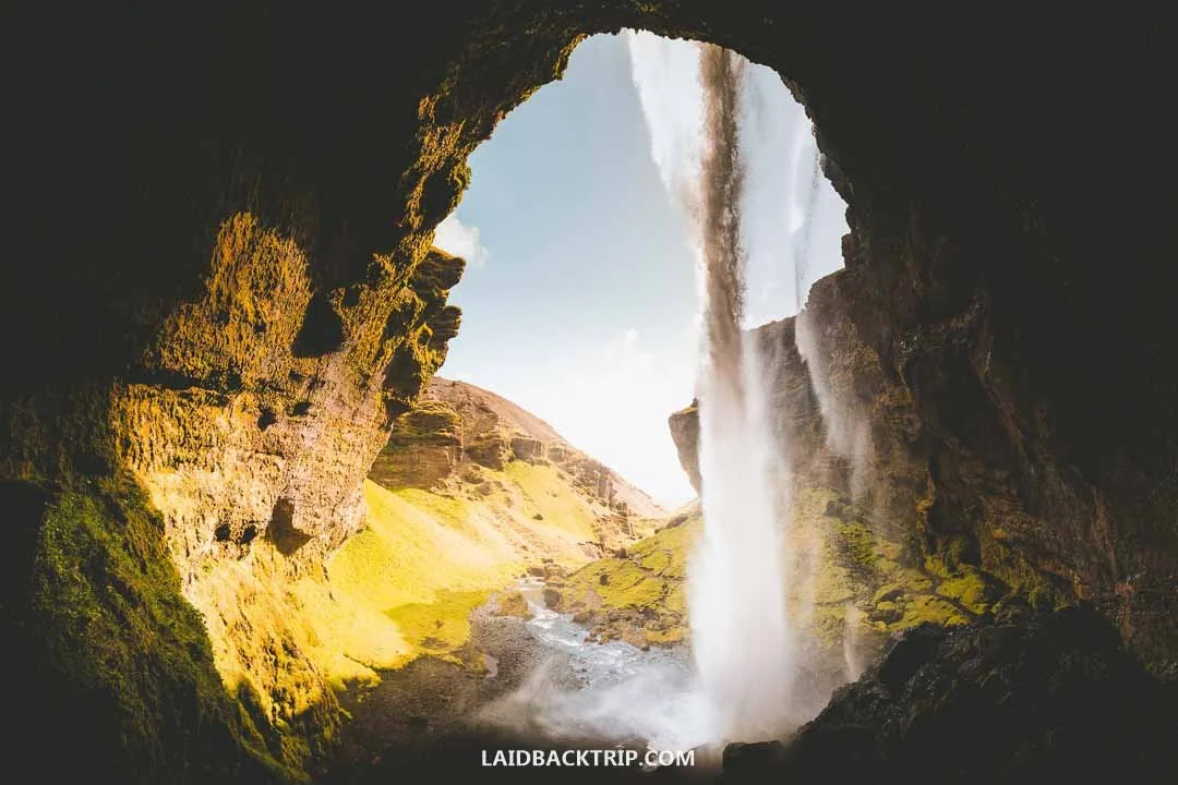
Seen from behind, Kvernufoss was even more beautiful.
While we got enough of the views of Kverna River plunging from the roughly 30‑meter volcanic cliff, it was time to walk behind Kvernufoss. The rocky trail was more slippery in this section, we got hit with plenty of spray as we made our way around the falling water, and the eroded cave looked even scarier than the one at Seljalandsfoss, though I think that was mostly because there was no one around.
Still, the view from behind Kvernufoss was pretty dramatic. The interesting part was that we couldn't actually make it to the other side of the narrow valley, because the trail abruptly ended right behind the waterfall, so we had to retrace our steps on the way back. Once back at our car, we realized the whole walk didn't take more than 40 minutes. Kvernufoss was definitely a fun stop, though we wouldn't say it was one of the essentials of the South Coast.
By this hour, the weather improved to the point where we realized we wanted to see more. And maybe it was the incredible scenery, maybe it was the sun finally overpowering the clouds, but we realized we still had tons of energy left in the tank. Which was great, because just a 10‑minute drive away was the trailhead for the Sólheimasandur hike.
Hiking to Sólheimasandur Plane Wreck
Before we went, we really only knew the basics about Sólheimasandur, like that we were looking at an almost 8‑kilometer trail (return trip) across a volcanic plain to an old abandoned DC‑3 plane wreck. But unlike more traditional trails like Glymur or Námafjall, we had no idea what this hike would actually feel like. From the info we had, this was no ordinary place.
So far we'd seen glaciers, waterfalls, geothermal areas, and all of them were about incredible scenery. Sólheimasandur was mind‑blowing too, but in a completely different way. The volcanic plain felt endless and desolate, and if it hadn't been for a few hikers in the distance ahead of us, we would've thought we weren't even on planet Earth anymore.
The only way to reach Sólheimasandur today is on foot unless you take a ride in a special bus or join an organized ATV tour. I get the appeal since it saves a lot of time, but if there was one hike where I was glad we could walk on our own, it was this one. For both Lucie and me, walking through this vast volcanic plain was the real highlight. I should add that we walked in good weather. Had it been raining with strong winds, we would've definitely skipped it.
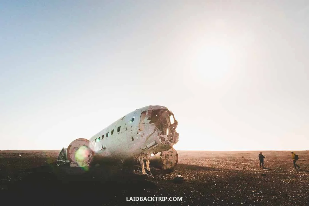
The plane crashed on Sólheimasandur in the 1970s.
Even though we'd been on the road since morning, and we definitely felt that, the hardest part of this trail wasn't physical but mental. It was one of the strangest hikes we've ever done. The trail was practically flat and led straight toward the plane wreck. Since it was getting late, we had the trail mostly to ourselves, which added to the eerie atmosphere. In about 45 minutes, we reached the plane.
The wreck has been on Sólheimasandur since 1973, when a US Navy Douglas Super DC‑3 crashed onto the beach due to poor weather. Luckily, the crew survived, the plane was stripped of anything valuable, and left behind. The contrast between the white skeleton of the plane and the black sand was incredibly photogenic (which is also why Sólheimasandur became so popular) and created a bizarre, almost surreal scene.
We explored the wreck, or at least what was left of it, took some photos, and thought about what to do next. Had we continued farther, we would've reached Solheimafjara, a black sand beach marking the end of the volcanic plain. We were tempted, but since it was already late and we still had another black sand beach in mind, we decided to head back.
Evening Visit to Dyrhólaey Peninsula
After the hike, we were just a 20‑minute drive from Vík í Mýrdal, a small tourist village with a campground where we thought about spending the night. But between us and the village were still two more stops, Dyrhólaey and Reynisfjara. We decided to see the peninsula first and then figure out the rest, so we followed the Ring Road from Sólheimasandur for another 12 kilometers until we reached the turnoff onto Road 218.
We stayed on this road until we encountered a barrier blocking the path. It was well after 9 PM when we finally reached the peninsula, only to find out that the main area of Dyrhólaey was closed. We were caught off guard because this was the moment we learned that the promontory is closed between May and June from 7 PM to 9 AM due to birds nesting on the cliffs.
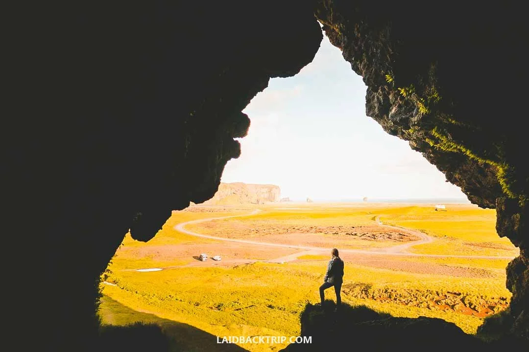
In the evening, we could at least enjoy views of Dyrhólaey from Loftsalahellir Cave.
At that point, we had to figure out our next steps. The only things still accessible at Dyrhólaey were Loftsalahellir Cave and the Dyrhólaós Estuary, though the lagoon was already visible from the car. So we decided to see the cave, spend the rest of the day at Reynisfjara, and come back the next morning. It was a good plan. We headed to Loftsalahellir Cave, which was just a quick 15‑minute stop.
The trail led uphill, but it was only about 200 meters long, so we tackled it quickly. Loftsalahellir was basically an opening in tuff rock created by ancient volcanic blasts. The cave itself wasn't that interesting, but the view from it was a different story, as we could see the entire Dyrhólaey promontory. After soaking in the views, we walked back to our car and drove off to Reynisfjara.
Watching the Sunset at Reynisfjara Beach
Since we didn't get to see all of Dyrhólaey, we decided to spend the rest of the evening on the beach. The idea sounded pretty cool when Lucie said it aloud, but we were in Iceland, not Bocas del Toro, so we had to put on a few extra layers to enjoy it.
The good part was that the weather really improved, and we could enjoy a beautiful, almost sunset‑like atmosphere as we arrived past 10 PM. Since we were there during the longest days of the year, the actual sunset was still a couple of hours away, but that was just a tiny detail.
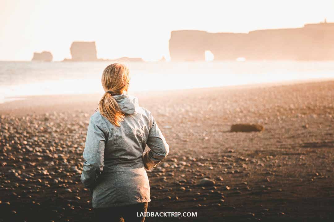
Reynisfjara was a perfect spot for catching the sunset.
Since Reynisfjara was known for its basalt columns, that's what we explored first. They were right at the start of the beach where the short trail brought us from the parking lot, so it wasn't difficult to reach them. The basalt columns, formed when lava cools, contracts, and fractures into long hexagonal shapes, were incredible. And since the sea was retreating, we could also visit the little cave with basalt columns hanging from its ceiling. That was pretty cool too.
In the distance, we could see Reynisdrangar, more than 60‑meter basalt sea stacks (or trolls, according to old Icelandic legend) rising from the sea. The beach stretched for a few kilometers toward the west, and that's where we could see the high cliffs of Dyrhólaey as well as Arnardrangur, another massive basalt stack.
The interesting part about Reynisfjara was that behind the beach was a large lagoon with brackish water flowing into the sea around this western point, but at the moment we focused only on the black sand beach. We walked a bit along Reynisfjara, but since it was the end of the day for us, we took it slowly and enjoyed the moment rather than walking as far as we could.
The sun was out, the sea was calmer than usual, the wind wasn't as strong as we expected, and there were very few people around. The scene was almost idyllic. It certainly didn't look like we were standing on one of Iceland's most dangerous places. Yes, Reynisfjara is dangerous because of treacherous sneaker waves, and several people have died here. These big waves hit the beach without warning, and while we were there, we kept an eye on them and made sure not to get too close to the sea.
Ending the Day in Vík í Mýrdal
Once we were done with Reynisfjara, we tackled the last 10 kilometers to Vík í Mýrdal, where we found the main campground, and after an unsuccessful attempt to take a shower (it was coin‑operated and we had no coins), finally went to sleep. It was a very long day, and we were incredibly tired, but in a good way. We'd seen some of the most beautiful places in all of Iceland.
While Vík í Mýrdal was technically just a small and remote village, it was an important tourist hub with all the facilities, a big grocery store (Krónan), a gas station, the campground I already mentioned, a few restaurants, and several great places to stay like cheaper hostel called The Barn or the comfortable but pricier Hotel Vík í Mýrdal.

We eventually ended our first day in the small tourist village of Vík í Mýrdal.
There was also Víkurfjara, another black sand beach, but since we arrived around midnight from practically the same place, we really didn't feel like taking a walk along it. We also didn't get a chance to visit a couple of regional museums as they were already closed, but we did stop by the red‑roofed Vík Church, which had an incredible setting on a small hill overlooking the village.
Starting Day Two at Dyrhólaey Peninsula
The next morning, we headed back. This time, we knew we had to arrive no sooner than 9 AM. So despite getting to the campground pretty late, we got a good night's sleep. And since we had another long day ahead of us, it really helped. Our plan the evening before was to see Dyrhólaey with as few tourists as possible, but since that didn't work out, we just accepted it.
The upside of driving along Dyrhólaey twice was that the entire road was incredibly scenic, so we could enjoy it one more time. And when we passed through the now‑open barrier, we reminded ourselves that spontaneous decisions on the road often come with obstacles. Anyway, there were two parking lots, and we decided to drive up to the one by the lighthouse.
As soon as we left the car, there was a lot to take in. Since we parked at the highest point of the promontory, about 120 meters above the sea, we could enjoy stunning views of the South Coast. The view of Dyrhólaey Beach from the high cliffs was breathtaking. The lighthouse itself was nice, though not accessible to the public.

From the top of the cliffs, we could see the famous Dyrhólaey arch.
We didn't mind, because we had a 4‑kilometer in‑and‑out trail ahead of us. The path brought us along the cliffs to more incredible viewpoints, including the famous Dyrhólaey Arch, a natural rock arch carved by the sea. At the furthest end of the trail (where the other parking lot was), we enjoyed the view of the 14‑meter basalt stack Arnardrangur sitting just off Reynisfjara Beach (the same one we saw yesterday).
Along the way, we kept an eye out for puffins, since they nest at Dyrhólaey. We saw a few, but since it was already late morning, they were either too far or flying above the sea. It was nice to see them, though the experience wasn't as intense as at Látrabjarg or Borgarfjörður eystri.
As we hiked back to our car, we both agreed that Dyrhólaey was simply incredible and instantly became one of our favorite stops on the whole South Coast. It was one of those places we were really glad we didn't miss. Anyway, we couldn't stay forever. Our next stop was Fjaðrárgljúfur.
Walking a Short Trail at Eldhraun Lava Field
As I said, the next morning we returned to Dyrhólaey and right after headed toward Fjaðrárgljúfur. Once we passed Vík í Mýrdal, the landscape around us became mostly flat and surprisingly not that interesting. This time, we were driving through yet another stretch of volcanic plains that, through the window of our car, simply weren't as impressive as the one at Sólheimasandur, and the whole drive felt a bit tedious, at least by Icelandic standards.

The trail at Eldhraun Lava Field turned out to be quite rugged and not that easy to walk on.
But after 50 kilometers or so, that changed, and the scenery once again became unlike anything we'd seen. We entered the massive Eldhraun Lava Field, filled with moss‑covered lava mounds. Even though Lucie tried taking photos of this strange landscape from the car, the best opportunity came when we reached the designated area with the short Gönguleið um Eldhraun trail, sometimes simply called the Green Lava Walk. So just before reaching the canyon, we made another spontaneous stop, because this was something we wanted to explore on foot.
This vast lava field, one of the biggest in the world, was created in 1783 during the disastrous Laki eruption. The whole trail was just 150 meters long, and while it was super short, it was pretty interesting. Beyond the eruption trivia, we also learned that the moss carpet was more than 50–60 centimeters thick in some places. We walked the whole thing in about 15 minutes and really enjoyed this little site.
Hiking in Fjaðrárgljúfur Canyon
After we were done with the Eldhraun Lava Field, we hopped back into our car and continued for about three kilometers until we reached the turnoff to Fjaðrárgljúfur. We turned left and drove another three kilometers until we reached the canyon's main parking lot.
We were visiting at the start of summer and arrived on a fairly quiet day. Fjaðrárgljúfur, carved by the Fjaðrá River, was a roughly 2‑kilometer canyon with steep moss‑covered cliffs on both sides that ended with two big waterfalls. We couldn't wait to explore it.
The weather was changeable, but so far no rain, which was fine with us. After grabbing something to eat, we were ready to explore. The 2‑kilometer in‑and‑out trail along the canyon's edge turned out to be fairly easy, as it was well‑maintained and the incline wasn't too steep.
The trail took us along Fjaðrárgljúfur with several viewpoints that brought us right to the canyon's edge. Each offered a different view of the canyon, which was, like pretty much everything else on this list, incredibly beautiful. At the last viewpoint, we could also see the lovely Mögárfoss (the other waterfall was more hidden).

Fjaðrárgljúfur Canyon turned out to be yet another South Coast gem.
The interesting part was that we were visiting Fjaðrárgljúfur not long after it had reopened. The canyon wasn't widely known until it appeared in Justin Bieber's music video, and once that happened, the site wasn't prepared for the crowds. People walked wherever they wanted, damaging the fragile moss‑covered environment, which eventually led local authorities to close the area so it could recover and so they could improve the facilities.
As we walked along the designated trail, we could still see the consequences of the damaged areas, often leading right to the edge of the steep cliffs. And since we were about 100 meters above the canyon floor, a single slip would've meant a long way down.
By the way, this trail was the only way to explore Fjaðrárgljúfur, as wading through the canyon was prohibited. Even if it weren't, I'm not sure we would've gone, because it was getting colder by the minute. Rain was coming, which wasn't ideal since we still had one more place to explore that day. About an hour east of us was Skaftafell, a gateway to Vatnajökull National Park.
Exploring Vatnajökull National Park from Skaftafell
Before we reached Skaftafell, we made a short stop at Skeiðarársandur, a large glacial outwash plain with the Skeiðará Bridge Monument. Just before that, we crossed a small bridge with the abandoned Skeiðará Bridge on our right.
At this stop, we learned its story. The almost 900‑meter bridge was built in 1974 as one of the most impressive structures on the Ring Road, but in 1996 it was badly damaged by massive glacial floods. After that event, the river changed its course, and the bridge was no longer needed. It was an interesting story we read on the info panels, but I have to admit we were more focused on the glaciers ahead of us.
When we arrived in Skaftafell, it was already raining. We waited for a bit but eventually decided it was pointless, so equipped with our rain ponchos, we headed into the Visitor Center. Since Skaftafell is known as one of the best places on the South Coast for hikers and adventurers, and we had no idea what trails were in the park, we were curious what we could actually do there. Besides hiking, Skaftafell is also a starting point for ice cave tours and glacier hikes, but we arrived too late for that.
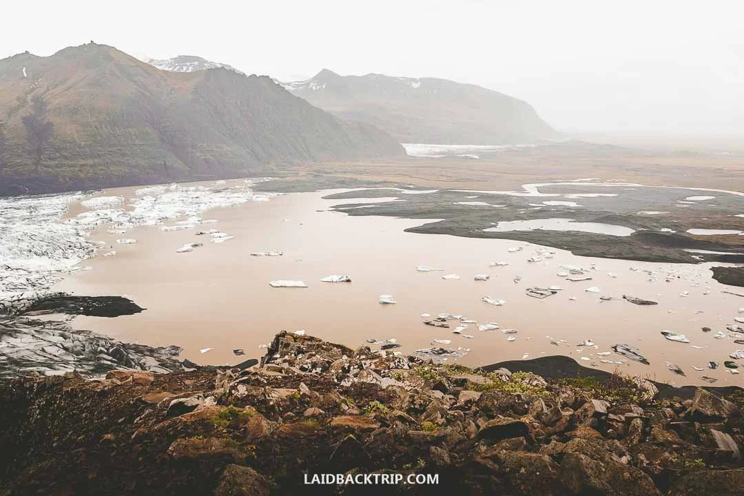
Even with the rain, we still managed to enjoy some amazing views of Skaftafell.
We talked to the park ranger, and he recommended the S6 trail, about 7 kilometers long with roughly 250 meters of elevation gain, featuring both Svartifoss and Sjónarnípa, one of Skaftafell's highlights when it comes to shorter hikes. The park had several trails, but we really liked this one. I wished we could've done the Kristínartindar trail, but it made no sense in this weather. Anyway, we put on our rain ponchos and set off.
First, the trail brought us to Svartifoss, also known as the Black Waterfall, famous for its basalt lava columns. Along the way, we passed nice waterfalls like Hundafoss and Magnúsarfoss, but Svartifoss was the most interesting one (and we remembered it later when we hiked to Hengifoss).
Then we continued to Sjónarnípa viewpoint, which was supposed to have stunning glacier views. We were slightly worried about visibility in this weather, but the views turned out to be great. And Skaftafellsjökull was just breathtaking.
On the way back, we had some time to think about what to do next. It was already late, and the weather was bad, so we thought about calling it a day in this area. We considered staying at the Skaftafell campground, but then Lucie found another one just a short drive away that looked less busy. And because of that, she added one last stop of the day that was along the way, roughly five kilometers from where we were. It was the Svínafellsjökull.
Making a Detour to See Svínafellsjökull
So after we were done with the Skaftafell area, we drove to nearby Svínafellsjökull. When we were there, the old road was in poor condition, full of potholes, and we drove as slowly as we could. The weather got even worse, if that was possible, and we probably should've skipped this last detour for another day.
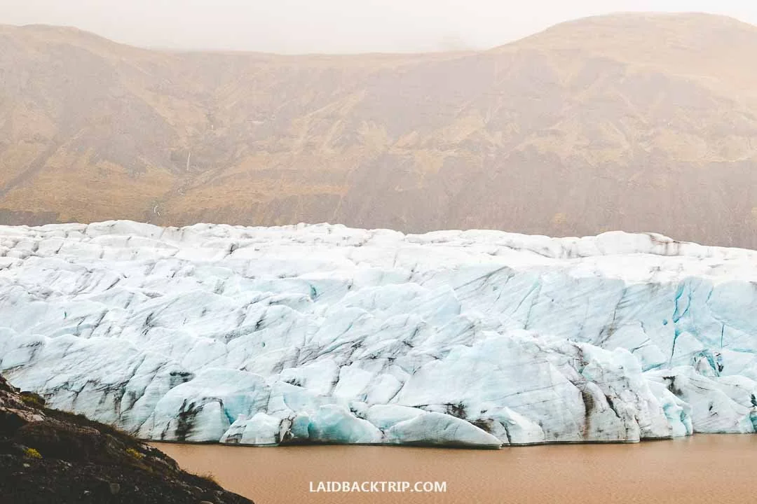
Svínafellsjökull was much closer to the trail than the other glaciers we saw in Iceland.
As we drove toward the glacier, we met only one other car coming the opposite way. That was it. When we finally reached the empty parking lot, Svínafellsjökull was just a short walk away. The view of the glacier was incredible, but because of the rain, clouds, and strong icy wind, we stayed only a few minutes.
Camping in Tjaldsvæðið í Svínafelli
Once we were back on the Ring Road, we had only five kilometers left to reach Tjaldsvæðið í Svínafelli. Unlike the Skaftafell campground, this one was really quiet. We arrived relatively late again, though not as late as the previous night. The campground had everything we needed, plus a great common area with a nice kitchen.
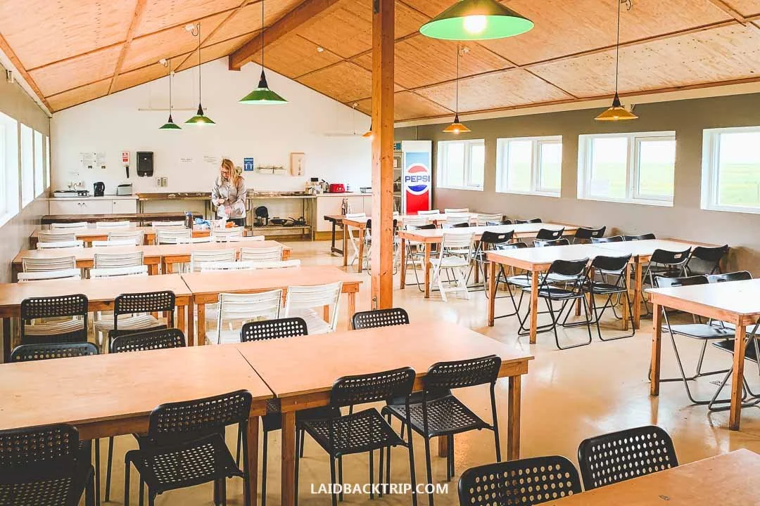
Svínafell Campground had this nice kitchen where we could easily make our dinner.
Right next to it was a cute accommodation called The Potato Storage, but we were perfectly fine staying at the campground. It was a charming spot tucked beside a big rock, but with the rain pouring down, there wasn't much for us to do, so we went to sleep as soon as we could. We just hoped the next morning would give us at least a little break from the rain.
Visiting Hofskirkja on Our Third Morning
On the morning of the third day, we woke up early, like 4:30 AM early. The reason was simple. The weather forecast promised a low chance of rain during the early hours. And since the rest of the day was supposed to be super rainy and windy, it was the only way to see at least a few places without getting drenched to the bone. Or so we hoped. The big plan was to see Jökulsárlón, but we had two stops before that, an old turf church and another glacier lagoon.
The first one was Hofskirkja, a 19th‑century turf church located just 10 kilometers from where we stayed (or about 20 kilometers from Skaftafell). Unlike Keldur, Hofskirkja was only 500 meters off the Ring Road, which meant this was a really quick stop without any extra driving.
The South Coast was dotted with interesting places, but we simply couldn't see them all. Some we visited, others we passed without a second look, not because we didn't want to see them, but because we had no room for them in our itinerary. Hofskirkja was one of those places we weren't sure about, but since it was so close to the main road, we decided to give it a try.
After a short drive, we reached the church. The place was quiet since we were the only ones there, though the wholescene was dramatic as the church stood against a steep hillside shrouded in thick clouds. It was closed, so the only thing we could do was enjoy it from outside and read a bit about its history.

Even churches like Hofskirkja were once built in the traditional turf‑house style.
Hofskirkja was built in 1884 as the last of its kind in Iceland. Today, it's preserved as a historical monument and is only one of six turf churches still standing. If it weren't for the cross on the roof and the adjacent cemetery, we wouldn't even know it was a church because from the outside it looked like a big turf house.
After walking around and taking some photos, we were ready to continue to our next stop. Hofskirkja wasn't exactly a must‑see, but it was another interesting place we got to experience on the South Coast, and we were glad we made this 10-15 minute stop.
And even on a rainy, cloudy morning, the church was very photogenic, and we felt like the bad weather added to its eerie charm. By the way, right next to the church was Adventure Hotel Hof, where you can stay overnight if the Skaftafell area is full.
Stopping at Fjallsárlón Glacier Lagoon
From Hofskirkja, we headed to Fjallsárlón, which was less than 30 kilometers farther east. It was another place we weren't entirely sure about, but since this glacier lagoon was just 600 meters off the Ring Road, we decided to make the detour. It wasn't raining yet, which was another reason to go.
Glacier lagoons were one of the reasons why the South Coast was so popular among tourists and easily among Iceland's most famous attractions, so we were really curious about them.
Fjallsárlón formed when Fjallsjökull, part of the much larger Vatnajökull glacier, began retreating during the 20th century. Meltwater filled the deep basin left behind as the ice pulled back. That was pretty much all we knew about Fjallsárlón when we pulled into the empty parking lot. It was still early in the morning, and once again, we were the only ones there.
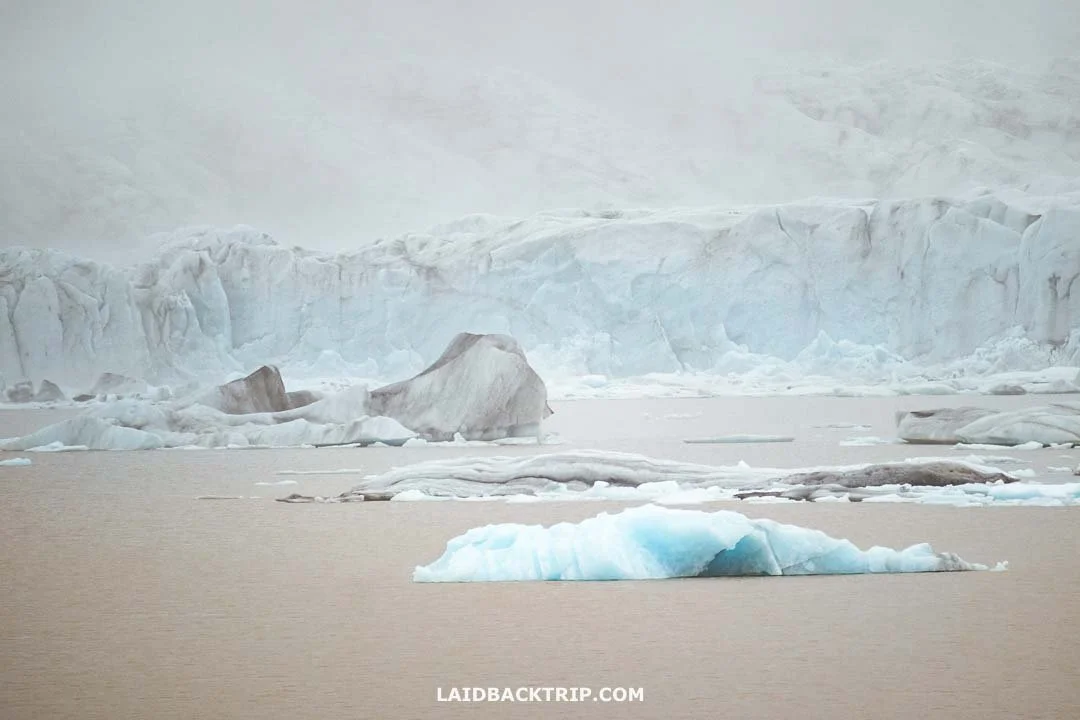
The weather wasn't ideal, but we could still see the glacier at Fjallsárlón.
From the parking lot, a 1.3‑kilometer loop trail took us to the lagoon's shore and back. The trail was easy and had minimal elevation gain. We arrived at Fjallsárlón at the beginning of summer, and by this time, Fjallsjökull had already retreated quite a bit. We could see the glacier's snout, and if it hadn't been for the clouds, we would've seen much more of it. But I won't deny that we expected Fjallsjökull to be a bit closer at this time of year.
At this hour, walking was the only thing we could do at Fjallsárlón. The popular zodiac boat tours weren't running yet, and the offer kayaking trips and floating adventures were the same case. I have to admit we weren't really interested in those anyway, since we were thinking about taking an ice cave tours, but that one runs only in winter, so we couldn't do it either. Still, we didn't mind. The scenery was dramatic even from the shore.
Although Fjallsárlón wasn't as popular as the bigger Jökulsárlón, we both agreed that the stop was awesome. The lagoon with floating icebergs and a glacier, even in the distance, was absolutely stunning, and since we arrived early in the morning before the tour buses, we could enjoy an unusually quiet moment here.
Watching Drifting Icebergs Across Jökulsárlón
From Fjallsárlón, we drove 11 kilometers to Jökulsárlón, Iceland's most famous glacial lagoon and arguably the most popular place on the whole South Coast. It took us two and a half days to reach it, but we were finally there.
The (paid) parking lot was almost empty, though unlike the other two lagoons, there were already a couple of cars parked. Still, at first and second glance, the place felt just as quiet as the ones we'd visited earlier. It was a cold day, and since we were closer to the coast, it was noticeably windier here.
Even from the parking lot, we could already see floating icebergs slowly drifting toward the sea. Unlike Fjallsárlón, which sits a few kilometers inland, Jökulsárlón is only a few hundred meters from the ocean. And because of the outlet channel connecting the lagoon with the sea, we could watch this spectacle from up close. There was a nice, easy trail along the lake, so we did some walking and then returned to the channel's entry point, where another iceberg was about to float out into the ocean.

There was something almost therapeutic about watching the floating icebergs at Jökulsárlón.
The biggest surprise about Jökulsárlón was learning that it wasn't some ancient lake but a fairly recent one. The story was the same as Fjallsárlón. Breiðamerkurjökull, an outlet glacier of Vatnajökull, started retreating about two centuries ago, and by the early 20th century, the lagoon began to form.
Jökulsárlón's history was mind‑blowing, because today the glacier's snout sits several kilometers out into the lagoon. And because of the low clouds, we couldn't even see it. Jökulsárlón was one of many places where we could see how Iceland's landscape is constantly changing.
We visited Jökulsárlón in summer, and on the day we went, there were fewer icebergs floating on the lagoon than we hoped, at least along the shores or as far as we could see. Since it was too early for the zodiac tours (they also run amphibian boat trips and kayaking adventures), that was all we could do. We didn't mind, though. We were happy to see Jökulsárlón without rain and without crowds.
Plus, watching the floating icebergs was fun, and because it was nesting season, those massive, oddly shaped, slowly drifting ice blocks were packed with seabirds, which was a pretty cool sight. And that wasn't all. Jökulsárlón still had more to offer.
Walking Along Diamond Beach
Only 500 meters from Jökulsárlón's parking lot was Diamond Beach. This long black sand beach was split by the channel, and while normally we would've walked, we wanted to see both sides (and avoid walking across the bridge), so this time we took the car.
We'd already seen some beautiful black sand beaches, some stretching for miles, some with basalt columns, and some with high cliffs. This one had diamonds. And since we were still just a short walk from the glacial lagoon, they were made of ice.
When the icebergs from Jökulsárlón reach the sea, some of them wash back onto the shore. And some look like diamonds. The contrast between the jet‑black sand and crystal‑clear ice was pretty cool, as was looking at the various shapes the sea and melting process created. Besides the ice, we kept an eye out for seals, who often come to this beach (and even the lagoon), but we had no luck.

A couple of blue icebergs that were washed back on Diamond Beach.
Similar to both lagoons, there weren't that many icebergs, nor diamonds, on the beach, but the ones we found were pretty awesome. And we really enjoyed looking for them. And walking along the quiet but increasingly windy beach.
We explored this sandy stretch for about 30-40 minutes and would've probably stayed longer, but when the first raindrops hit the beach, we knew we should retreat back to the car. The rain was returning to the South Coast and also the Eastfjords, where we were heading next.
And with that, we were practically finished with our journey along Iceland's South Coast. Technically, we were already in the Eastern Region (Austurland), but it's usually Jökulsárlón (or Höfn) that marks the end of this scenic route, so we went with tradition too.
For us, this was really just the start of our trip around Iceland. We still had so much ahead of us. Not to mention that between Jökulsárlón and Höfn was still a 65‑kilometer drive. This stretch was pretty straightforward as it didn't have any major attractions, and we tackled it without many stops since the weather was getting worse and worse.
Driving the Final Stretch from Höfn to Djúpivogur
For the rest of the day, we needed to tackle the 100‑kilometer stretch to Djúpivogur, where we planned to stay overnight. We had a few optional stops along the way, but as I already mentioned a few times, the weather wasn't on our side that afternoon.
Once we reached Höfn, we parked by Nettó, stocked up on food, took a picture of the big wooden sculpture of a narwhal tusk, and had a quick debate about whether it would be a good idea to spend the rest of the day at the Höfn campground.
But we decided it was still too early to call it a day, so we kept going. Lucie wanted to see Stokksnes, an incredibly beautiful headland (only when the weather is good) with a black sand beach, dramatic mountainscape, and even a Viking village. But because of the clouds and rain, we skipped it. We were also hesitating because, unlike all stops so far (except Kerið Crater), Stokksnes had an entry fee. The weather solved that dilemma for us.
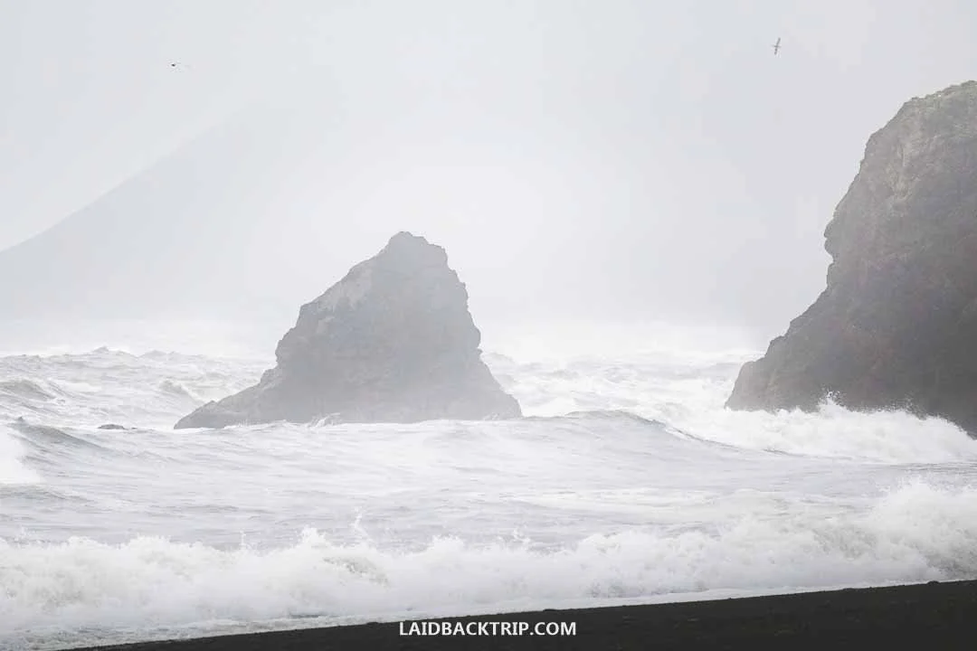
The coast of the East Region greeted us with bad weather and dramatic views.
After leaving Stokksnes behind, we made a quick stop at Hvalnes Nature Reserve Beach and Hvalnes Lighthouse, but it was just a very quick stop since the rain was battering the coast. At Fauskasandur, another beautiful black sand beach with a huge basalt monolith rising from the sea, we took a long break and waited for a few hours to see if the weather would improve. It didn't, but at least we caught up on some sleep.
Eventually, we made one final stop at Djúpavogskörin hot spring just before reaching Djúpivogur. It was as basic as it could get (this was definitely not Blue Lagoon neither Mývatn Baths), since this was basically just a small tub filled with hot water, but after such a cold and rainy day, it felt perfect. It looks like this place is closed now, though, so hopefully it'll be reopened someday.
After three days of driving, our journey across the South Coast was finally at its end. We couldn't wait to find out what adventures were lying ahead. And since we were about to visit the East Fjords the next day, then drive around the Diamond Circle, watch the whales in Húsavík, and eventually make it to the Westfjords, we had a feeling that this trip was just getting started.
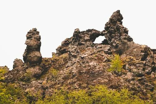
Our travel guide to Grjótagjá Cave covers everything you need to know before visiting this famous lava cave in North Iceland, including how to get there, parking information, what to expect inside, why it became so popular, and the best times to visit.