A Guide to Þingvellir National Park
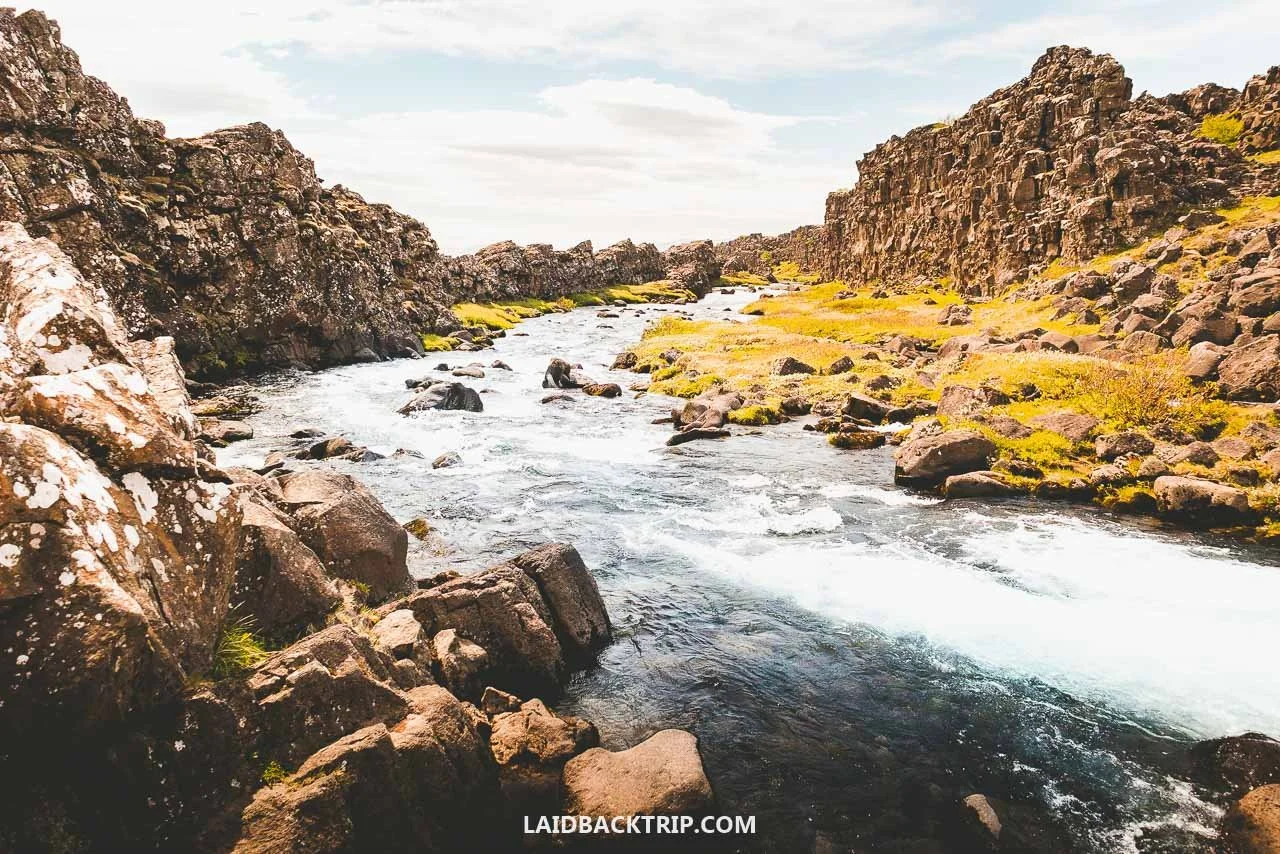
Thanks to its interesting mix of nature and history, Þingvellir was one of the places we were most excited to see in Iceland. Here's how our visit went.
Þingvellir National Park was the very first stop on our Iceland road trip, not counting a quick drive to the rental office to pick up our campervan and a short visit to Krónan to stock up on food. The funny part was that normally, in any other country, it would probably take us more time than just 45 minutes or so to reach a national park from the capital, but as we were quickly learning, things were a bit different here in Iceland.
Þingvellir, Iceland's oldest national park and a UNESCO World Heritage Site, is historically the most important place in the whole country. This is where Alþingi, the world's oldest surviving parliament, was born. Yes, the same one we later saw in Reykjavík, which is its current seat.
Beyond that, it's a rift valley that forms part of the Mid‑Atlantic Ridge and the boundary between the North American and Eurasian tectonic plates, and just south of it lies Þingvallavatn, Iceland's largest natural lake. So Þingvellir connects both natural and cultural heritage, and because of that, we really couldn't have picked a better place for our first stop. As if that weren't enough, it's also part of the famous Golden Circle.
The first time we looked at the map of Þingvellir, the whole place seemed a bit confusing, and we ended up with lots of questions about what we should see or where we should park. The park offered several hiking trails and adventure activities, and we also learned about the tectonic plates and a big waterfall.
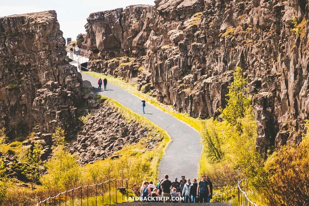
We couldn't wait to walk between the two tectonic plates in Þingvellir.
But at the start, we couldn't get a clear picture of how the park was laid out, and it didn't help that Þingvellir covered over ninety square kilometers. It had five parking areas at different entry points. On paper, it was a pretty large place to explore. It turned out that most of the must‑see sites were around the Hakið area, all within walking distance from each other and close to the main parking areas.
Eventually, we figured it out and came up with, as Martin would say, a really great plan. After all, how hard could it be, right? In Þingvellir's case, not that hard, because our visit turned out great and we realized this had to be one of the easiest national parks we've ever visited. After the trip, we wrote down everything about this place and ended up making this guide where we simply show how we explored Þingvellir, practically step by step. So let's dive into it!
How to Get to Þingvellir National Park
First, we had to figure out how we'd reach Þingvellir, which in our case was pretty easy. We'd rented a campervan in the morning and simply drove there. From Reykjavík, the national park was under fifty kilometers away. The whole trip took us less than an hour, and this was probably the only stretch where we didn't make any stops along the way, unlike when we were on the South Coast or in the East Fjords.
The scenery was just starting to get interesting, and we were eager to finally start exploring the park, hence no stopping. We technically started in Hafnarfjörður, where we stayed overnight after landing in nearby Keflavík, but the driving distance was basically the same as starting from Reykjavík's city center.
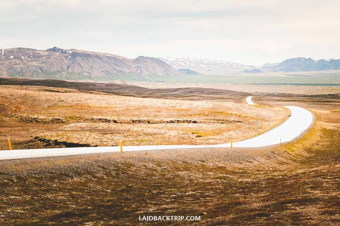
The road from Reykjavík stayed paved the whole way to Þingvellir and was in great condition, at least in summer.
The drive itself couldn't have been easier. From Reykjavík, we joined the famous Ring Road for about ten kilometers until we reached Mosfellsbær, where we turned right onto road 36 and stayed on it for another thirty kilometers until we reached Þingvellir. The road was paved the whole way and super easy to follow. Funnily enough, we planned to do the Ring Road counterclockwise, but because of Þingvellir, we actually had to drive this short stretch the other way.
If driving wasn't an option for us, we would've just taken a tour. It wouldn't be the most convenient choice, but it's really the only other option since there's no public transport to Þingvellir from Reykjavík or any other town. Because Reykjavík is so close, there are tons of tours to choose from.
We'd probably pick one that covers the whole Golden Circle, since it makes more sense to see not just Þingvellir but also the other famous sites on the route. While most tours stop at the same places, some include something extra, like the one that also visits the Blue Lagoon. The last option would be a snorkeling tour at Silfra, which is part of Þingvellir. Just make sure it actually includes transport, because that tour normally starts at the parking lot.
Parking at Þingvellir
Another thing we had to figure out was where we'd actually park once we got to Þingvellir. By looking at the map, we found that the park had five designated parking areas, marked simply P1, P2, P3, P4, and P5. Each one basically served as an entrance to the main area of the park. Since we were arriving from Reykjavík, it made sense to leave the car at the first lot we came across, which in this case was P1.
We knew Þingvellir gets super busy, so we had no idea how hard it would be to find a spot, because we'd been to similarly popular places in the past like Canadian Rockies or Yellowstone where parking could be tricky. So we kept P3, roughly 2.5 kilometers further down the road, as a backup option. We also checked that P2 was ideal for seeing Öxarárfoss, while P5 was right next to the Silfra fissure. The last one, P4 near the Þingvellir church, was only for visitors with a handicap.
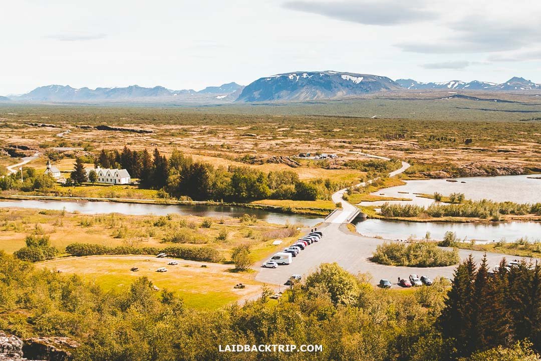
We parked at Hakið on top of the gorge (same as P3), while P2, P4, and P5 sat down below.
Anyway, once we pulled into P1, technically the main parking lot by the visitor center, we quickly found a spot, so we didn't have to worry about other options. But in case it's full, it's good to know you've got plenty of alternatives. The lot was fairly big, and judging by the number of cars, it looked like we arrived on a relatively quiet day. Lastly, all five parking areas were within that 2.5‑kilometer range, and since we wanted to walk around the whole park where all the top attractions were located, it practically didn't matter where we left the car.
Parking at Þingvellir cost 1000 ISK per car, and we paid at one of the machines, though there was also an option to pay online through the official site. Interestingly, the fee was only charged at P1, P2, and P5. We didn't know that, because we assumed all of them required payment, and we realized it only after we left. So had we known, we would've parked at P3, which was the only free one (not counting P4).
Back then, paying for parking at Þingvellir was one of the few exceptions, as other popular sites didn't charge anything, but nowadays that's changed, and if you visit places like Dyrhólaey or the Sólheimasandur Plane Wreck, you'll have to pay there too.
No Entry Fee to Þingvellir
When we were there, Þingvellir was technically free to explore. But as I already said, our visit wasn't completely free since we still had to pay for parking, but had we arrived without a car (like with a tour or if we hitchhiked), we would've seen it without spending a single dime (though of course we'd pay for the tour). Anyway, most of Iceland's natural sites remain free, but parking often isn't.
Lastly, there's an entry fee of 1200 ISK for the exhibition in the visitor center. That's obviously just for the exhibition, which adds more info on Þingvellir, but it's not essential for the visit. We didn't go because we had tons of plans for the rest of the day and wanted to stay outdoors.
When to Visit Þingvellir
We arrived at Þingvellir on a sunny weekend at the start of summer, and to be honest, we were slightly worried about how busy the national park would be. After all, Þingvellir is one of the most popular day trips from Reykjavík, not just among tourists but especially among locals who come here on weekends.
So we didn't expect to have the place to ourselves, which turned out to be the right mindset, because Þingvellir was easily the busiest place we visited in Iceland, not counting Blue Lagoon and Mývatn Baths (but those were obviously a different case). I'd say the park could've been way busier, though, and maybe because it was a Sunday and not Saturday, it still wasn't that bad.
Þingvellir is open all-year‑round, and the best time to visit is between May and October, when you'll have the best chance of good weather. We visited at the turn of June and July, and the weather we had there was probably the best of our entire two‑week trip, though in Þingvellir's case it was more about the fact that it simply wasn't as windy as the coast (not to mention the Westfjords).

I can't speak for other months, but Þingvellir was just beautiful at the end of June.
And when I say the weather was great, in typical Icelandic fashion it stayed that way only for the couple of hours we walked through the park, because as we were about to leave, it changed. Not drastically like it did in Skaftafell and Jökulsárlón a few days later, but it still showed us how unpredictable the weather would be in the following days.
Spring and autumn are also nice times to visit Þingvellir, as all roads and paths within the park are open, and even though the weather can be chilly, rainy, and with less daylight, temperatures are still fairly okay. Þingvellir is open in winter too, but some hiking trails might be inaccessible due to snow and ice. That said, the main trail leading between the tectonic plates to Öxarárfoss should usually be open. I would probably contact the Visitor's Center to get up‑to‑date information on current trail conditions during this period.
Þingvellir is open all day, which is ideal if you're traveling in summer when the days are long. This time, we arrived in the early afternoon, so it didn't matter much, but we visited plenty of places around midnight, like Látrabjarg or Borgarfjörður eystri, and each time it was an amazing experience, and even better, we enjoyed them without the crowds.
The only place with opening hours in Þingvellir is the Visitor's Center at the Hakið area (open between April and October from 9 AM to 6 PM, and an hour shorter during the rest of the year) and the church.
What to See in Þingvellir National Park
The following list has all of Þingvellir's top attractions as we saw them. As I said, we started at the Hakið area, where we left our car at parking P1. Our plan was to see the fissure, walk through the gorge, see the ancient parliament, reach the waterfall, and then return via the old church and the lake back to our car. It was as simple as that. If you follow the same route we did, be prepared to walk about 4.2 kilometers in total with an elevation gain of around 20 meters.
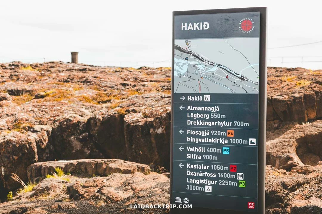
All Þingvellir's trails were clearly marked.
Because Þingvellir is one of the most visited places in Iceland, all the trails were really easy, well‑marked, and well‑maintained. If you have to use a different parking lot, you may need to change the order of the sites on our list to make it work, but as I said, it's not difficult, since the whole place is as tourist‑friendly as possible.
Hakið
We decided to start our visit at Hakið simply because it was the main entrance to Þingvellir. It had a big parking lot, a main visitor center, and a panoramic viewing platform. After we paid for parking, we walked about 300 meters to a newly built viewing platform overlooking the whole area. On the way, we crossed over the rift in the basalt rock, which was really cool.
Once at the platform, we could see the mountains to the north, a vast plain to the east, Þingvallavatn, Iceland's largest lake, to the south, and the visitor center with the parking lot behind us to the west. From up here, it felt like having Þingvellir in the palm of my hand.
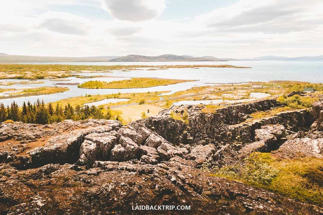
This view of Þingvellir from Hakið was easily my favorite.
I loved the view of the mouth of Þingvallavatn with Öxará flowing into it. We'd been in Iceland for just a few hours, and this was one of the first real views we got of a country that was supposed to be one of the most beautiful in the world (not counting the drive itself). And while this view wasn't as dramatic as some we had later at Tröllaskagi or in the Snaefellsnes Peninsula, it was still pretty amazing. And we were still just a short walk from the parking lot.
Speaking of views and the drive, we actually stopped before entering the national park at a small parking lot just off Þingvallavegur (GPS coordinates: 64.21111, -21.26050) that had a nice view of Þingvallavatn too. It was a pleasant little stop, and the view was nice, though the lake was a bit farther away. Honestly, we enjoyed the Hakið Viewpoint more and probably wouldn't stop here again if we were heading straight into the park.
By the way, if fishing is your hobby, it's good to know that this lake and the Öxará River within the park are great spots for catching trout. From Hakið, we followed the boardwalk without steps that brought us down into the gorge.
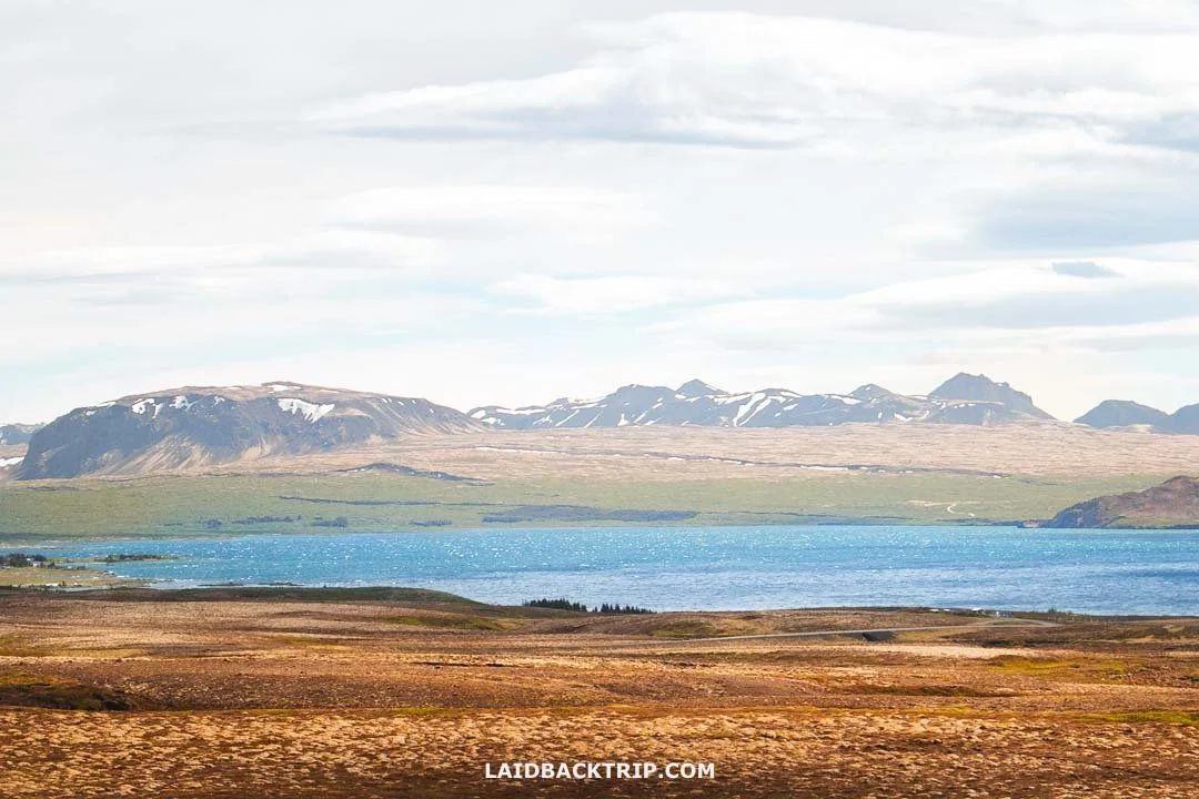
Þingvallavatn is Iceland's largest lake.
Almannagjá Gorge
From all the natural sites in Þingvellir, I was most excited to see Almannagjá, an 8‑kilometer‑long fissure between the Eurasian and North American tectonic plates. Our past travel adventures brought us to tons of amazing places around the world, but we'd never walked through a gorge between continents.
And this isn't an exaggeration, because at Almannagjá the trail really led us straight through the gorge where the rift is forming. And no matter how dramatic that sounds, it was actually one of the easiest and most pleasant walks we've ever done (unlike for instance Eldhraun Lava Field), thanks to the flat gravel path after the boardwalk ended.

Walking between the continents along the Almannagjá trail was simply an unforgettable experience.
These plates have been drifting apart very slowly, about two centimeters per year, and it was pretty cool to see the exposed edges of each tectonic plate, especially from such an accessible place. The interesting part was that while we saw Almannagjá's rift on dry land, there was also an option to see this natural phenomenon under the surface of Þingvallavatn, something I'm about to talk about in a minute.
While Þingvellir is one of the best places in the world to see the rift between two tectonic plates, it wasn't the only place where we could explore such unique geology. Later in the trip, we made it to the Reykjanes Peninsula, where there was another spot to see a fissure between the plates above sea level, at the Bridge Between Continents.
Alþingi
Roughly after 500 meters, we finally reached Alþingi, Þingvellir's most important historical site. Here, the trail forked, and while we could've continued straight through the main corridor, we definitely wanted to take this little detour. It was only about 150 meters, and then the path rejoined the main trail, so we didn't miss anything, especially since we walked this same stretch on the way back. This spot was technically called Lögberg, known as the Law Rock, which served as a podium for speakers.
Anyway, those 150 meters were all about Icelandic history. The view from the wooden podium in the middle was nice, but the historical significance of this place easily beat it. Since 930 CE, Þingvellir, translated as the "assembly plains," was where the world's oldest parliament met under the open sky.

The world's oldest parliament, Alþingi, was founded right here in Þingvellir.
Every summer for about two weeks, a huge gathering took place right here, during which new laws were passed, treaties approved, and important news announced. Simply put, this open‑air assembly represented the whole of Iceland. These gatherings were held here for centuries and were only moved to Reykjavík in the 19th century.
It was, of course, very different from how modern democratic governments work, but Alþingi is still called the world's oldest surviving parliament. What made it even more interesting was that it wasn't just a legislative assembly but also a supreme court and a massive community festival.
There were a few info panels about Alþingi's history, and they were definitely worth reading. It felt pretty special to stand in the exact place where people once made some of the most important decisions in Iceland's history. And unlike places like the Roman Forum, here we were surrounded by pristine nature. From Lögberg, we continued toward Öxarárfoss. After about 800 meters, the gravel path turned into one with flat stones, and we had to make a short climb up.
Öxarárfoss Waterfall
After walking about 1.5 kilometers from where we started, we were almost at Öxarárfoss, Þingvellir's most impressive waterfall. Okay, it was the only one in this part of Þingvellir, but it was genuinely beautiful. And I'm not saying that just because it was the first waterfall we saw in Iceland.
We still had the final 100 meters ahead of us, but we covered them in a minute or so since it was just an easy walk along a wooden boardwalk from the junction (not that the walk up to this point was difficult anyway).
At about 20 meters tall, Öxarárfoss wasn't the highest or even the most impressive waterfall we saw in Iceland (that would be either Skógafoss or Dettifoss). But with the dramatic setting of the Mid‑Atlantic Ridge, we were definitely amazed. And not just by its beauty but also its history.
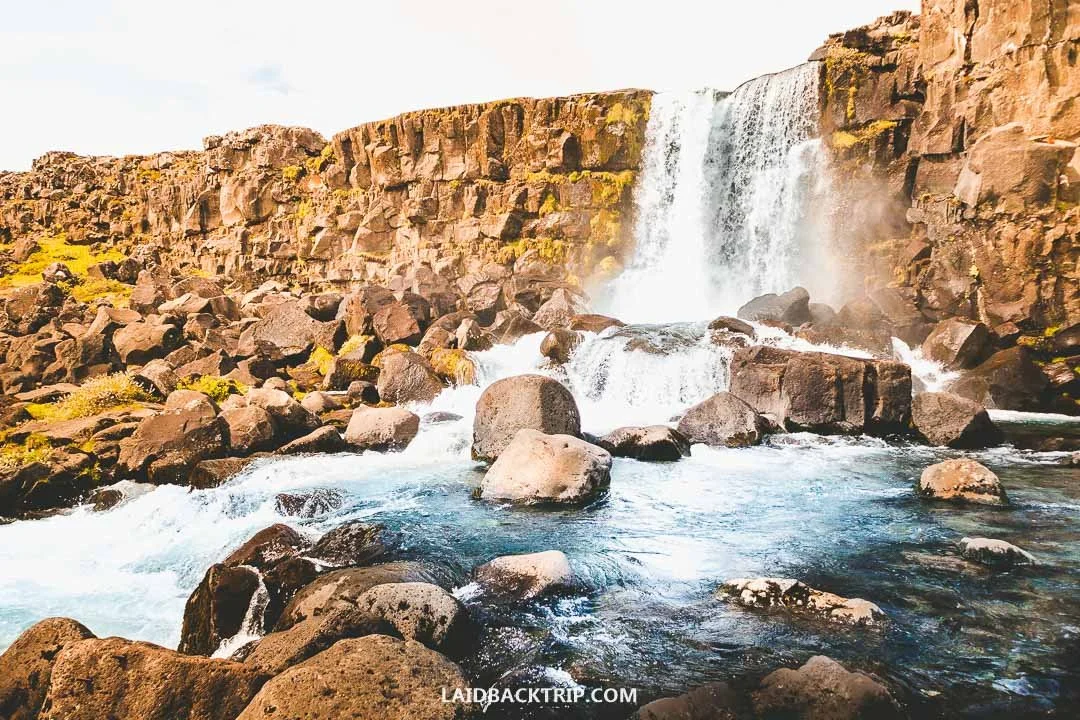
Öxarárfoss was our first Icelandic waterfall, and it looked gorgeous.
Unlike pretty much all the other waterfalls we saw in the following two weeks, and that number was huge because they were everywhere, Öxarárfoss was actually man‑made, created all the way back in the 10th century to provide freshwater for the people of the Alþingi. Yes, this wasn't some modern hydroelectric project but a thousand‑year‑old one. Local settlers redirected the course of the Öxará River so it would flow over the basalt cliffs of the Almannagjá gorge, creating the stunning Öxarárfoss.
When we reached the viewing platform, it was quite busy because we arrived at the same time as one of the big groups, but they left after a few minutes, so we could enjoy the waterfall in a much calmer atmosphere. My favorite thing about Iceland's waterfalls was how different each one was.
Later that day we hiked to Brúarfoss and saw Gullfoss. The former was bright blue, while the latter was incredibly powerful. And Öxarárfoss had the gorge between two continents. And I know this is a Þingvellir post, but I want to show I'm not making this up, so here are a few more examples. Hengifoss had basalt columns, Dynjandi looked like a bridal veil, and Seljalandsfoss had a trail behind it. And each of them, including Öxarárfoss, was just incredible.
Þingvallakirkja (Church of Þingvellir)
Once we were done with Öxarárfoss, we decided not to walk any farther. We returned through the Almannagjá gorge all the way to Lögberg, and once we passed it, we turned left. From there, we followed a wooden boardwalk that brought us to the Öxará River, with two small islets, Öxarárhólmi and Jakobshólmi, and two wooden bridges.
After crossing to the other side, we reached Þingvallakirkja, a picturesque church dating back to 1859. I have to say this was one of my favorite areas in Þingvellir simply because there was something calm about it.

Þingvallakirkja has traditional Icelandic wooden church architecture.
Old stories say there was always a church in Þingvellir, probably as early as the 11th century. Unfortunately, neither the original structure nor its exact location survived. Unlike the church in Stykkishólmur or Reykjavík's Hallgrímskirkja, this church was tiny and had traditional architecture.
Next to it was a small Icelandic National Cemetery, where several notable Icelandic figures found their final resting place. The church was supposed to be open between June and August as long as a park ranger was present, but when we visited, it was closed.
Silfra Diving
We continued walking south along the river until we reached a bridge by the P5 parking area. Here the Öxará flowed into Þingvallavatn. We'd read that the water had incredible visibility in this section, but reading about clear water and watching people snorkel and dive here was one thing, and actually seeing a group getting ready to enter the lake was another.
It had been a beautiful, partly cloudy day when we arrived at the national park, but after two hours the weather changed and dark clouds rolled over Þingvallavatn. So when we saw a group of tourists heading toward the dark lake in dry suits, we were pretty glad we didn't take this tour. On a clear sunny day, it might've been a different story, though those days aren't exactly common in Iceland.
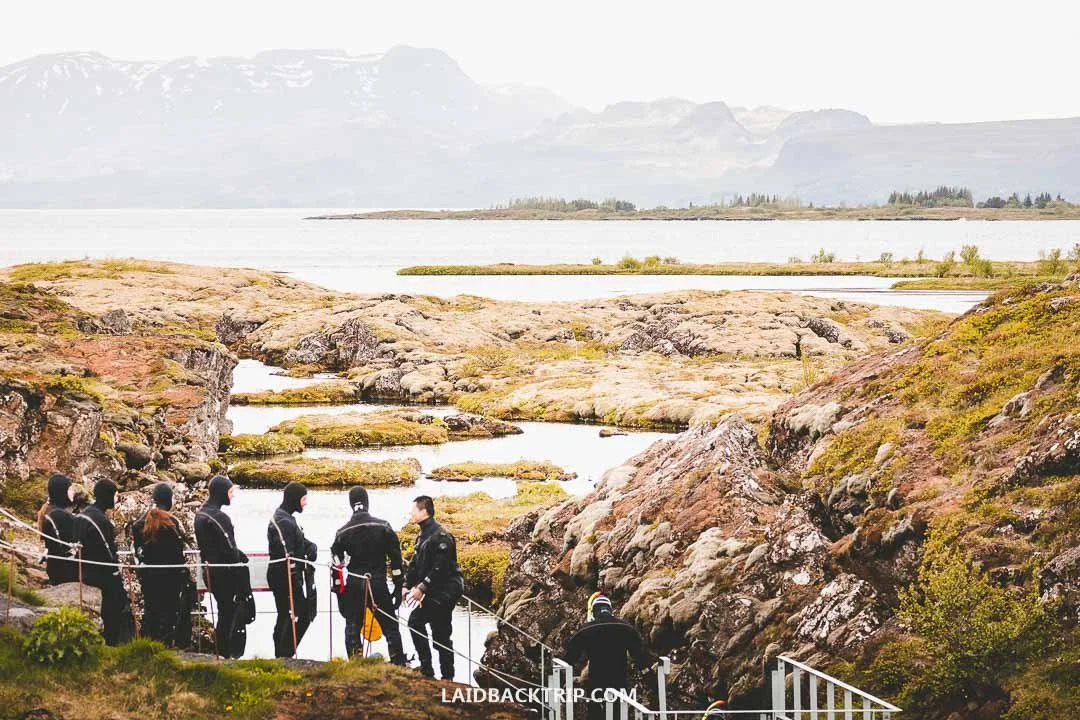
Snorkeling between two tectonic plates at Silfra is a popular activity in Þingvellir.
I knew that snorkeling at a place where two tectonic plates drift apart wasn't something we'd do every day, but we simply didn't have this activity on our list. At least not on this visit. They say visibility in the lagoon can be more than 100 meters in perfect conditions, which is unique. Even from the shore, we could easily see there was some truth to that.
World Nomads provides travel insurance for travelers to cover their trip essentials, including sports and adventure activities.
SafetyWing is affordable travel insurance for backpackers, long-term travelers, and digital nomads.
As we watched the group slowly heading toward the lake, we thought about the Travers Sabine Circuit, a fantastic hike we did in New Zealand ages ago that had a lake with incredibly clear water too. And by the way, Silfra is sometimes called the real Blue Lagoon of Iceland. While we won't question that opinion, the water temperature in the Blue Lagoon was much more to our taste.
Where to Stay in Þingvellir
There are no big hotels located directly inside the Þingvellir National Park because it's a protected area. However, the park has several campgrounds. The main one, Nyrðri‑Leirar, is just a five‑minute drive north of the Hakið area, and the other three, Syðri‑Leirar, Fagrabrekka, and Vatnskot, aren't very far either. Only Nyrðri‑Leirar is open year‑round.
If camping isn't exactly your thing, you can find private accommodations right next to the park and even some bigger ones like the ION Adventure Hotel, about twenty minutes from the Hakið area. And of course, plenty of hotels and guesthouses are a short drive away along the Golden Circle route as well as in Reykjavík.
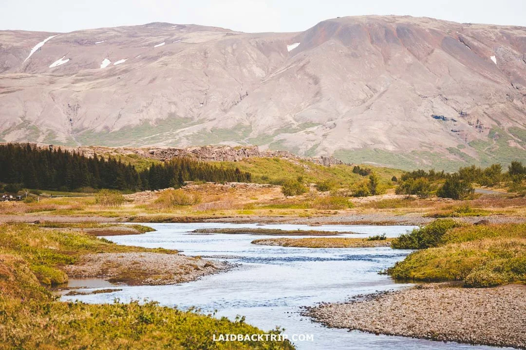
Aside from the campgrounds, there's no accommodation inside Þingvellir National Park.
Since we arrived in Þingvellir basically in the middle of the day, we didn't stay. While camping in the national park sounded fun, it made zero sense for us because we still had almost ten hours until midnight. We eventually stayed in Selfoss, which is about a forty‑five‑minute drive from here, though we obviously did the rest of the Golden Circle first, so the journey was much longer. Another popular place to stay is Laugarvatn, about thirty minutes from the Hakið area.
How Much Time We Spent in Þingvellir National Park
As I said, it was our first day, and we planned to do the whole Golden Circle, which meant we didn't have all day for Þingvellir. This actually played into our hands because Þingvellir's main tourist area was really compact, and it didn't take as long to see all its highlights as we initially thought. In the end, we spent about two hours in Þingvellir, which I'd say should also be enough for most visitors.
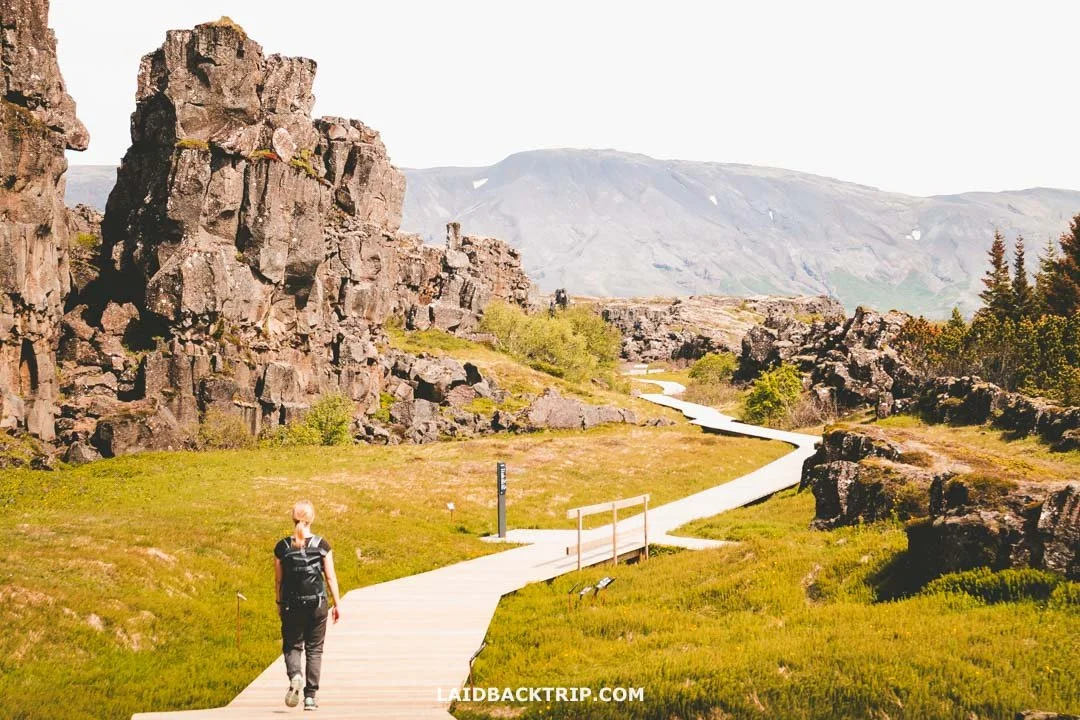
The main tourist area of Þingvellir took us a little over two hours to explore.
We saw the tectonic plates, the fissure, the church, the waterfall, the lake, the parliament, so pretty much all the highlights the national park offered. Had we done the snorkeling tour (or anything else here), we'd definitely have needed more time in Þingvellir, since we would've wanted to see the exhibition in the Visitor Center too.