A Self-Driving Guide to Golden Circle in Iceland
Starting in Reykjavík, the Golden Circle is one of the best scenic drives in Iceland. Was it really that good?
From Reykjavík, we embarked on a 250‑kilometer journey along the Golden Circle. We were in Iceland for just a few hours and super excited to finally explore one of its most popular scenic drives. We knew the Golden Circle had three main stops consisting of Þingvellir National Park, Geysir Geothermal Area, and Gullfoss Waterfall.
But by simply looking at the map, we realized it could be easily extended by several other super interesting stops like Brúarfoss Waterfall, Kerið Crater, Reykjadalur Hot Springs, Skálholt Cathedral, or the Secret Lagoon. After writing everything down, we realized there was a lot to see on the Golden Circle, and that actually gave us a bit of a planning problem. But I'm getting ahead of myself, so let's take a slower and more detailed approach.
After landing in Keflavík and spending the night in Hafnarfjörður, we were ready to start exploring Iceland. Our big plan was to drive the Ring Road, and since this was our first trip to Iceland, we really couldn't wait to hit the road. As Hafnarfjörður was right next to Reykjavík, where this famous scenic route started, it was a pretty straightforward plan.
Our only dilemma was when we realized there was another scenic drive called the Golden Circle that also started in the capital and shared a bit of the route with the Ring Road. It had a big waterfall, an erupting geyser, and a rift valley with tectonic plates, as well as other interesting stops.
We had two choices. We could either tour the Golden Circle right away or save it for the very end of our trip. Both options had some pros and cons, which we had to walk through before setting off. We were leaning toward the former option because it seemed like an ideal way to start the whole trip. The nature looked beautiful, all the sights were really accessible by car, we could add a hike if we wanted, and the national park also had a pretty interesting history. For a first adventure, it looked almost ideal.

The scenery on the Golden Circle was stunning right from the start.
The only issue was that Lucie added at least extra three or four places to the itinerary, which meant we would really need a whole day for it, and that wasn't possible because we had to pick up our campervan in the nearby rental office first and then make a stop at Krónan grocery store to stock up on food. So we couldn't start the day as early as we would've needed to pull this off.
Obviously, the latter option would mean we could plan the day we wanted and start super early (had the rest of the trip gone without any hiccups, of course). We finally decided to start with the Golden Circle, visit its main highlights, see some of its less popular sites if time allowed, and maybe come back at the end of the trip in case we missed something interesting. With that settled, we were ready to hit the road!
Touring the Golden Circle Route
We knew that the Golden Circle was supposed to be home to some of Iceland's most stunning landscapes, including rift valleys, geothermal areas, volcanic craters, geysers, and waterfalls. But there was so much more to see than just the must‑sees.
Whether it was the churches with traditional Icelandic architecture, endless fields of lupins, rising mountains on the horizon, or grazing sheep on the green pastures, we really enjoyed those first moments of getting to know Iceland. These first hours on the road were incredible and some of my favorites of the whole two weeks we spent in Iceland. Just driving the Golden Circle was an experience on its own. It was also one of the reasons why we enjoyed the trip so much.
Is Golden Circle Worth It?
I'd read some opinions that the Golden Circle was overrated, and this was something I just couldn't comprehend. We were only an hour from Reykjavík and could already see some of the most amazing natural sights this island had to offer.

We loved the geothermal area, especially seeing both the active and inactive geysers.
Þingvellir had a super clear lake and let us literally walk between the continents (not to mention all the history), Geysir had the very active Strokkur geyser erupting every few minutes, and Gullfoss had to be one of the most powerful waterfalls we saw during the entire trip.
And that was just the must‑sees, because there were other really interesting sites on top of that. I could understand that the area being so close to the capital felt less remote than Westfjords and was way busier, but other than that, the Golden Circle was just amazing.
Getting to the Golden Circle
We started in Reykjavík, and had we done the whole loop, we would've driven about those 250 kilometers as I mentioned earlier. But since we didn't come back to the capital and instead continued from Kerið to Selfoss and then followed the Ring Road toward the South Coast and East Fjords, we really drove just under 200 kilometers that day.
The interesting part about the Golden Circle was that it was more like a triangle, with two of the sides, from Reykjavík to Gullfoss and from Selfoss back to Reykjavík, being pretty straightforward. The stretch between Gullfoss and Selfoss, however, was a different story and allowed a lot more flexibility. And consequently made it harder to decide what we wanted to see and what we had to skip.
The road was only busy in Reykjavík, but the traffic dropped significantly once we left the capital behind. Even though we'd driven through the city during a day, we didn't encounter any traffic jams. Once outside the city, local people drove very considerately and safely, as did the tourists (the road was very scenic). The road was toll‑free, like the vast majority of roads in Iceland.
Which Way to Drive the Golden Circle?
We started in Reykjavík and did the Golden Circle clockwise for a very simple reason, which was that we wanted to continue driving the Ring Road counterclockwise. To us, this direction just made sense. It felt natural, especially given that we could see Þingvellir, which had lots of history, first.
Had we been arriving from the South Coast, then we would've done the Golden Circle counterclockwise, probably with a detour to Reykjadalur first. But since the Golden Circle is a relatively short route, at least compared to the Ring Road, it really wasn't that important decision.
When to Visit Golden Circle (and Avoid Crowds)
Another important detail I'd like to share from our journey was that we did the Golden Circle at the very beginning of summer, at the turn of June and July. We'd planned a long day on the road, and it was only possible because the Golden Circle, like the rest of Iceland at this time of year, had super long days with lots of daylight even at night. It meant we could stay exploring this scenic drive pretty much all day.
We got lucky that it didn't rain during the day, so we could stay on the road as long as we wanted. In our case, it meant that we finished after midnight. The main upside was that thanks to the midnight sun we could see places like Geysir, Gullfoss, or Reykjadalur without crowds, and looking back at it, I think it was definitely worth it.
Being here in summer made everything straightforward, but we read that the Golden Circle should be fairly easy to explore even in winter, as the roads are frequently cleared of snow and ice and most of the stops are just an easy walk from the parking lot. The only downside would be the lack of daylight, especially from November to February, which might not be that big of a deal if you come to see the Northern Lights on the Golden Circle.
How Long It Takes to See Golden Circle
It took us practically a full day to cover those 250 kilometers of the Golden Circle. By the time we left Reykjavík, it was already late morning, but we stayed exploring the Golden Circle for the rest of the day and finished after midnight. In a single day, we saw Þingvellir, Geysir, Gullfoss, Skálholt, Kerið, and hiked to Brúarfoss. We didn't manage to visit Reykjadalur, as we did this trail at the end of the trip.
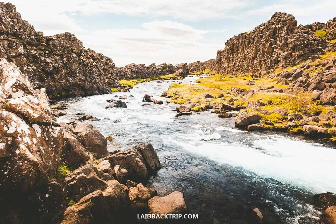
The Golden Circle had so many places to explore that it ended up taking us more than a day to see it.
We drove for about four hours and spent the rest of the time exploring the natural sites. All in all, I'd say it took us more than 14 hours to drive around the Golden Circle, but we really saw a lot. Mind you, that was still without visiting Reykjadalur, which we hiked later, and that place added more than three extra hours to the whole thing.
If you'd ask me what the minimum time needed for the Golden Circle would be, I'd say you could see it in about eight hours, but of course, that would mean focusing only on the highlights and skipping any hiking.
Golden Circle Without a Car
I've already said that we drove around the Golden Circle because we also wanted to drive around the whole island. Without a car, seeing the Golden Circle's highlights would be just as easy, or maybe even easier, since there's no public transport (I have a feeling it'll stay this way in the future, as most of the highlights are in the middle of nowhere), so your only other option would be taking a tour.
These tours are incredibly popular, usually well‑rated, include the very best of the Golden Circle, and depart daily from Reykjavík. If we weren't driving, we'd definitely go for this option.
Hotels and Campgrounds on the Golden Circle
The night before we road‑tripped the Golden Circle, we stayed in a hotel in Hafnarfjörður (a town adjacent to Reykjavík that had the rental office), and then ended up in Selfoss, which had a good campground. Since we stayed in the hotel right after our flight from Prague, we booked it in advance. However, the rest of the journey we left fairly open. I saved some main campgrounds (Mosskogar, Flúðir, Reykholt, Þingvellir, Geysir, Hveragerði, etc.) on the Golden Circle so we could be as flexible as we needed.
In the end, we stayed in the Selfoss campground. We planned on camping while in Iceland, and the Golden Circle was no exception. Since we weren't sure how that would go, I also saved some hotels, though we kept them as a last resort because they were all quite pricey. I had Héraðsskólinn Historic Guesthouse in Laugarvatn, Hotel Geysir in Geysir, or Hotel Selfoss in Selfoss. The whole Golden Circle was dotted with various accommodations,so these were just a few we had on our list.
Roadside Services Along the Golden Circle
Lastly, I'd like to say that the Golden Circle was really incredibly easy to explore. All the roads we drove were paved, there were gas stations and EV charging spots every 30-50 kilometers (open 24/7, payment by credit card), and the signage was good, though we still used GPS navigation to be sure. While driving around Iceland was super easy even in more remote areas like Tröllaskagi Peninsula or the Diamond Circle, the Golden Circle was easily the most accessible.
Had we had less time, we'd definitely want to road trip the Golden Circle since it's one of the best trips from Reykjavík. And as I said earlier, the natural sights we saw along the road pretty much represented the very best of Iceland, just, like Lucie said, condensed into a single day. So here's our own self‑drive Golden Circle itinerary with all the stops we visited ourselves.
Our Stops on the Golden Circle Route
So our plan was to visit all the must‑sees, Þingvellir National Park, Geysir Geothermal Area, and Gullfoss Waterfall first, and then see whether we'd have some time left. If things went well, our plan also included a hike to Brúarfoss Waterfall. In the end, we also managed to stop by Skálholt Cathedral and Kerið Crater.
The only place we missed was the Reykjadalur Hot Springs simply because it was too late when we arrived in Selfoss. While this thermal river isn't traditionally included in the Golden Circle, it would've made sense to stop here had we driven back to the capital. Which we didn't, so we had to visit it at the end of the trip.
Þingvellir National Park
Picking Þingvellir as our very first stop on the Golden Circle was pretty fitting to the whole trip, because this wasn't just a UNESCO World Heritage site and Iceland's oldest national park, but also the most important historic site in the entire country. As I said, we couldn't pick a more interesting place than this. It was also the first spot on the list we reached while driving, so there was definitely some practicality behind it.
When we looked at the map while reading about Þingvellir, everything seemed a bit confusing since we didn't know which attractions to see or even where to leave the car. The park had five parking lots in different areas, so practically five entry points, but once we looked closer, we realized the main tourist area was pretty compact.
We decided to explore Þingvellir from the Hakið area (parking P1), which was actually the first one on the way from Reykjavík. Here we paid 1000 ISK for parking (by credit card at the machine, though there was also an option to pay online), and then continued on foot.
So what was there to see in Þingvellir National Park? Since we parked near the Visitor's Center at Hakið, we had more than 4 kilometers of walking ahead of us. It was a loop trail with a detour to Öxarárfoss, so we could easily see most of the top attractions in one go.
First, we walked through Almannagjá, a place where we could clearly see Iceland being slowly ripped apart by natural forces. What does that mean? Þingvellir is one of the best places in the world to see two tectonic plates drifting apart on dry land, in this case the North American and Eurasian plates. Like I said earlier, in Almannagjá we literally walked between the continents.
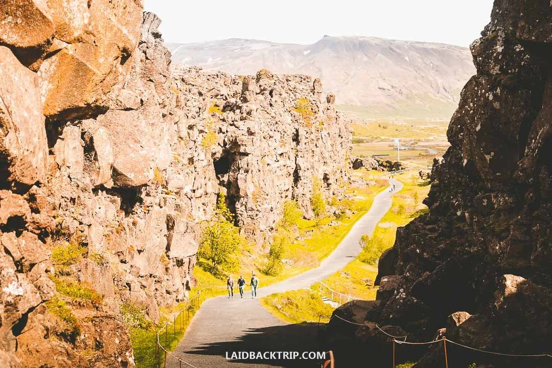
The walk between the North American and Eurasian plates was my highlight of Þingvellir's visit.
Right after that, we came across another highlight. Þingvellir wasn't only geologically interesting, but it was also one of the most important places in Iceland when it came to culture and society. Alþingi (Althing), the first Icelandic Parliament, was established here around 930 CE.
It was an outdoor assembly held on these plains that were easily accessible for tribes living on the island. After a short walk, we reached Lögberg (Law Rock), the center of the whole gathering, which had some interesting info on the history of Þingvellir as well as a wooden podium and a big Icelandic flag.
Then we walked along the river flowing below the rocky ridge and after a couple of minutes reached Öxarárfoss, the big waterfall of Þingvellir. It was the very first waterfall we saw in Iceland, and it was definitely one of the most beautiful places in the park. The interesting part was that it was actually man‑made centuries ago to bring freshwater to the Alþingi.
We then retraced our steps along the same path, and once we passed the Lögberg, we turned left and followed a boardwalk with two small bridges over the Öxará River until we reached Þingvellir Church, one of Iceland's oldest churches. There was also a small cemetery where some notable Icelandic figures were laid to rest.
From here, we continued to Silfra, a popular site for snorkeling, while enjoying views of Iceland's largest lake, Þingvallavatn. This lake isn't just huge, but the area where it meets Öxará has incredible visibility that makes it a popular spot for seeing tectonic plates underwater. While it all sounded pretty cool, we simply didn't have time for it.
And I'm not even mentioning that when we saw a group of people dressed in drysuits heading for their snorkeling tour while we were putting on our down jackets as the weather dramatically changed since our arrival, we were kind of okay with seeing the lake just from its shore. We then headed back to our car. Our plan was obviously to make a stop at Geysir, but we were really tempted to see Brúarfoss.
Brúarfoss Waterfall
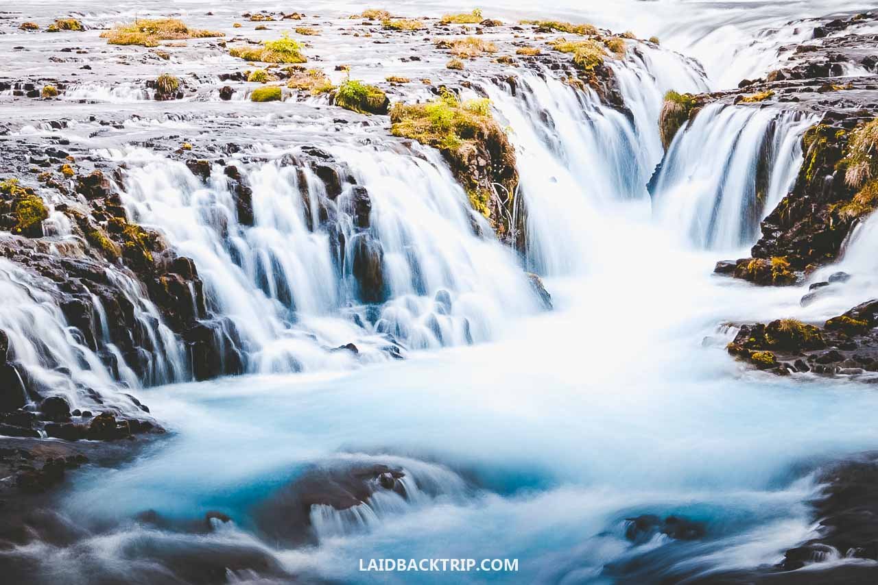
Brúarfoss, known as Iceland's Bluest Waterfall, was one of our favorite stops on the Golden Circle for a couple of reasons. First, this waterfall with the (allegedly) bluest water in all of Iceland was incredibly beautiful, and second, to see it, we had to do the 6.2‑kilometer in‑and‑out trail. We'd already walked those four kilometers in Þingvellir, but it didn't feel the same because the trails there were much more maintained. Brúarfoss, on the other hand, had a pretty rugged trail.
The interesting part was that back in the day, it was possible to drive much closer to the waterfall, so hiking wasn't involved. But once the waterfall got popular, they changed that and closed the private road. So when we were there, hiking those six kilometers was the only way to see Brúarfoss. Now, though, they've built a gravel road on the west side of the Brúará river that takes you only a couple hundred meters from the waterfall, which means the hike is optional.
When we did the hike, Brúarfoss wasn't the classic stop on every Golden Circle itinerary, and I think it's still not as popular as other sights, but I can imagine there are a lot more tourists coming to see its blue water these days because of that road. Even though you can drive much closer now, I still think the trail was great and worth doing, at least if you have an extra two hours, as that was about how long it took us to tackle it.

Hiking those six kilometers was definitely worth it just to see Brúarfoss and its incredibly blue water.
The trail to Brúarfoss was mostly flat, luckily not very muddy, and took us not just along the beautiful Brúará river but also through a woodland area, which isn't that common in Iceland. Along the way, we could also see two more waterfalls.
Both Hlauptungufoss and Miðfoss were really nice, and for us, coming from Czechia, they'd be worth seeing even without Brúarfoss. But Brúarfoss was there. And it was simply stunning. It wasn't very high (especially compared to Glymur), but it had a beautiful U‑shape and incredibly blue water. The whole scene looked almost unreal.
After taking in the views, we had to return the same way. The trail that day was fairly quiet, and with dark clouds looming ahead of us since the start, we picked up the pace and headed back to our car. Once back, we took off our muddy hiking boots, grabbed a quick snack, and continued to our next stop, the Geysir Geothermal Area. It wasn't a long drive, and in less than 15 minutes, we were pulling into yet another big parking area.
Geysir Geothermal Area
From the parking lot, the entrance to the Geysir Geothermal Area was right across the road. We could already see steam rising from the earth, and the smell of rotten eggs hit us immediately. Even without fjords or high cliffs, the scenery felt incredibly dramatic.
Another thing that stood out right away was how accessible the site was. Brúarfoss wasn't a tough hike, but it was still a hike. Geysir Geothermal Area, on the other hand, had a paved, flat trail that brought us to the erupting geyser in just a few minutes.
This whole area is called Haukadalur and is Iceland's most famous geothermal field, known for its mineral‑colored soil, bubbling hot pools, fumaroles, clay pots, the strong smell of sulfur, and, of course, geysers. It's also the best place to see an active geyser in Iceland.
And I have to say that while all the Golden Circle stops were pretty incredible, I was most excited to see an erupting geyser. Because here we could find Geysir with the capital G, the geyser that gave its name to all others around the world. A few years earlier, we saw geysers in Yellowstone, and that was a pretty unforgettable experience. This one was awesome too.
The funny part was that the famous Geysir was currently dormant. The whole area was still very active, but this particular geyser was sleeping. Over the centuries, its activity changed several times due to earthquakes and even human interference, but at the moment, there was no boiling water erupting from its pool. Seeing the large blue pool so calm was almost eerie.
But while Geysir rested, Strokkur was very much awake. We reached Strokkur first since it was closer to the parking lot. We saw its first eruption from afar, which meant we had to wait a bit before it erupted again. Luckily, Strokkur erupts every five to ten minutes, so we knew we wouldn't miss it.
World Nomads provides travel insurance for travelers to cover their trip essentials, including sports and adventure activities.
SafetyWing is affordable travel insurance for backpackers, long-term travelers, and digital nomads.
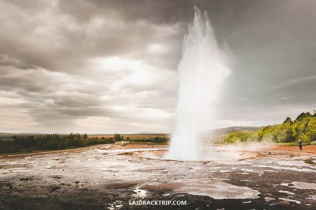
Watching Strokkur shoot boiling water into the air every few minutes was an incredible spectacle.
And by the time we got close, it was ready for another blast. It was a big one. And we couldn't wait for the next. Waiting for the eruption that sent boiling water several meters into the air while spraying everything around was so exciting. And yes, we stayed for one more. "Lucie, can we see another one?"
The whole Geysir Geothermal Area was quite small, but we still spent about an hour here, mostly waiting for Strokkur to erupt again. After we finished exploring, we walked back to our car (and if you want to see more geothermal areas, Hverir was another one we really enjoyed).
Geysir wasn't a village, but it had solid tourist facilities like a big parking lot, hotels with restaurants, a campground, and a gas station. Since it was getting late, it would've been tempting to stay here for the rest of the day, but we still had places to see. It was our first day in Iceland, and we weren't ready to call it a night. Luckily, the weather held up. So we continued. Our next stop was Gullfoss, just a 10‑minute drive away.
Gullfoss Waterfall
Once we pulled into the lower parking area, it was already pretty late in the evening. During the day, Gullfoss gets really crowded, but we kind of hoped that at this hour it would be quiet. As we started walking toward the main viewpoint on the lower trail, we found out our guess was right.
Since Gullfoss really was one of the main attractions on the whole Golden Circle, there were still people around, so it wasn't like we had the place to ourselves like Kolufoss or Kvernufoss, but it was still a quiet evening.
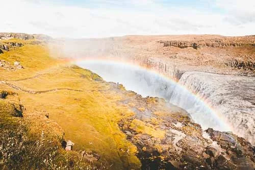
Even though we were still fairly close to the capital and this was our first day, we'd already seen a good number of waterfalls. They were all so different, but one thing they had in common was that they were all beautiful. But it was really Gullfoss that showed us how incredibly powerful Icelandic waterfalls could be.
Even from the parking lot, we could already see that the amount of water plunging each second from the volcanic rock was on a whole other level compared to the ones we'd seen earlier. And honestly, in this regard, it was really only Dettifoss and maybe Skógafoss that were this powerful.

Photos can't capture how incredibly powerful Gullfoss really was.
In Icelandic, Gullfoss literally means Golden Falls. From here, it was only a short step to name this drive the Golden Circle. It was a great idea because the name was really catchy. On a summer evening, the soft light touching the Hvítá River made it look golden, as it did the steep canyon.
We first explored the lower trail, which was my favorite because it brought us right next to the waterfall. Then we did the upper trail (this one is usually done by people parking at the main parking lot), which had great views of the whole waterfall that actually had two sections. The upper was a beautiful wide cascade, while the lower was where the raging Hvítá dropped into a narrow gorge. For us, visiting Gullfoss was one of the highlights of the day.
Gullfoss was technically the last attraction of the Golden Circle, but it wasn't the last place we stopped that day. We still had to find a place to spend the night. After a quick look at the map, it made sense to return to the Ring Road and stay in Selfoss. It was roughly a 70‑kilometer drive that would take us about an hour or so, but that was without stopping.
There were some interesting sites along the way, but as midnight was approaching, we wanted to keep it simple. So we settled on two stops, Kerið Crater and Skálholt Cathedral, which were just off Road 35.
Skálholtskirkja (Skálholt Cathedral)
After leaving Gullfoss behind, we were on the road once again, heading toward Selfoss. About 30 minutes into the drive, we turned left onto Road 31 and stayed on it for about three kilometers until we reached Skálholt. It was late, and the cathedral was closed (it's open daily from 9 AM to 6 PM), so there wasn't much to do other than read a bit about its history, enjoy its interesting architecture, and take a few photos. We were the only ones there, so it felt pretty serene.
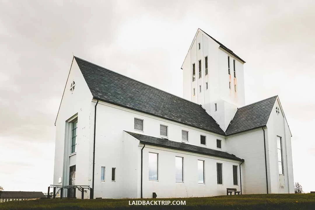
For us, Skálholt Cathedral was just a quick stop, because we couldn't go inside as we arrived too late.
The church was quite photogenic from the outside and set in a charming landscape. Back in the day, Skálholt was the center of Iceland's Christianity, as it was the seat of bishops from 1056 until it was moved to Reykjavík in 1785. The first church was built here in the early 11th century when locals converted to Christianity, and the structure we saw was actually its tenth version.
The interior was supposed to have beautiful stained‑glass windows, a modern mosaic altarpiece, great acoustics (concerts are frequently held here), and even an old underground crypt with artifacts excavated at the site and an 800‑year‑old stone coffin of Bishop Páll Jónsson. But as I said, we couldn't go inside.
Right next to the church was a turf house called St. Thorlak's Booth, or Þorláksbúð in Icelandic. It was a replica honoring St. Thorlak, which stood here between the 16th and 18th centuries. Again, it was closed too.
Next to the cathedral was Hotel Skálholt, which would've definitely been cozier than the campervan. At this point, we were really tired, and the idea of staying somewhere nice was tempting. But we were set on camping and didn't want to stretch our budget more than necessary. So we hopped back into our car, returned to Road 35, and drove for about 20 minutes to our final stop of the day, Kerið Crater.
Kerið Crater
And for the last stop, we couldn't pick an easier site. Kerið Crater was the only place where we had to pay an entry fee, which was 700 ISK (not for parking like at Reynisfjara or Dynjandi, but an actual entry fee). Back when we were there, it was slightly less, and since we arrived late, there was no one at the site to whom we could pay it.
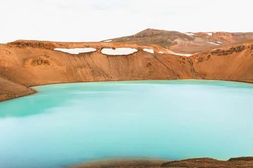
But there was a ticket booth at the start of the rim trail, so it really depends on when you arrive. Because, believe it or not, Kerið Crater is also one of the few natural sites with opening hours, which the official site vaguely describes as "when the sun is shining," whatever that means. Kerið is a volcanic crater lake with vibrant blue water thanks to minerals from the soil, only 6,500 years old (at least that would be on a sunny day).

We had clouds when we arrived at Kerið Crater, and the water color wasn't nearly as blue as I'd seen in some other photos.
The caldera is about 55 meters deep, 170 meters wide, and 270 meters across, and is made up of unique red volcanic rock covered by mossy green vegetation on its slopes. Unlike what many people think, Kerið wasn't formed by a volcanic explosion. Instead, it was once a small volcano that emptied its magma, causing the ground to collapse and create the crater. The shallow lake at the bottom is connected to natural groundwater, not filled by rain.
From the parking lot, the crater itself was just a short walk. All the boardwalks surrounding the crater and the stairs leading to the shore of the crater lake looked new and were really easy to walk on. It was possible to do the entire rim walk around Kerið Crater, which was about 800 meters, but since we were already pretty tired, we just enjoyed the views from the side closer to the parking lot. For us, it was a super quick stop.
Reykjadalur Hot Springs
After Kerið Crater, it was just 15 minutes to Selfoss. It was well past midnight, it had been a super long day, and we were just beat. Luckily, Selfoss had a nice campground where we could enjoy a good night's sleep.
The town, one of Iceland's larger ones, also had several grocery stores (like Bónus, Krónan, and Nettó), a couple of gas stations, and some restaurants and hotels like Hótel Selfoss or Hotel South Coast. But at this hour, we simply found an empty spot in the campground and called it a day.
The next day, we joined the Ring Road and headed east, which meant we didn't actually complete the Golden Circle loop, since that would've required driving back to Reykjavík. It just didn't make sense. At least not at that moment.
But we still had one more place on our list. It was the Reykjadalur Hot Springs, one of the places we really wanted to see. Our idea was to visit it at the end of the trip. We still wanted to explore the Reykjanes Peninsula, and Reykjadalur, whose trailhead was just three kilometers north of Hveragerði, looked like the ideal spot to finish our final day. And as planned, we did.
So after almost two weeks, we were back in this area. We drove to Hveragerði and followed the paved road to the starting point of the Reykjadalur Hot Springs hike. Yes, I'm saying hike because, unlike most places on the Golden Circle, this thermal river was actually almost four kilometers up in the Reykjadalur Valley. The funny part was that we arrived late in the evening again. But this time, it was part of the plan. Because the hot springs at Reykjadalur are free, set in a beautiful landscape, and so close to the capital, they're often overrun by tourists.
Arriving late, we started walking no sooner than 10 PM, gave us a chance to enjoy Reykjadalur without crowds. The hike was relatively easy, but we still had to tackle 200 meters of elevation over those four kilometers, which meant walking mostly uphill. In less than an hour, we finally reached the bathing spot.

Soaking up in the hot springs was the ideal way to finish our Golden Circle trip.
This wasn't Mývatn Baths or Hofsós Pool, so everything here was as basic as it could get. Okay, there was a wooden platform that made access to the river easier, and some changing screens (yes, just screens, no cabins), and that was it. But we loved it. The river had an ideal temperature for bathing, and the views were just as amazing.
We spent just over an hour in the hot springs, and since it was as long a day as the one we'd driven the Golden Circle for the first time, we couldn't have picked a better place to finish it. If you're heading back to Reykjavík, it's just a 50‑minute drive. We headed back to Reykjanes as we still had a visit to the Blue Lagoon ahead of us. We stayed at the free Gata campground, and the next day visited the famous lagoon filled with mineral‑rich runoff water. The experience between both places couldn't have been more different, but we enjoyed both.
The only place we were kind of bummed we didn't get to visit was the Secret Lagoon (Gamla Laugin) at Hverahólmi. This geothermal area near Flúðir is home to the oldest swimming pool in Iceland (built at the end of the 19th century), and these days it's a popular tourist attraction (so it's really not secret).
These hot springs, with water rich in sulfur and temperatures of 38-40 Celsius year‑round, would've been a great addition to our list, but we simply didn't have time. And we picked Reykjadalur instead (because the Secret Lagoon was actually quite pricey and didn't include the hike).
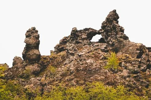
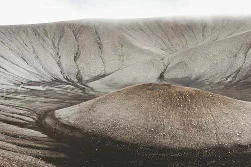
Our travel guide to Grjótagjá Cave covers everything you need to know before visiting this famous lava cave in North Iceland, including how to get there, parking information, what to expect inside, why it became so popular, and the best times to visit.