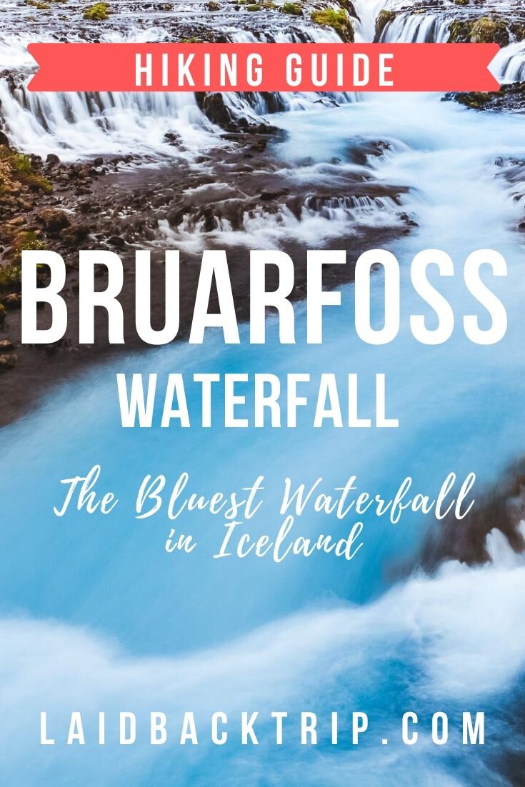
Hiking to Brúarfoss Waterfall
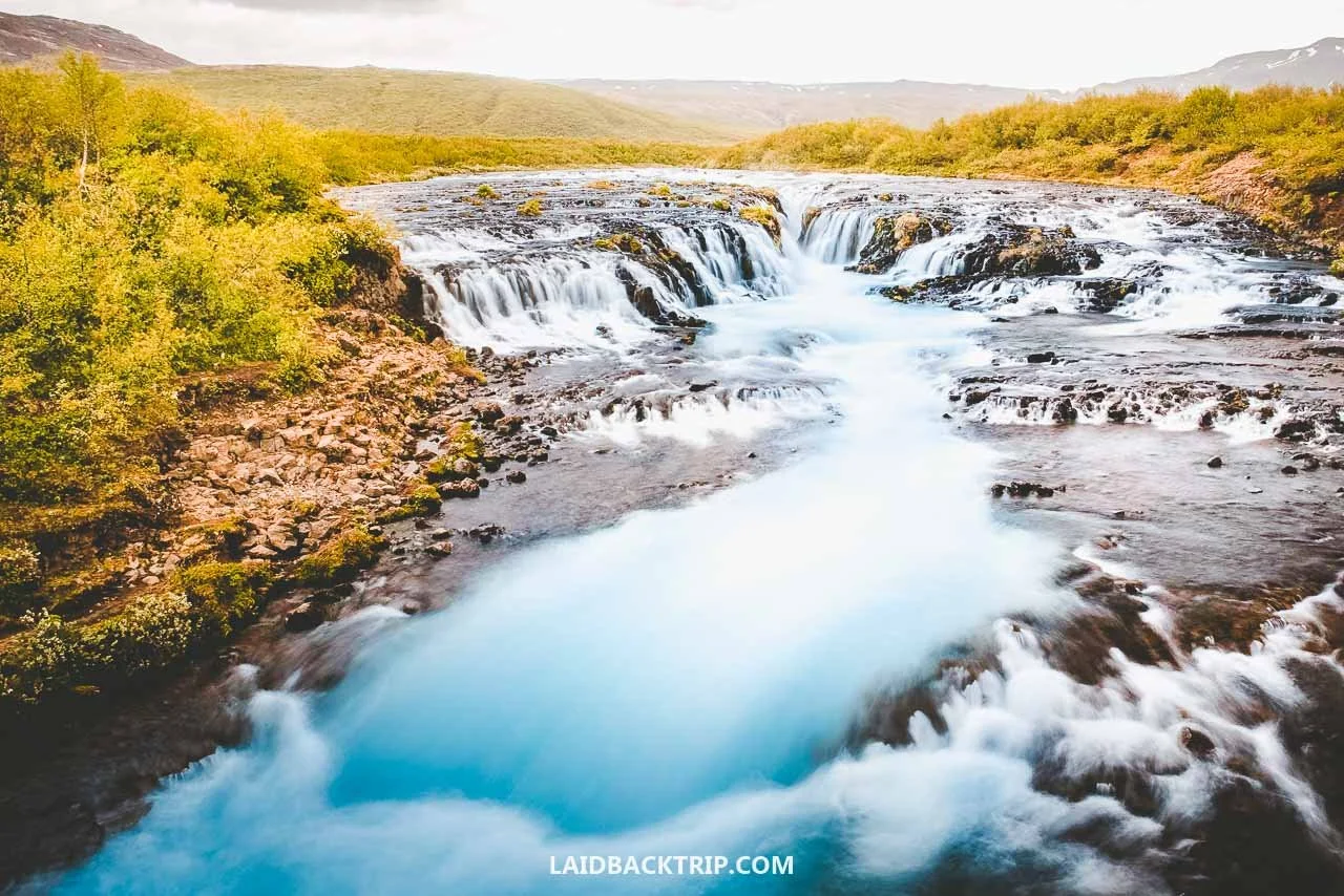
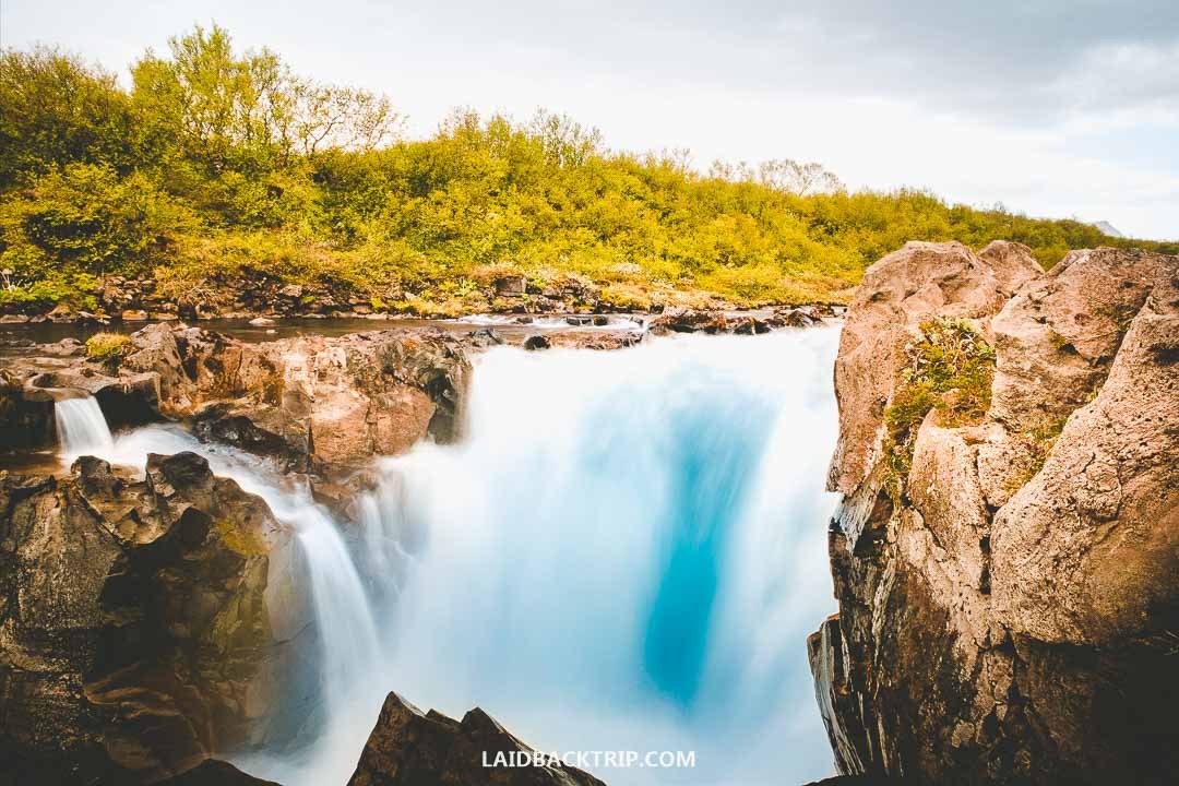
Brúarfoss is the bluest waterfall in Iceland.
As our first trail in Iceland, we picked Brúarfoss. And we loved every bit of it!
After driving around all of Iceland and seeing tons of waterfalls, we think Brúarfoss was the most picturesque of them all. This beautiful cascade on the Brúará River was unlike anything else we saw during our two weeks in the country, and none of the others had water this blue. Though that wasn't exactly a surprise, since Brúarfoss is nicknamed the Bluest Waterfall in Iceland, so we kind of knew what to expect in that regard.
We also knew our first day in Iceland would be tough. Even though our flight to Keflavík wasn't long, we still had to get up early and arrived at our hotel well after midnight. And since we had to pick up our campervan pretty early and had big plans for the rest of the day, we added lots of easy stops to our itinerary.
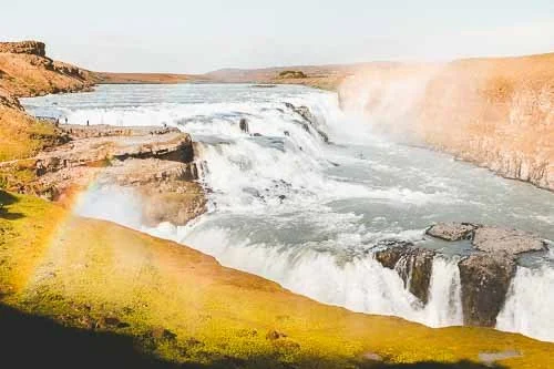
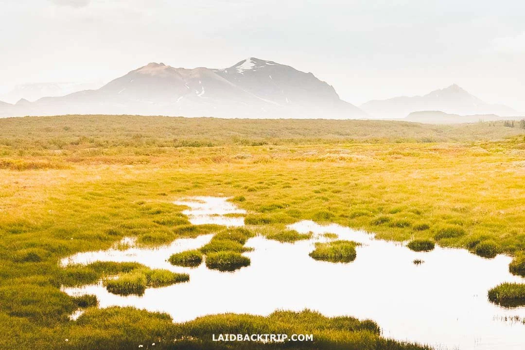
Which honestly wasn't hard, because our plan was to drive the popular Golden Circle. We were super excited about this scenic loop, since it promised a nice and easy introduction to Iceland's nature. We had all the major stops lined up, like Gullfoss, Geysir, and Þingvellir National Park. Lucie said that while it had pretty much everything, it was missing one little detail. A good old hike.
After a quick search, we decided to see Brúarfoss. It was actually an easy choice, because the moment we saw the first photo of this charming cascade with its azure water, we knew this was it, especially since getting there meant hiking a 6.2‑kilometer out‑and‑back trail. On paper, it looked like an easy walk on a mostly flat path, but we read that the trail could get muddy, which might make things a bit trickier. We just had no idea what the conditions would be like when we got there.
Brúarfoss was a great easy hike for our first day in Iceland.
Before choosing this trail, we'd read that access to Brúarfoss had been closed not that long ago. The place got really popular and couldn't handle the number of tourists driving there every day. This wasn't the only spot with that issue, and we heard similar stories at Fjaðrárgljúfur or Sólheimasandur. The parking lot used to be close to the falls, but the trail crossed private land and was shut down because of disrespectful visitors.
Fortunately, a new trail along the Brúará River opened not long after. The only downside was that reaching the waterfall now required walking over six kilometers in total. Not only did we not mind, but it actually worked perfectly for us, since it gave us a chance to stretch our legs and escape the crowds, as fewer people visited after this "improvement." However, these days a new road on the west side of the Brúará has a parking lot just a few minutes from Brúarfoss. So both options are possible, but since we did the longer hike, that's what we'll focus on in this guide.
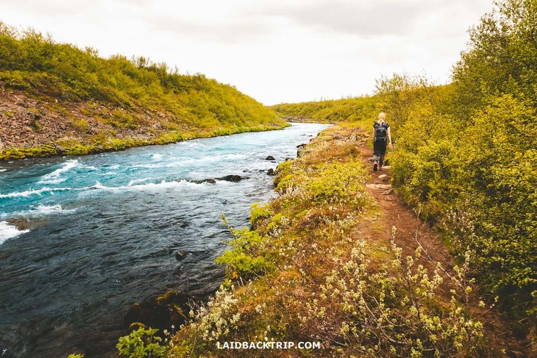
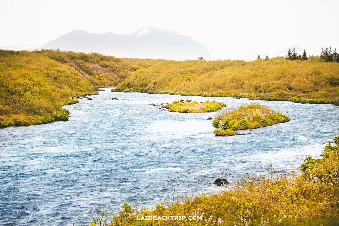
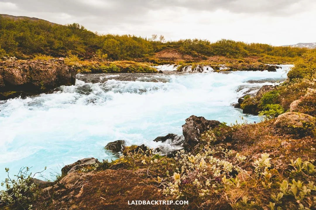
Even without Brúarfoss, the bright blue Brúará River alone would've been reason enough for us to visit.
Getting to Brúarfoss
Since we were doing the long hike, we found the Brúarfoss trailhead on road 37 (Laugarvatnsvegur), about 90 kilometers east of Reykjavík. We started there in the morning and then continued to Þingvellir first, from where it was about 45 kilometers to Brúarfoss. After this hike, we made one more stop on this road, and that was Geysir, about 15 kilometers west of the waterfall. The whole road 37 was paved, so the parking lot where the hike started was easily accessible with our small 2WD campervan.
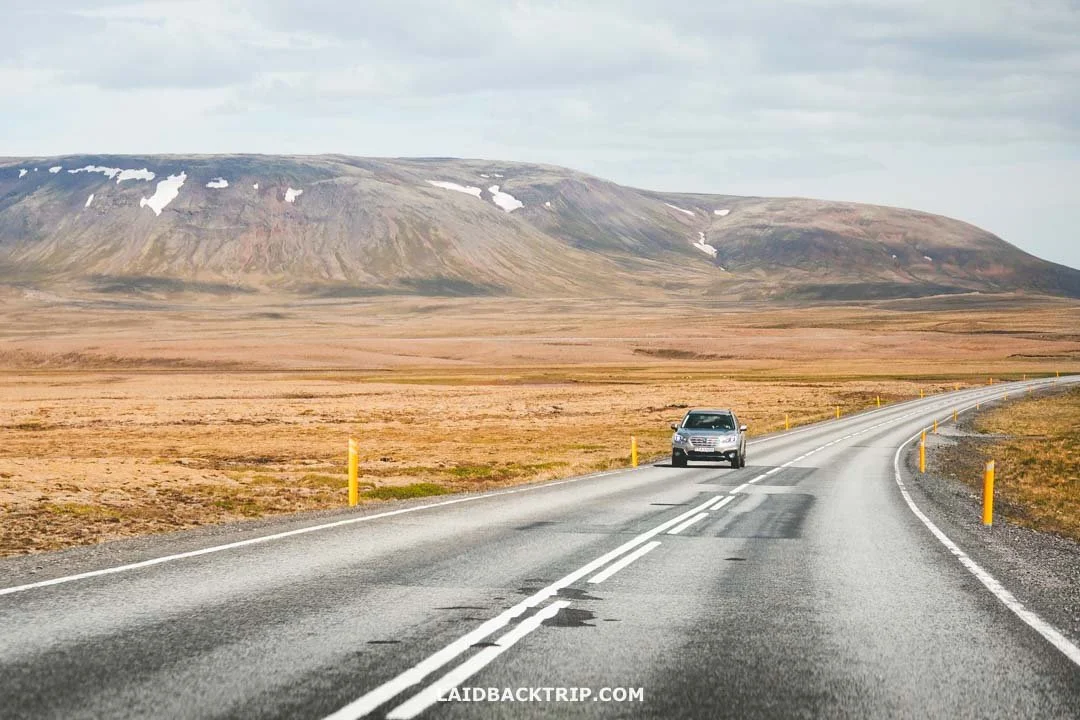
The road to Brúarfoss was fully paved, really easy to follow, and packed with great scenery.
Unfortunately, there's no way to reach the trailhead by public transport, so you either need to drive there like we did or take a tour. Back then, most tours exploring the Golden Circle didn't include Brúarfoss since it required about two hours of walking. But now that the new road was built, some tours like this one do make a detour to Brúarfoss.
Parking at Brúarfoss
The GPS coordinates for the parking where we left our car were 64.24011, -20.52409. It was right on road 37, and since we arrived from the Reykjavík direction, it was on our left side just past the bridge over the Brúará River. This Brúarfoss parking lot was free, had enough spaces for most days, I'd say around 30 spots, but it was obviously very basic and had no facilities at all. And on the afternoon we visited, it was almost empty.
The other parking lot (GPS coordinates 64.26213, -20.52087), the one close to the waterfall, can also be reached from road 37 by driving about three kilometers along Bruarfossvegur. This is a gravel road, often with lots of potholes depending on the season, and the parking has a fee of 750 ISK for a small car for up to four hours.
The main upside is that instead of a 3.1‑kilometer hike, you can see Brúarfoss in less than 350 meters. On the other hand, if you do the longer hike like we did, then you can still see Brúarfoss completely for free. I know the parking fee isn't big, but with so many places now charging, like Dynjandi or Hverir, it's just another expense to keep in mind.
Bruarfoss Waterfall Hike
It was already late in the afternoon when we climbed over a stile (just like later at Kvernufoss) and started walking along the Brúará River. The first part of the trail was as straightforward as it gets. There were no markers, but there was only one way forward. As I said, we had roughly 3.1 kilometers of walking ahead of us (one way) to Brúarfoss on what was supposed to be a mostly flat trail with only about 40 meters of elevation gain.
I noticed that the official sign at the trailhead mentioned this was a 7‑kilometer trail (round trip), but the GPS on my watch clocked it at 6.2 kilometers, and Lucie got pretty much the same number, so I'm using those instead. When I checked the map, I saw it also showed a (probably an older) trail that followed the Brúará River right from the start, but now it cuts through the first meadow, which probably explains the small difference.
The scenery was breathtaking from the very start of the Brúarfoss trail.
Another little detail from that sign was that it rated the hike to Brúarfoss as moderately difficult, but from my perspective it was definitely on the easier side, especially since the trail wasn't as muddy as it would be on a rainy day (and definitely easier than Hengifoss and Glymur hikes we did too). Another important thing was that we did the hike in early summer. Had we done it outside this season, the trail conditions would probably have made the walk harder.
The trail was open 24/7, which in summer meant it was walkable all day thanks to the midnight sun. Midnight was still a few hours away when we were there, so that didn't apply to us, but it's good to know. We took advantage of this in the following days at places like Látrabjarg or Húsavík, but not here. The last detail we picked up was that the long trail to Brúarfoss was closed in winter.
Anyway, the first 400 meters of the wide gravel trail were really easy, and since we were a bit away from the river, not very interesting. Since we needed some exercise, we picked up the pace and kept going.
At the beginning of the trail, the Brúará River seemed pretty calm.
After about five minutes, we finally reached the river and the trail got more interesting. It wasn't just the blue tint of the water that caught our attention but also the brown color of the muddy trail we had to walk through. Luckily it wasn't as bad as it could've been, but we were still glad we wore hiking boots. Not long after, we were surprised to enter a small woodland area.
We knew Iceland had very few forests and trees in general, so it was pretty cool to find some here. That said, I wasn't sure what to expect from an Icelandic forest. At Brúarfoss, it was mostly short birch trees, lots of shrubs, and even a few spruces poking out of the green mess. While we were technically walking on a lava field, the scenery looked nothing like Eldhraun or Reykjanes. The trail got muddier in these sections, but as I said, we didn't arrive after heavy rain, so it could've been much worse.
Speaking of rain, it looked like it could start any moment. As we drove from Þingvellir, dark gray clouds rolled in and stayed the whole time we were out there. Seeing that, we packed our rain pants, put on our rain jackets (which also helped with the wind), and hoped it wouldn't rain. Luckily, it didn't.
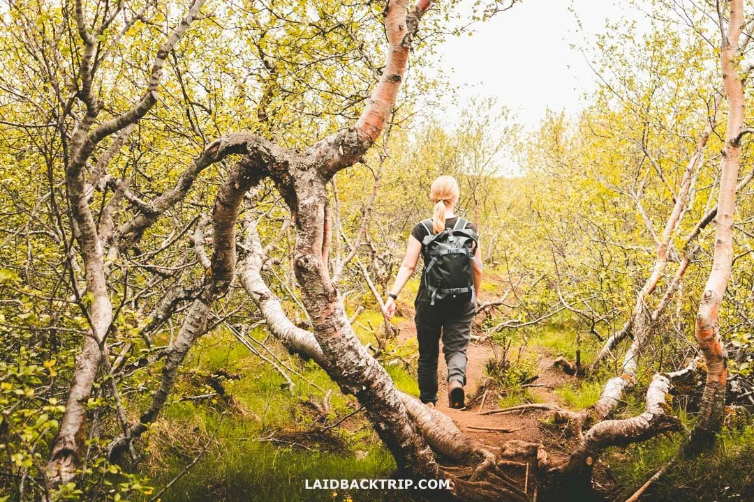
We then continued into a small birch forest with a few muddy stretches.
Hlauptungufoss Waterfall
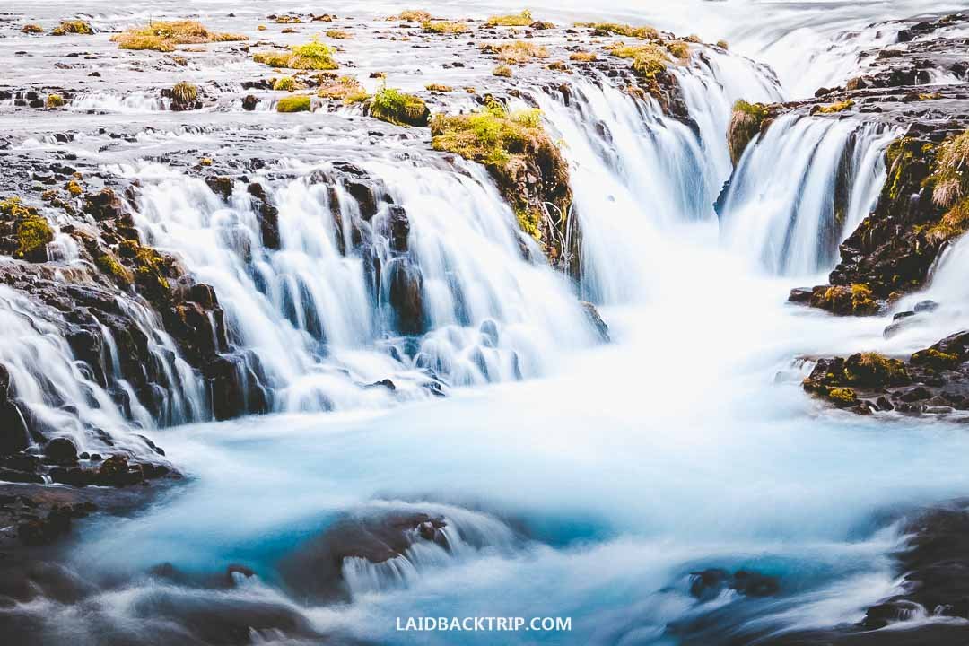
After 1.7 kilometers, we finally reached Hlauptungufoss, the first of the three waterfalls on this trail. We thought these two would be small cascades, just a distraction on the way to Brúarfoss, but this waterfall proved us wrong. It was totally unexpected.
The drop was only a few meters, but since the volcanic rock narrowed at this spot, the waterfall was really powerful. Watching all that thundering water rush through the chasm reminded me of (a much smaller) version of Huka Falls we saw ages ago in New Zealand.
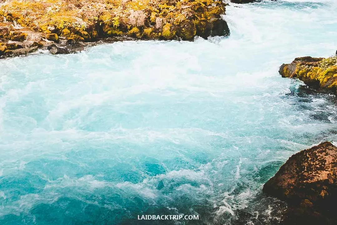
The reason why the Brúará River and all its waterfalls, Hlauptungufoss, Miðfoss, and Brúarfoss, are so blue is the mix of glacial meltwater from Langjökull Glacier, silica‑rich minerals suspended in the water, and the dark volcanic riverbed. And of course, the sun.
Even though it was cloudy, and I mean really cloudy, the water was still incredibly blue. I wasn't sure the color would stay this vibrant without sunlight, but it did. That was pretty awesome, because it makes this trail worthwhile even when the weather isn't ideal.
Our first waterfall on this hike was Hlauptungufoss.
Miðfoss Waterfall
We continued on a dirt path along the edge of the Brúará River for about 500 meters until we reached the second waterfall, Miðfoss. It looked completely different from Hlauptungufoss we'd seen just minutes earlier. Even though it was about the same height, Miðfoss was almost as wide as the river itself, so it felt more like a broad cascade.
I'd like to say it was calmer or even timid, but that would be misleading, because the Brúará was just as powerful here as anywhere else along the trail. And while we didn't know it yet, it actually looked like a smaller version of Brúarfoss, which was our final stop.
The second waterfall on the trail was Miðfoss.
While we had the river on our left, on our right was Brekkuskógur, a large holiday village. It was pretty close to the trail, and we did see a few houses, but it still felt like we were walking through nature.
The village was made up of privately owned cabins, summer houses, and vacation rentals, so there were definitely places we could've stayed, but it was still early in the day and we had other plans. Plus, there was no campground, which was a big downside for us. If you're looking for a more traditional hotel, there was Farmhotel Efstidalur just off road 37, right before the bridge over the Brúará River. And just a few minutes' drive away were either Hotel Laugarvatn or Hotel Geysir.
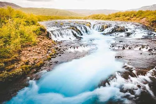
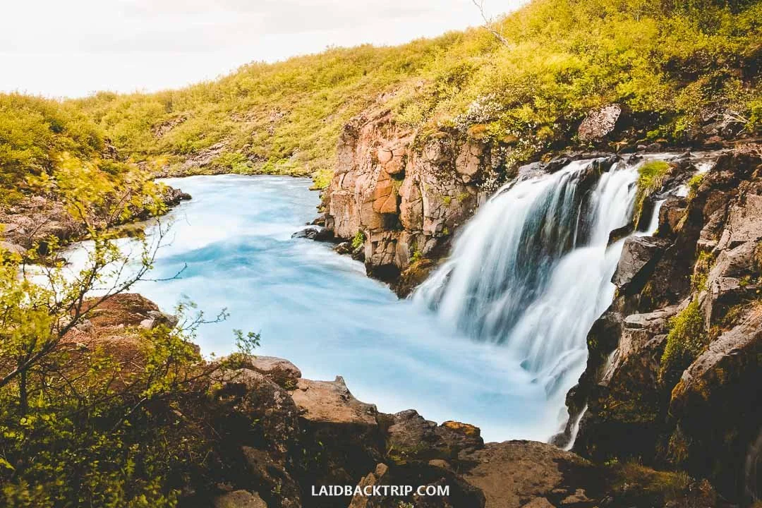
Brúarfoss Waterfall
In about 30 minutes of walking, we finally reached Brúarfoss. It was a pretty serene moment because even though we'd met a few people along the trail, there was no one around at the last viewpoint. We didn't mind that at all. We knew that lots of places in Iceland could get overwhelmingly busy, like the Blue Lagoon or Reynisfjara Beach, but by this point in the trip, the only crowded place we'd really experienced was Þingvellir. And to be fair, that one wasn't exactly empty either.
So arriving at Brúarfoss and seeing this beautiful cascade with the incredibly blue color of the Brúará River, while being there alone, felt pretty surreal. We definitely don't have anything like that in Czechia, so we were stunned it was so quiet here. But again, this was our first day in Iceland, so we were still in that discovering phase.
Brúarfoss was easily one of the most beautiful waterfalls we saw in Iceland.
Brúarfoss means Bridge Waterfall because long ago a natural stone bridge actually spanned the river. Since it acted as a bridge, that's how it got its name. Even though the stone arch collapsed long ago (a legend says it happened at the beginning of the 17th century), the name survived. But today, Brúarfoss looks nothing like that. Unlike the other two waterfalls on this hike, there's a modern bridge over the Brúará River here, so we could enjoy all the amazing views from a safe spot.
Despite the trail being easy and not looking dangerous, there have been a few deaths when people fell into the river. The Brúará is a fast‑moving river with strong currents, freezing glacial water, and slippery rocks along its edge. At Brúarfoss, the wooden bridge makes viewing safer, but the rest of the trail has nothing like that. There are no guardrails or roped‑off areas, unlike at Dyrhólaey or Dettifoss. Seeing all that blue‑white icy force pushing through a narrow volcanic gorge was enough for us to not get too close to the river's edge.
World Nomads provides travel insurance for travelers to cover their trip essentials, including sports and adventure activities.
SafetyWing is affordable travel insurance for backpackers, long-term travelers, and digital nomads.
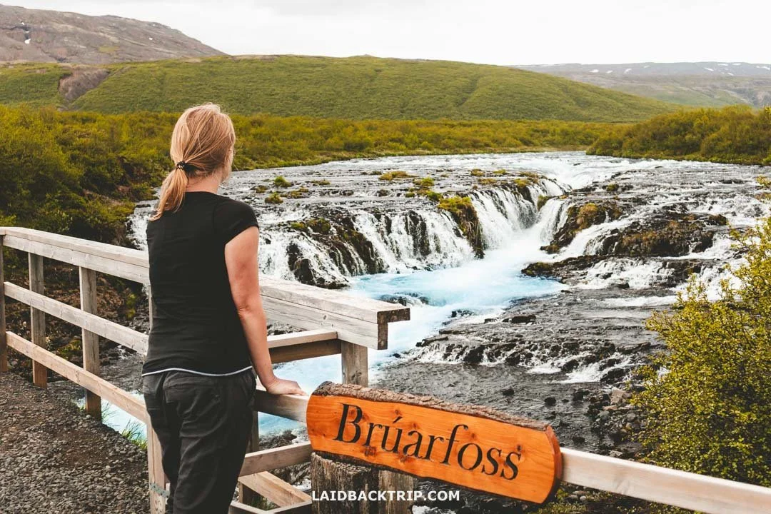
We could enjoy views of Brúarfoss from this little bridge.
Was Brúarfoss Worth Visiting?
As we were making our way back to our car, Lucie pointed out how completely unfair it was that one country could have so many amazing waterfalls. If Brúarfoss had been in our home country, it would've been one of the most visited natural sites, but here it was often overlooked simply because Gullfoss was just around the corner and the famous South Coast had places like Seljalandsfoss or Skógafoss, not to mention the rest of the island being packed with incredible waterfalls too. They were everywhere. And this little observation brings me to my final thoughts on Brúarfoss.
Since this was basically our first hike in Iceland, we had the whole trail almost to ourselves, the weather was good, and Brúarfoss looked beautiful even on a cloudy day, so both Lucie and I really enjoyed this whole little adventure. I'd say it was one of those easy hikes through charming scenery that just worked for us in that moment.
Hlauptungufoss was almost as beautiful as Brúarfoss.
But as I said at the beginning of this post, we saw tons of amazing waterfalls in Iceland, usually in much more dramatic settings. And had we done the Ring Road the other way, making Brúarfoss one of our last stops, I'm honestly torn between saying the hike was worth it and saying we saw much more striking places in less time. These are my thoughts looking back, because right after the hike, we were really glad we chose this trail.
I do have a few more thoughts, though. Now that the other parking lot lets you see Brúarfoss in less than five minutes instead of roughly 45, I'd say the waterfall lost a bit of its aura as one of the Golden Circle hidden gems, since it's now so easily accessible by car.
My other less positive view is that while the long trail would still be fairly quiet, it kind of loses the magic of arriving at Brúarfoss with only a few people around. Because now there'll be folks who simply drove there. But if you ever find yourself in the same situation we were in, then this hike could work for you the same way it did for us.
Travel Resources
Here you can find links to all the travel resources we use and which you might find helpful when planning your next holiday.
Accommodation: When looking for accommodation, we usually search hotels via Booking.com or Hostelworld.
Tours: Although we love to travel independently, some places are better to visit with a guided tour.
We prefer GetYourGuide for its easy-to-use interface and solid reputation. Another great alternative is Viator.
Rental Cars: When going on a road trip, we always use Rentalcars.com, a reliable site for booking a rental car in advance.
Flight Tickets: When looking for flight tickets, you can search Skyscanner to find the best price.
Travel Insurance: World Nomads and SafetyWing cover against risks of travel.